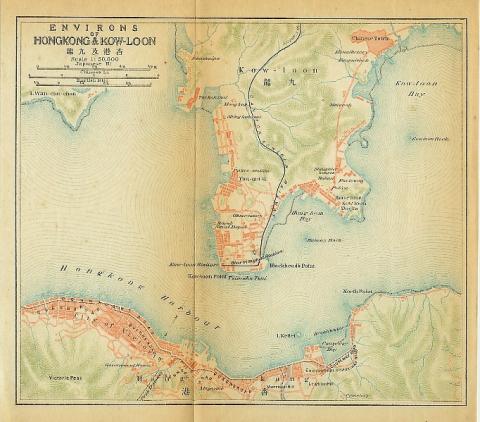
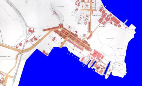
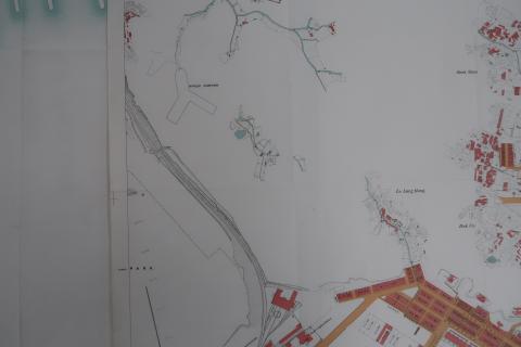
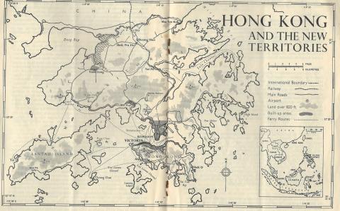
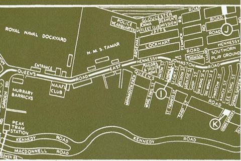
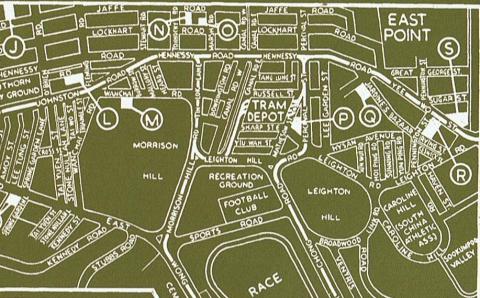
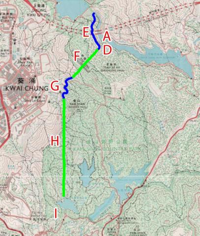
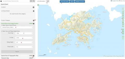
Photos tagged "map"
Primary tabs
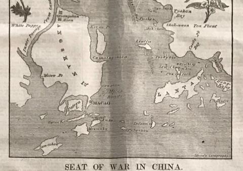
1840: 1840 Cum-sing moon.JPG
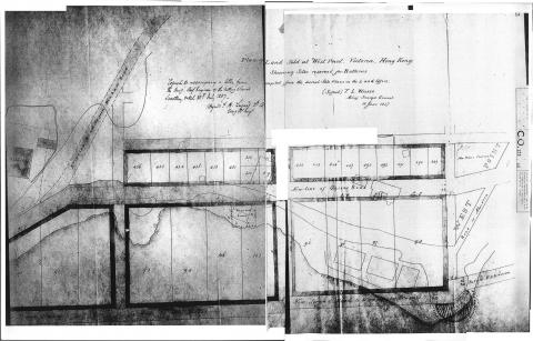
1842: 1842 Map of Initial Land Sales in the Colony
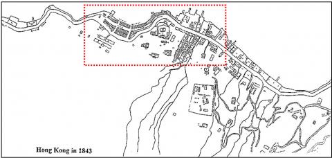
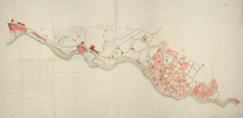
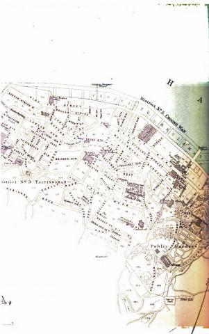
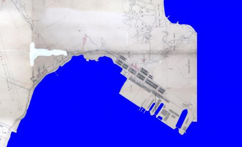
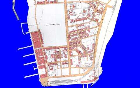
1843: HK in 1843
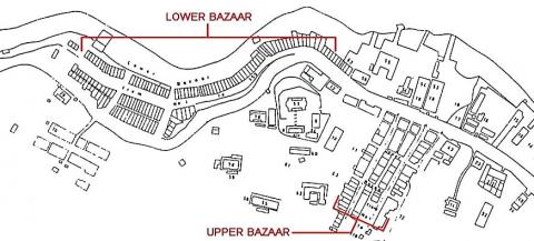
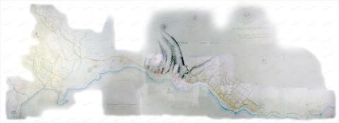
1843: HK in 1843 - detail
1843: Admiralty, 1843
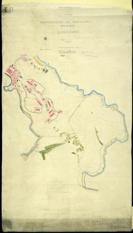
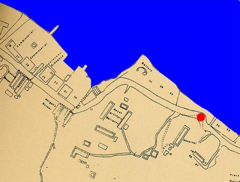
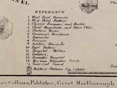
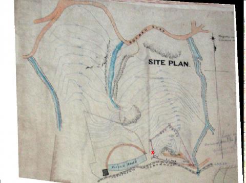
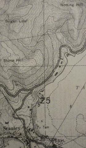
1844: Stanley cantonment reduced.jpg
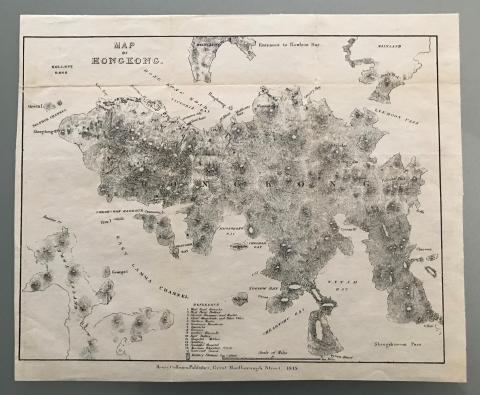
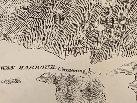
1845: 1845 map 00.JPG
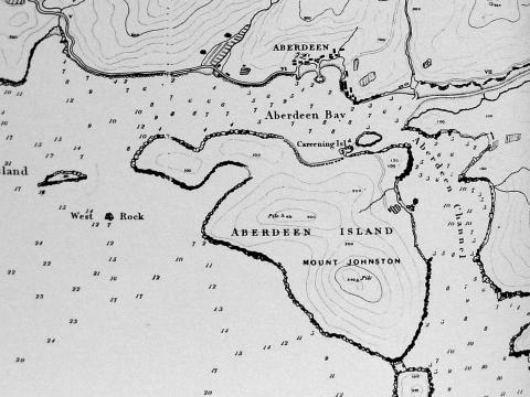
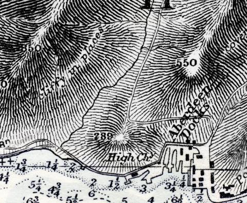
1845: 1845 Map of Aberdeen
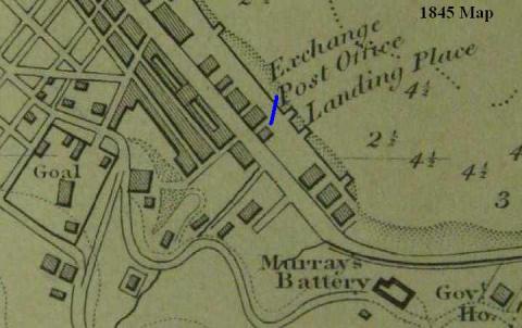
1845: 1845 Map (detail) Central
1845: 1845 map 07.JPG
1845: 1845 map 04.JPG
1845: 1845 map 01.JPG
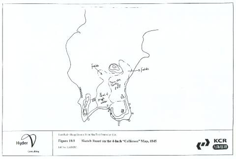
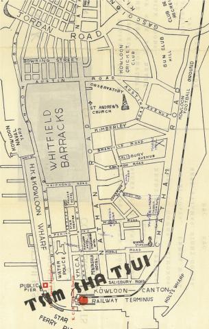
1845: Tsim Sha Tsui sketch based on 1845 Collinson map
1845: 1845 map 08.JPG
1845: 1845 map 05.JPG
1845: 1845 map 02.JPG
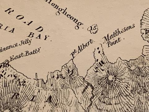
1845: 1845 Belcher.jpg
1845: 1845 Map
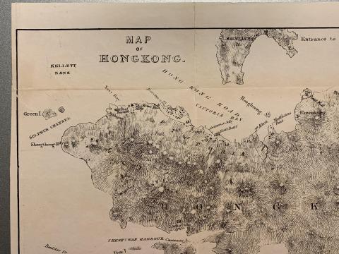
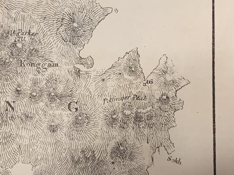
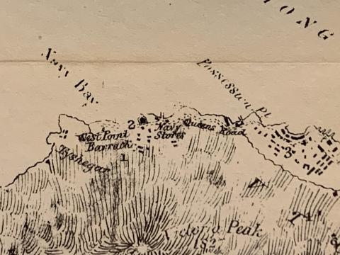
1845: 1845 Map of Hong Kong
1845: 1845 map 06.JPG
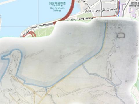
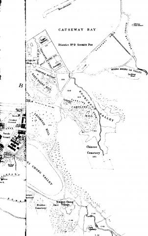
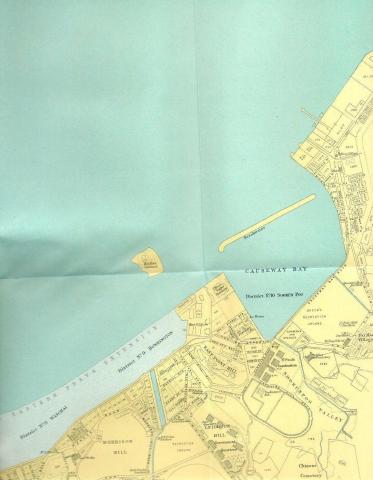
1845: 1845 Causeway Bay map
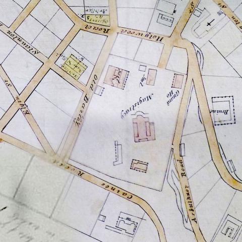
1845: 1845 map - Magistracy & Jails
1845: 1845 map 03.JPG
1846: Harbour Master's House
1850: 1850 Green Bank
1850: 1850 Cast iron tanks and pipes in Victoria Cantonment

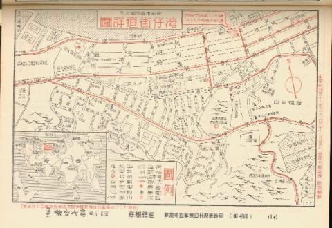
1850: Mid 1800s Wanchai Map
1850: Cast iron tanks
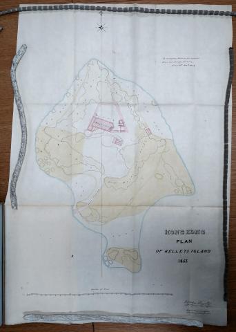
1853: Kellett Island 1853
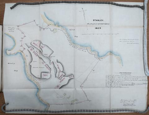
1853: Stanley Military Cantonment 1853
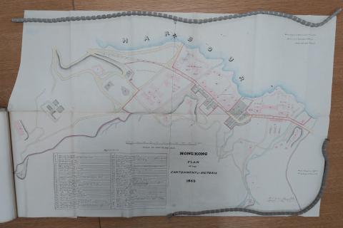
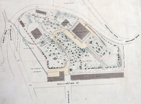
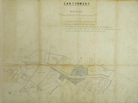
1853: 1853 Plan of the Cantonment at Victoria
1855: Mid 1800s Wanchai Map
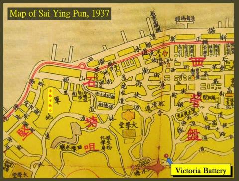
1856: 1856 Map - Detail - Sai Ying Poon

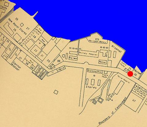
1856: Admiralty, 1856
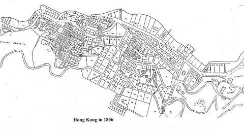
1856: HK in 1856
1856: Map 1856 - Admiralty
1857: 1857Map copy.jpg
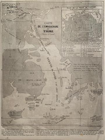
1858: 1858 map of Hong Kong, Macao, Canton, Pearl River
1861: Plan of Victoria Military Facilities
1862: 1862 Map of Hong Kong
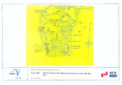
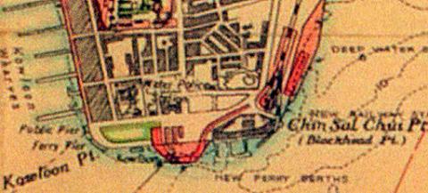
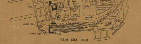
1863: 1863 Tsim Sha Tsui map
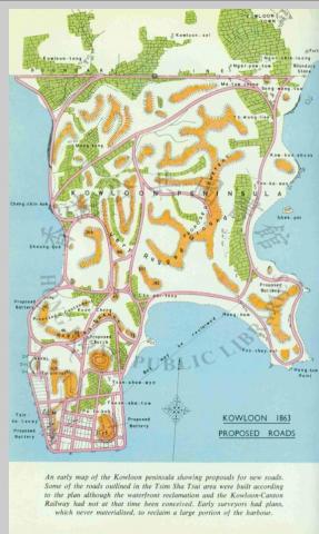
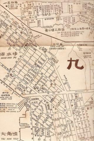
1863: 1863 kowloon map
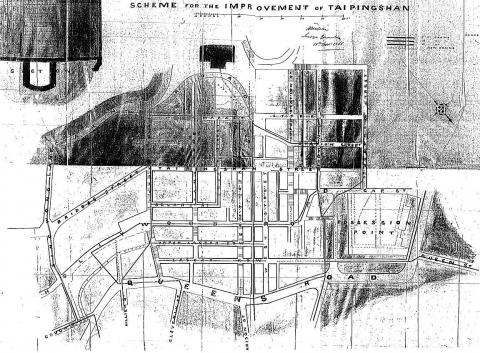
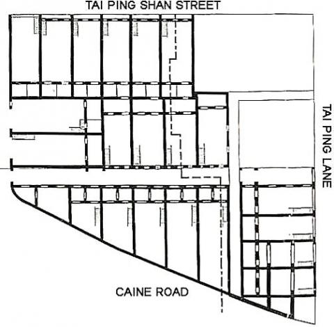
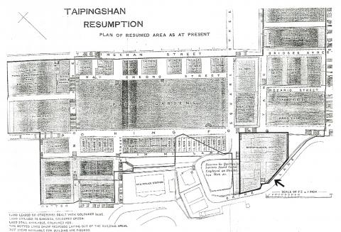
1866: Tai Ping Shan
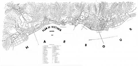
1866: Victoria-Harbour - map of 1866
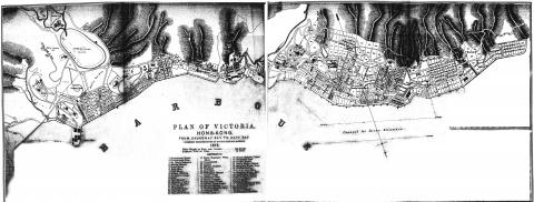
1873: Victoria Harbour-Plan 0f 1873
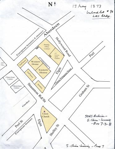
1873: Map of the LMS compound
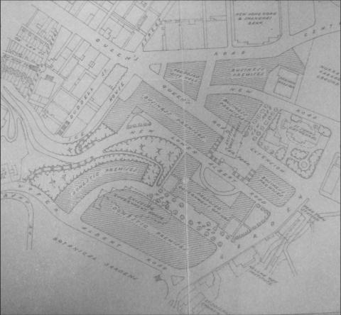
1874: 1874 Map of Central
1880: Wanchai map 1880
1880: Admiralty, 1880
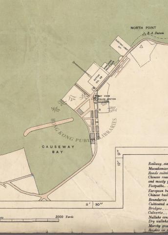
1880: East Point - map 1880
1882: Tai Ping Shan
1882: Victoria Harbour Waterfront 1882.jpeg
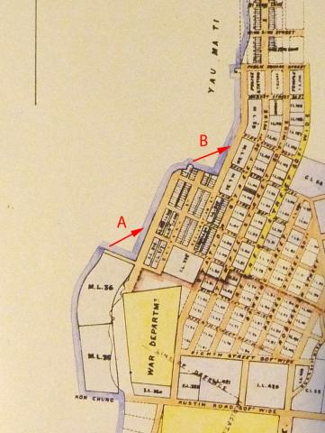
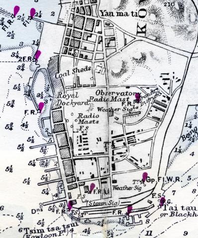
1887: 1887 Map of Yau Ma Tei
1888: Magazine Gap map 1888
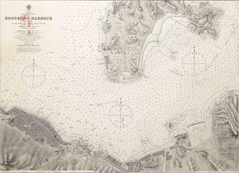
1888: 1888 harbour chart
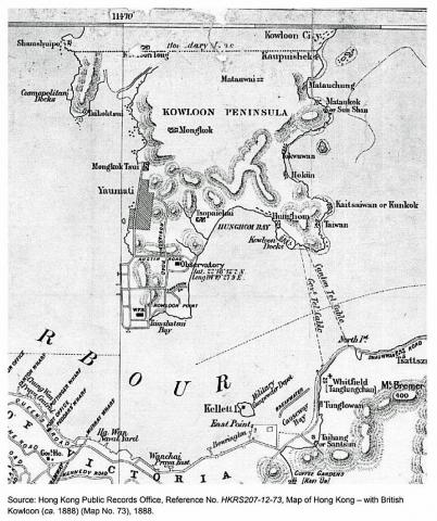
1888: Map of Hong Kong - with British Kowloon (ca. 1888)
1888: Fenwick Shipyard's boat pool
1888: TST point. c1888
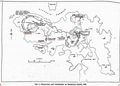
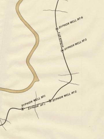
1889: Reservoirs and Conduits 1889
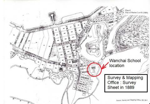
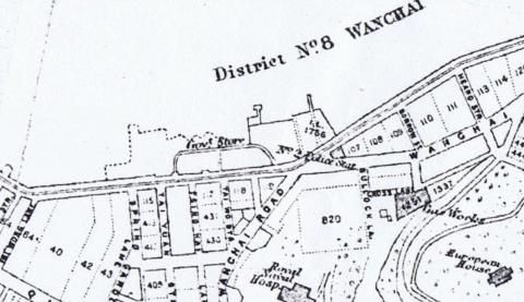
1889: Wanchai 1889
1889: 1889 Map showing 8-sided "Hospital Tank"
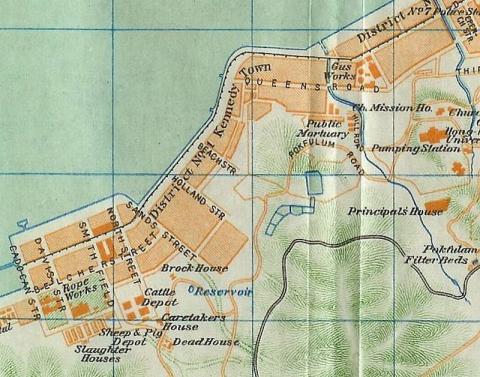
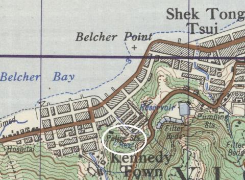
1889: 1889 Map of Kennedy Town
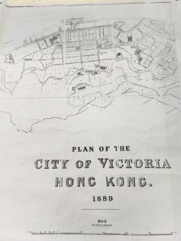
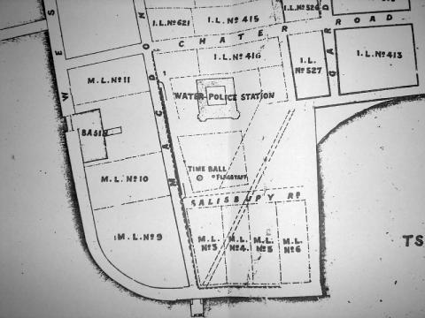
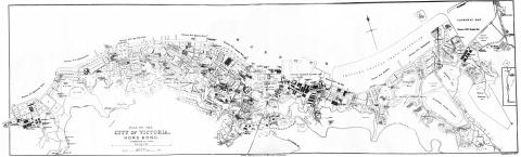
1889: Plan of the City of Victoria Hong Kong.jpg
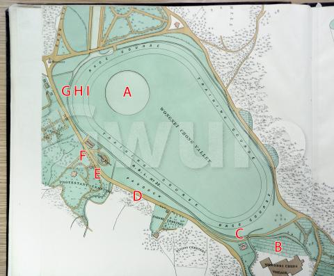
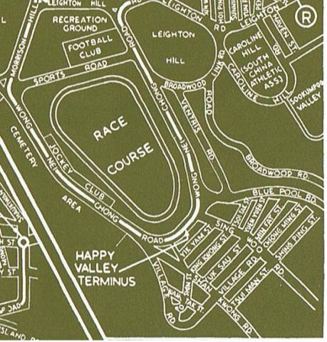
1889: 1889 map of Happy Valley
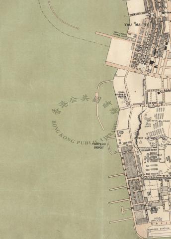
1889: Map showing Star Ferry Pier
1889: 1889-map-of-Pokfulam-conduit.jpg
1889: Survey sheet of Wanchai in 1889
1890: 1890 Site plan of Victoria Battery
1891: Plan of Hong Kong Cantonment
1892: Central + Causeway Bay Map ca. 1892
1892: Cheung Wan Map ca. 1892
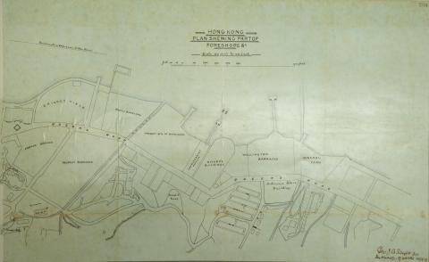
1892: Plan of Hong Kong Foreshore
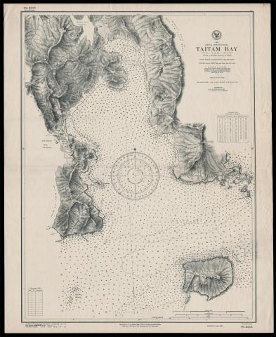
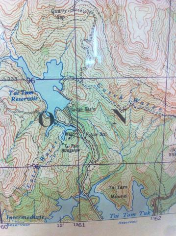
1893: Map of Tai Tam Bay
1895: 1890s Kowloon TST Map.jpg
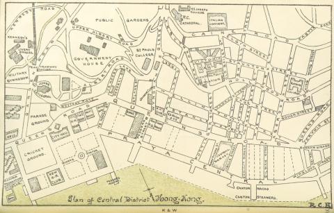
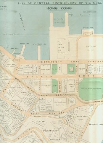
1895: 1890s Map of Central District
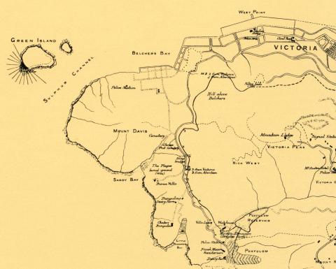
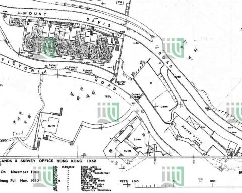
1895: 1895 Map of Mount Davis Area
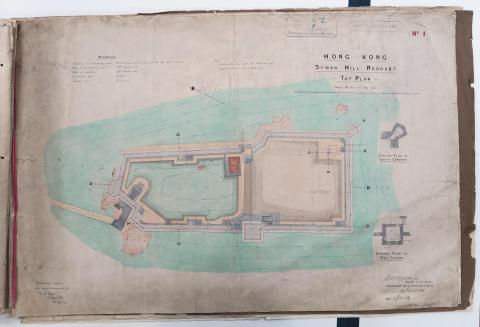
1895: Plan of Saiwan Redoubt
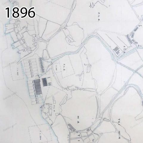
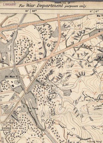
1896: Map of Ho Mun Tin in 1896
1896: Map of Yau Ma Tei in 1896
1896: Ho Mun Tin watercourses in 1896
1896: 1896 Mongkok
1896: 1896 TST
1896: Map of Hung Hom in 1896
1896: European Houses on Hankow Road
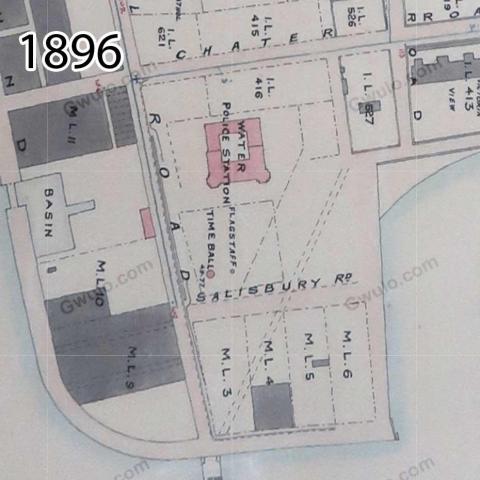
1896: Map of TST in 1896
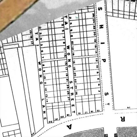
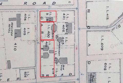
1897: 1897 map of Tai Wong Lane & Street
1897: HURLEY(1897)_p172_Map_of_the_KOWLOON_ESTATE_Property
1897: Map of CPS + Wyndham Street

1897: 1897 Tourist Map of China and Soon to be New Territories
1899: Detailed map of the boundary for the Extension of Hong Kong Territory in 1899
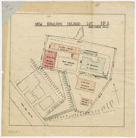
1900: Map N.K.I.L. 1/Basel Mission House
1901: Robinson Road
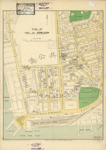
1901: 1901 City Map
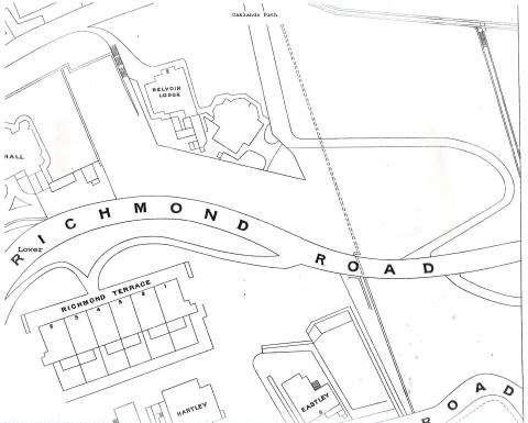
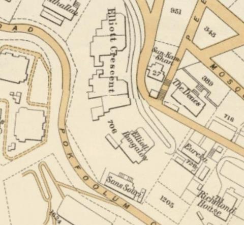
1901: Richmond Terrace
1901: 1901 Lot Map
1901: Queen's Gardens layout
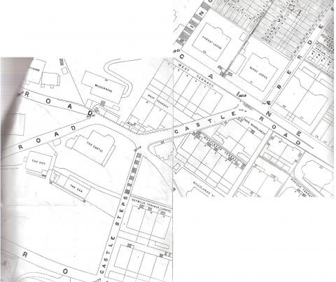
1901: Castle Road - 1901
1901: 1901 Map - Kennedy and MacDonnell Roads - Sheet 16
1901: 1901-map-of-Pokfulam-conduit.jpg
1901: Hospital Tank
1901: 1901 map showing the cotton mill in Causeway Bay
1901: 1901 sheet 9 map, Robinson Road & Richmond Road etc. with house names
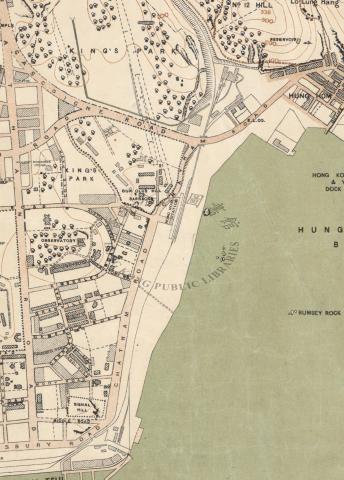
1901: Tsim Sha Tsui Map 1901
1901: 1901 map sheet 7 Bonham Road
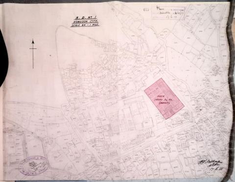
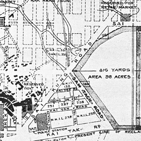
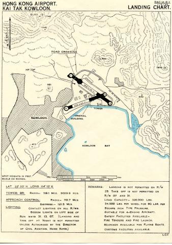
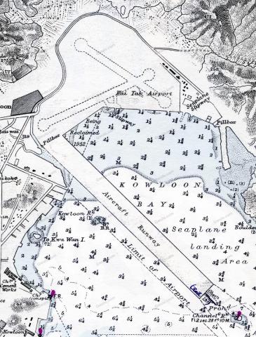
1902: Kai Tak airport area
1902: Maps of Wanchai seafront, 1897 & 1903
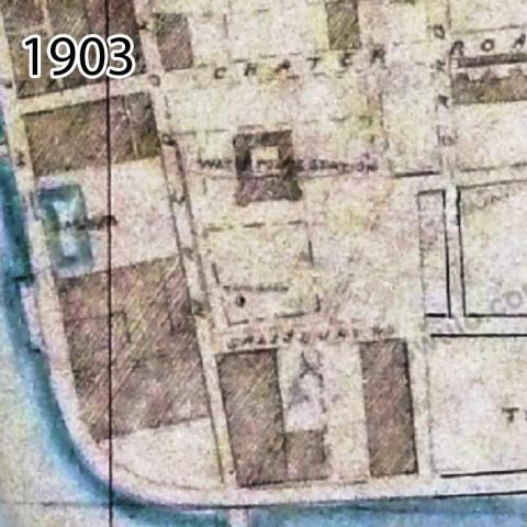
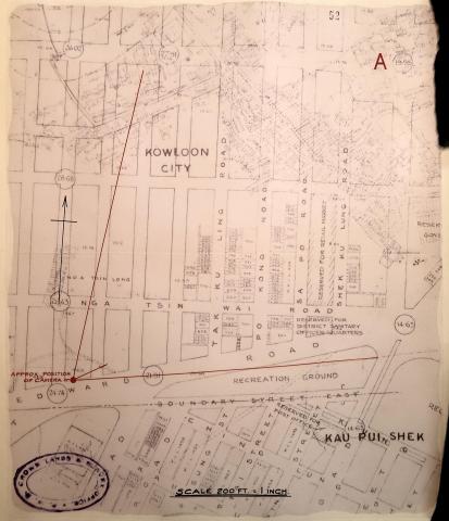
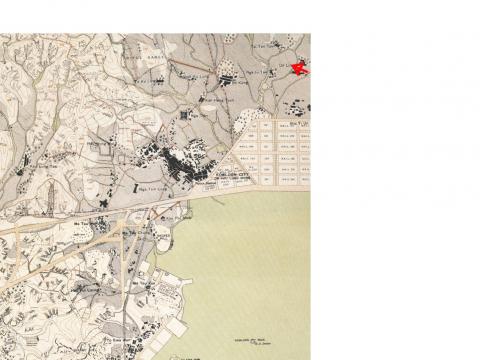
1903: 1903 Kowloon City annotated
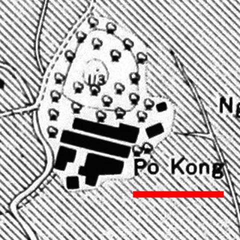
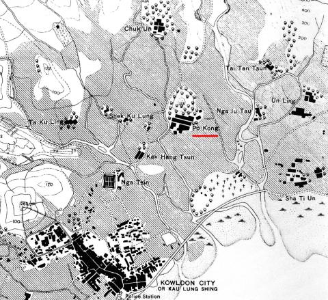
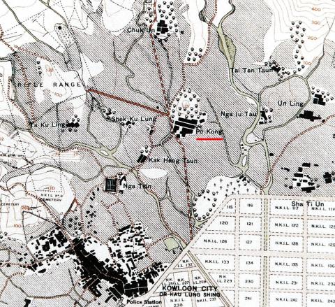
1903: 1902-3 Po Kong village
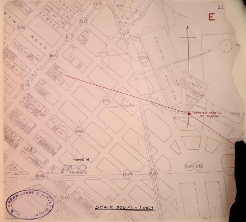
1903: 1903 Mongkok

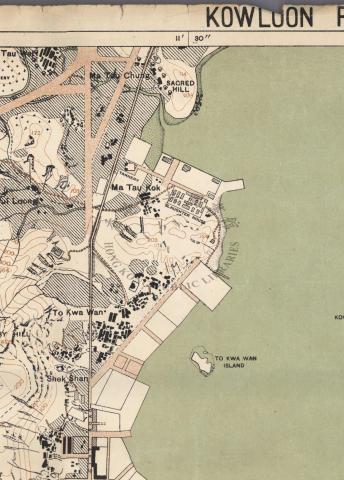
1903: 1903 Map of area around Ma Tau Wei
1903: Map of Peak Road
1903: 1903 Ma Tau Chung
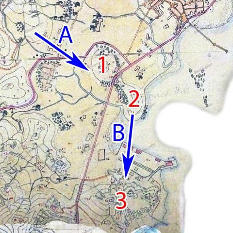
1903: 1902-3 Po Kong village and surroundings
1903: 1903 TST
1903: 1903 Ma Tau Chung (annotated)
1903: 1903 Kowloon City
1903: 1902-3 Map of Tsim Sha Tsui
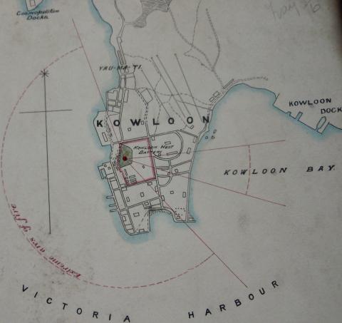
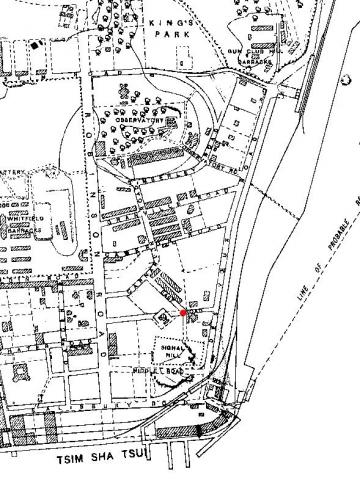
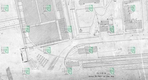
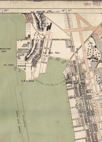
1903: Kowloon West Bty.1.jpeg
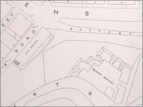
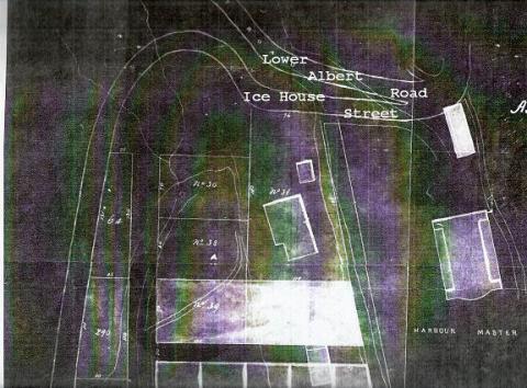
1904: Ice House and Murray Battery
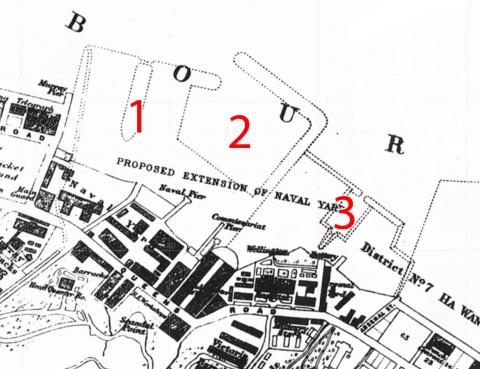
1905: 1905 map of the Naval Yard Extension
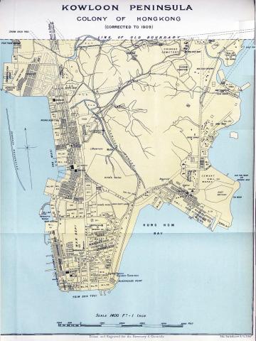
1909: Map of Kowloon Peninsula - 1909
1909: 1909 Map of Hong Kong
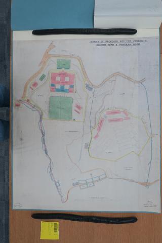
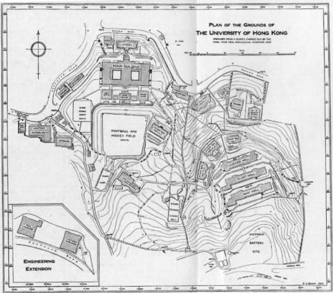
1910: 1910 plan of proposed university
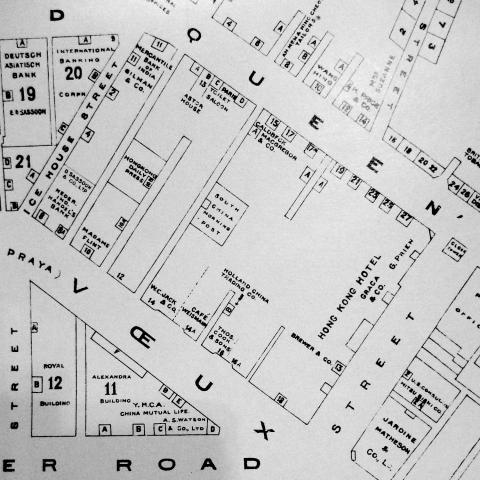
1911: 1911 Map of Central
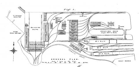
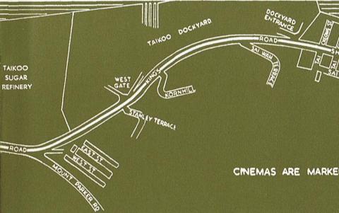
1911: Plan of Taikoo Dockyard
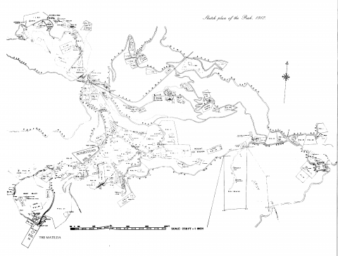
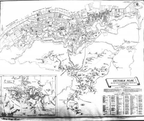
1912: Sketch Plan of the Peak 1912
1913: Wanchai Lot Map 1913
1913: Wanchai map_1913
1915: 1915 Hong Kong Map
1920: Map of Hung Hom in 1920
1920: 1920 Kln - Sheet 4 - Middle-left
1920: 1920 TST
1920: Map of TST in 1920
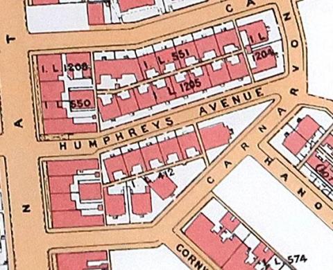
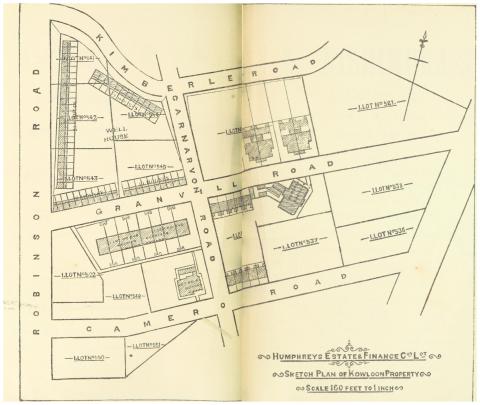
1920: 1920 Humphreys Avenue
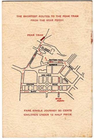
1920: "Star Ferry to Peak Tram" Map
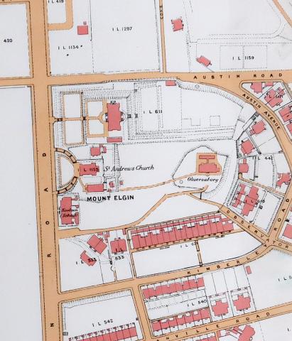
1920: 1920 map of Kowloon showing area around the Observatory
1920: 1920 Kln - Sheet 4 - Top-left
1920: Map of Ho Mun Tin in 1920
1920: Hung Hom Dockyard Quarters.jpg
1920: Map of Yau Ma Tei in 1920
1920: Ho Mun Tin watercourses in 1920
1920: Map of area around Po Hing Fong
1920: 1920 Kln - Sheet 4 - Bottom-left
1920: Ho Mun Tin highlights
1920: 1920 Mongkok
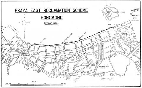
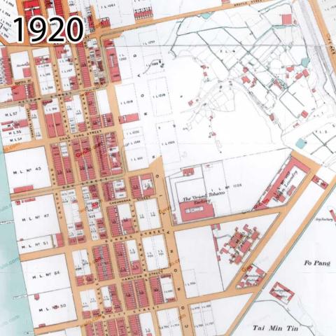
1920: Praya-East-Reclamation-1920s.jpg
1920: Yau Ma Tei landmarks
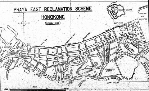
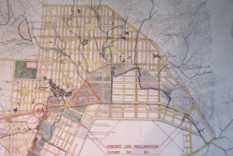
1920: 1920s Praya East Reclamation Scheme
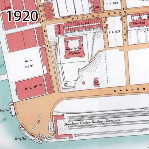
1922: TST map 1922_KCR
1922: 1922 map Chatham/Mody Roads
1922: TST map 1922_detail
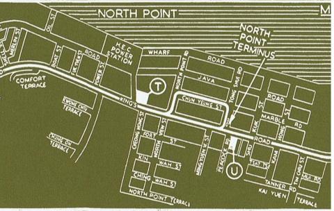
1922: 1922 North Point Map
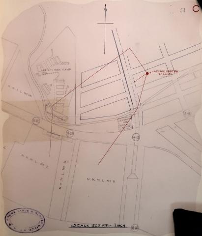
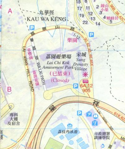
1923: Lai Chi Kok
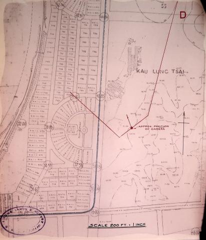
1923: Kowloon City
1923: Cheung Sha Wan
1923: Kowloon Tong
1923: Kowloon City
1923: Shek Kip Mei
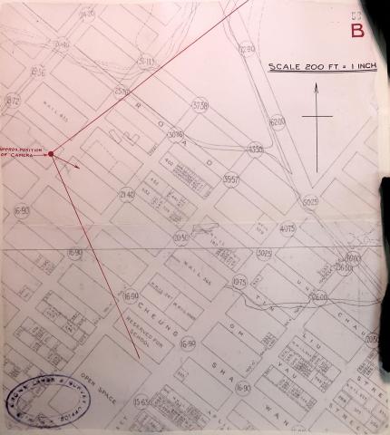
1923: Sham Shui Po / Prince Edward
1924: 1924 Kowloon map - Quadrant 2
1924: 1924 Kowloon map - Quadrant 9
1924: 1924 Thomas Cook 01.JPG
1924: The Peak - Map 1924 (2 of 2)
1924: Kowloon Map - 1924
1924: 1920s Kennedy Town Map
1924: 1924 Kowloon map - Quadrant 4
1924: 1924 Kowloon map - Quadrant 7
1924: 1924 Kowloon map - Quadrant 14
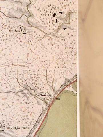
1924: 1924 map of Lok Lo Ha
1924: 1924 Map of Central & Western
1924: 1924 Map of Kowloon
1924: 1924 Map of Kennedy Town
1924: Kai Tak airport area
1924: 1924 Po Kong village and surroundings
1924: 1924 Kowloon map - Quadrant 4
1924: 1924 Kowloon map - Quadrant 8
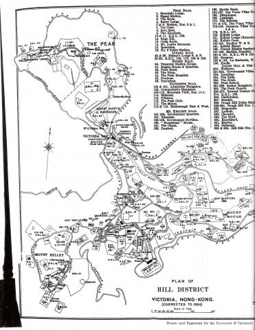
1924: The Peak - Map 1924 (1 of 2)
1924: Port development
1925: Tunnels Kowloon 1925
1925: 1920s East Point Map
1925: Kowloon City proposed hospital
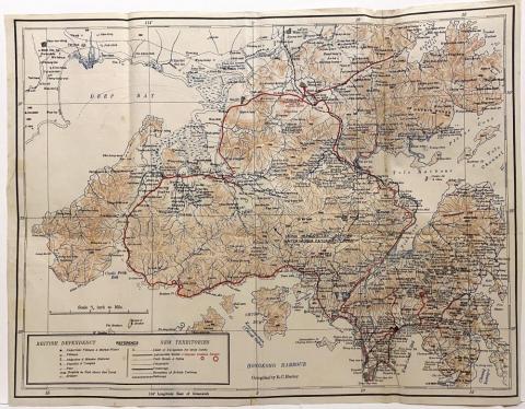
1925: New Territories 1925
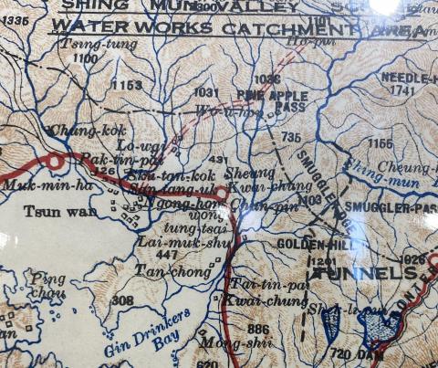
1928: 1928 map of the Shing Mun Valley
1928: 1928 Kai Tak airfield
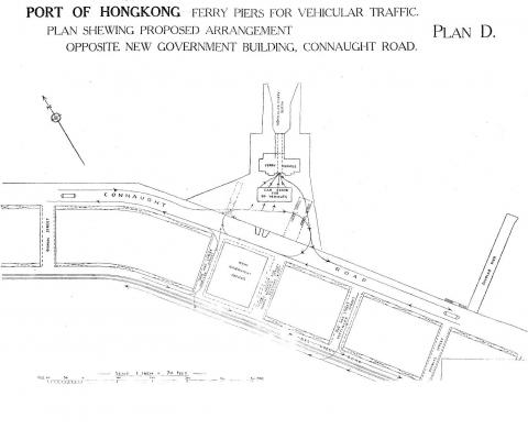
1928: Vehicular Ferry Pier Central: Plan 1928
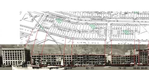
1930: Connaught Road Houses between the Central Fire Station and the Harbour Office 1930
1930: 42302s.jpg
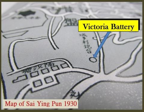
1930: Victoria Battery
1930: 1930 map section
1930: 1930s Kowloon City Street Map
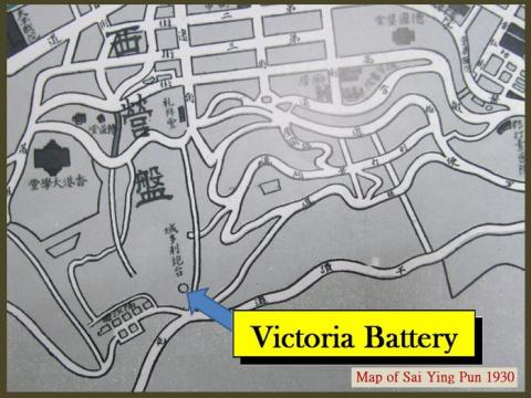
1930: Victoria Battery
1931: Wanchai 1931
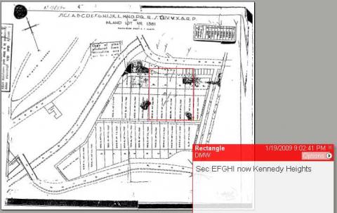
1931: IL 1381 - Kennedy Rd - MacDonnall Rd - Peak Tram
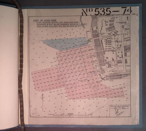
1932: Depths off Kowloon Point
1933: Government Hill redevelopment - proposed 1933
1933: HKU Map 1934
1935: Kai Tak airport area
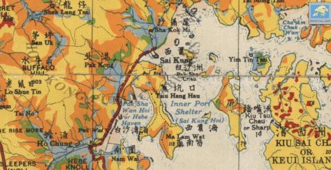
1936: 1930s Sai Kung Police Station
1937: Victoria Battery
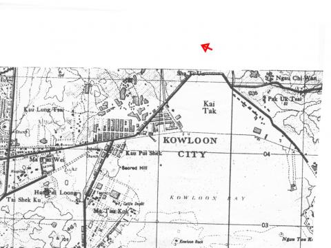
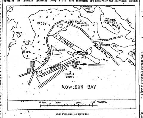
1937: Kai Tak Map
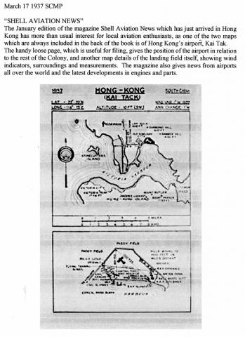
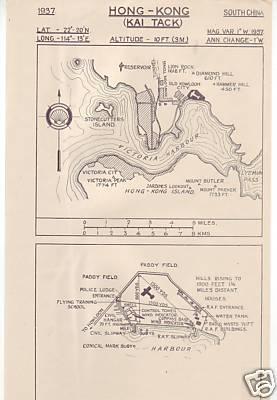
1937: KAI TACK airport location diagram-1937
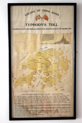
1937: 1937 Typhoon's Toll Document
1938: 1938 HK & Whampoa Dockyad KCR Extension.jpg
1938: LTR escape route map 1: SSP Camp to Three Fathoms Cove
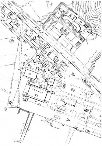
1938: RAF Hangar location in 1938
1938: LTR escape route map 2: To Yeung to Waichow
1938: Map used by Osler Thomas, BAAG
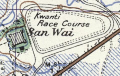
1939: Map of San Wai
1939: 1939 OS Map of Stanley Main Beach
1939: Map-North West New Territories-1939
1940: HK Island Pillbox Map
1940: Admiralty, 1936-46
1940: Sketched Map of Tsim Sha Tsui, 1930s or 1940s
1940: Tsim Sha Tsui-Kowloon Point-development proposal-1940
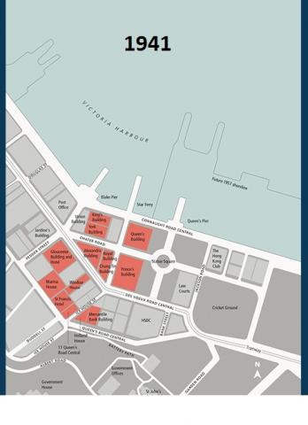
1941: 1941 Hong Kong Land properties
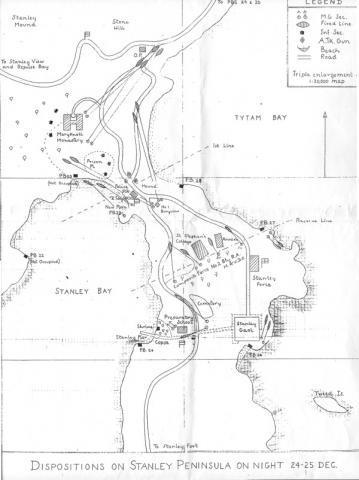
1941: Stanley 1941
1942: stanleymap_1942
1942: Morley's map of SSPo.jpg
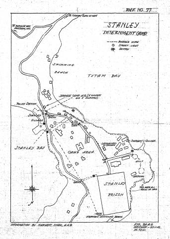
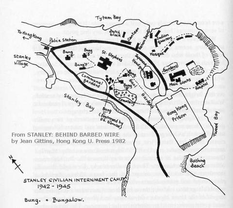
1942: Map of Stanley Civilian Internment Camp
1944: 1945 Map of Amoy
1945: 1945 Map of Kulangsu
1945: Tai Po Bridge map.png
1945: American Air Force map from 1945
1945: American Air Force-Hong Kong Island Map-segment.jpg
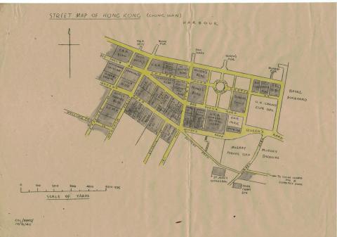
1945: Chung Wan
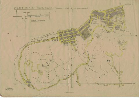
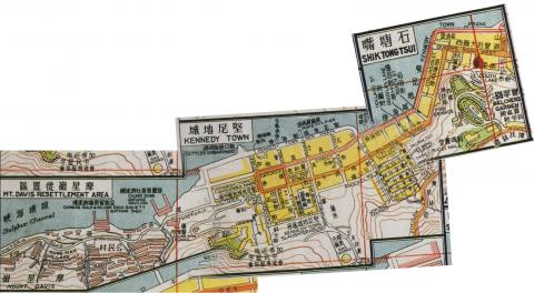
1945: Kennedy Town, Shek Tong Tsui
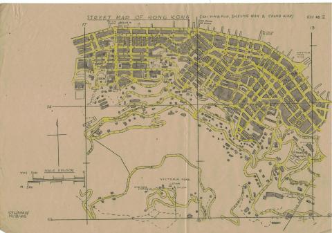
1945: Sai Ying Pun, Sheung Wan, Chung Wan
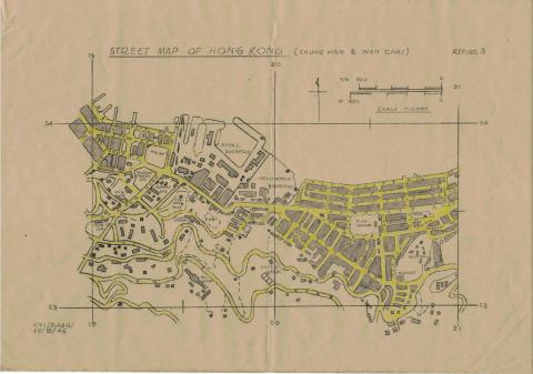
1945: Chung Wan, Wan Chai
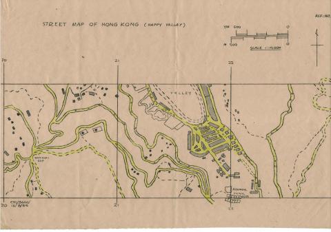
1945: Happy Valley
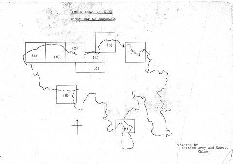
1945: Hong Kong street maps index
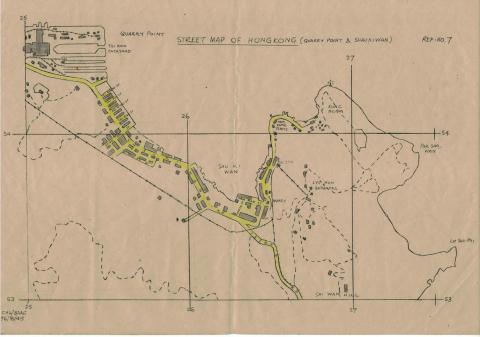
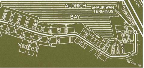
1945: Quarry Point, Shau Ki Wan
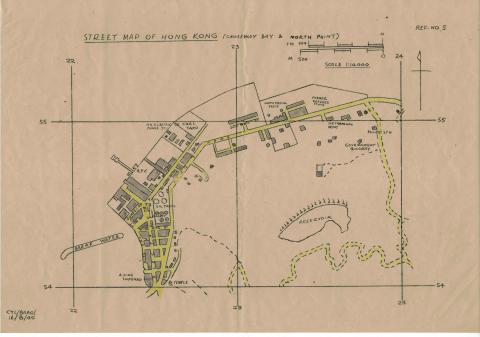
1945: Causeway Bay, North Point, King's Road
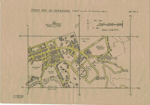
1945: Happy Valley, Causeway Bay
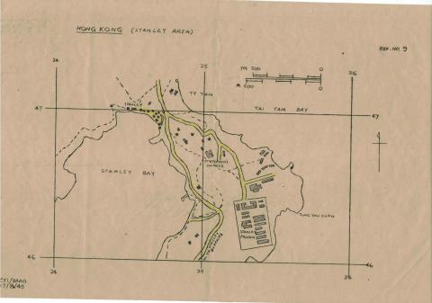
1945: Stanley
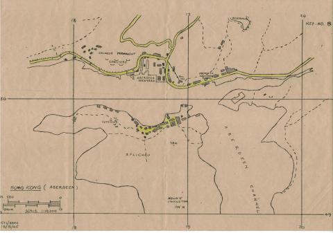
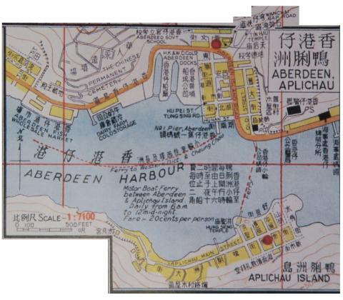
1945: Aberdeen, Aplichau
1945: Kowloon, Boundary Street, Prince Edward Road, Kau Lung Tong
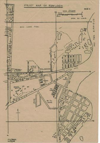
1945: Kowloon, Boundary Street, Waterloo Road, Kau Lung Tsai
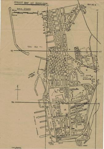
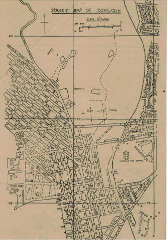
1945: Kowloon, Nathan Road Star Ferry, Yau Ma Ti
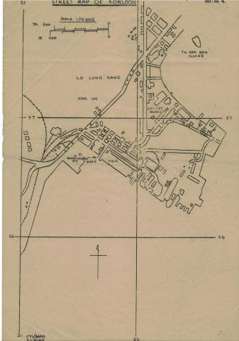
1945: Kowloon, Chatham Road, Lo Lung Hang
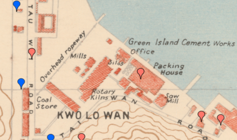
1945: map 1945 Kwo Lo Wan
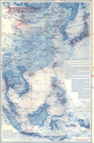
1945: Japanese POW Camps in WWII
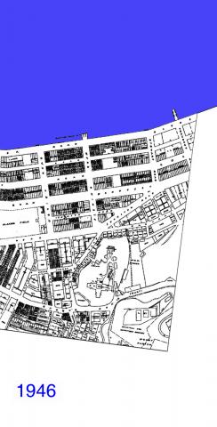
1946: Wanchai 1946
1947: 1947 KCR Railway Siding to Hong Kong Whampoa Dockyard
1947: 1947 Map of Kowloon near Chatham Road
1947: 1947 KCR Railway Siding to Holt's Wharf & KWGC
1947: Kai Tak Map 1947
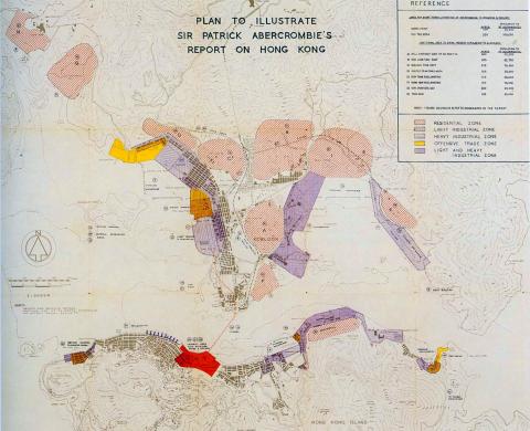
1948: Abercrombie development map-1948
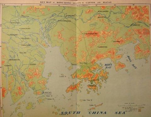
1950: 1950s Map Of Hong Kong (Relative to Canton and Macao)
1950: HK map 1950's 2.jpg
1950: 1950 Sookunpoo Map
1951: Kai Tak - map 1950/51
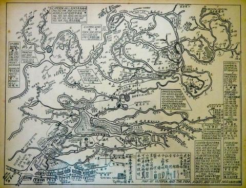
1951: Map of Ultopia & The Peak 15 Dec 1951.JPG
1952: 1952 map of Naval Dockyard
1952: 1952 map of Sugar Refinery
1952: North Point 1952
1953: 27 HK Guide Book Page 48 & Inside Back Cover
1953: 28 HK Guide Book Page Map Inside Back Cover
1953: 02 HK Guide Book Inside Front Cover Map
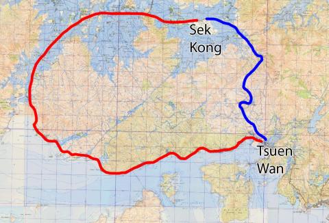
1953: Before and after Route Twisk
1954: 1954 HK Tramlines - Kennedy Town to Sai Ying Pun
1954: 1954 HK Tramlines - Sai Wan Ho to Shaukiwan
1954: 1954 HK Tramlines - Happy Valley Racecourse
1954: 1954 HK Tramlines - Sheung Wan to Central
1954: 1954 HK Tramlines - Causeway Bay to North Point
1954: 1954 HK Tramlines - Central to Wanchai
1954: 1954 HK Tramlines - Quarry Bay to Sai Wan Ho
1954: 1954 HK Tramlines - Wanchai to Causeway Bay
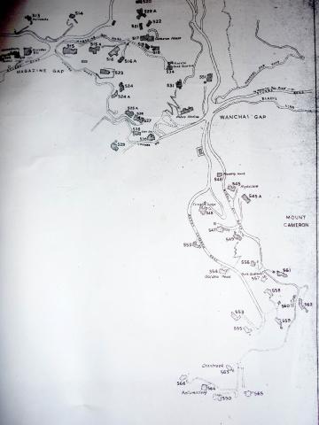
1955: 1950s Map of Wanchai Gap & Mount Cameron
1955: 1950s North Kowloon Map
1955: 1955 1-600 Robinson Road 196-SW-9
1955: Hong Kong Flotilla Armed Motor Launch on Patrol -The Crew
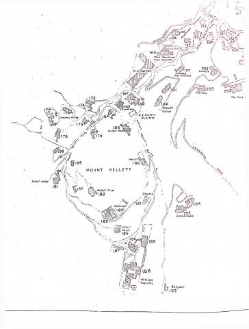
1955: 1950s Map of Mount Kellett
1955: 1950s Map of Central District
1955: Shek Tong Tsui Godowns (1950s) and map (1905)
1955: 1955 The Peak
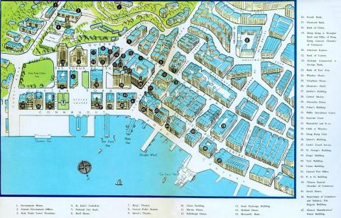
1955: Hong Kong-Central Business District-Pictorial map-1955
1955: Hong Kong-Pictorial map-1955
1955: 1955 1-600 map of Wyndham Street
1956: Peak Map
1956: Map West Point Pier (Tong Shui Road) 1956
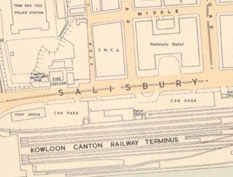
1956: Hong Kong Guide 1956 Map Of Kowloon
1957: Hong Kong street map 1957
1957: 1957 Map of Tai Po Market
1957: 1957 map of Tai Hang
1957: Wanchai Road
1957: Kai Tak airport area
1957: 1957-1-1-200-Lai-Chi-Kok-161-SE-B-(Ed-1957).jpg
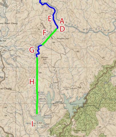
1957: 1957 map of the Shing Mun / Golden Hill area
1957: Hong Kong map 1957
1957: Kowloon street map 1957
1957: 1957 Sham Tseng map
1957: Map Wanchai Road 1957
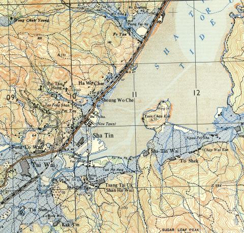
1957: 1957 Map of Shatin area
1957: Dockyard 1950s upload.jpg
1957: 1957 Map #3
1957: 1957 Map #1
1957: 1957 Map #2A
1957: 1957 Map #2B
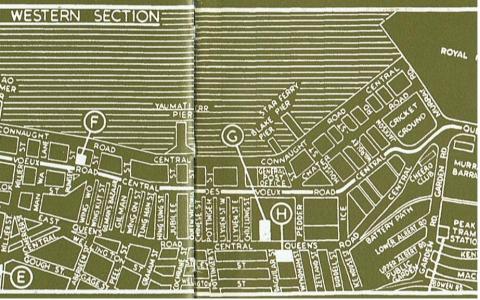
1957: 1957 Map of Central
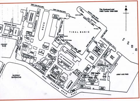
1958: Tamar.jpeg
1958: 1958 Map of Kennedy Town Area
1958: Far East Camp map
1958: 1950s TST Street Map
1958: 1958 Map of Pokfulam / Pokfield Roads junction
1958: 1958 map of Aberdeen
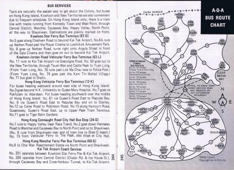
1959: Bus & Tram Route. Central, Hong Kong, 1956
1959: 1959 BOAC Street Map of Central
1959: 1959 Map of Central
1959: 1959 1:600 Dairy Farm
1959: Harcourt road_proposal
1960: A.R.P. SCHOOL AND HEADQUARTERS
1960: StJoseph'sComplexMap.jpg
1960: 1960s Cinemas in Kowloon
1960: 1960s TST Hotel Map
1960: 1960 map of block bounded by DVRC / Potttinger St / Connaught Rd / Douglas St.jpg
1960: 1960s Central District Map
1960: TST map 1960_febr_detail
1960: Sea Terminal-location Navy Street
1961: 1961 Map of Buildings between Ice House St and Pedder St
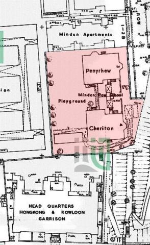
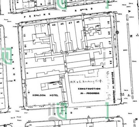
1961: 1961 1:600 Minden Row School
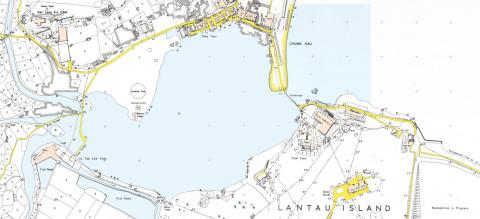
1962: 1962 Map of Silvermine Bay
1962: 1962 1-600 212-NW-4 showing Blarney Stone
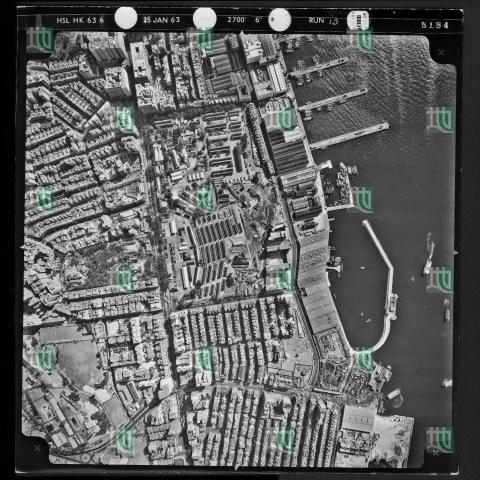
1963: 1963 map of TST
1963: 1963 Map of Tsim Sha Tsui
1963: Map of Wan Chai in 1963 (Chinese Version)
1963: Map of Seymour & Robinson Roads
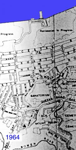
1964: Wanchai 1964
1965: 1960s Map of Central
1967: Cavendish Heights 1960s
1968: Map showing Southern end of Anderson Road, circa late 1960s
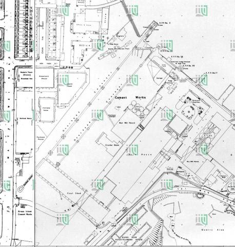
1969: 1969 map of Green Island Cement Company
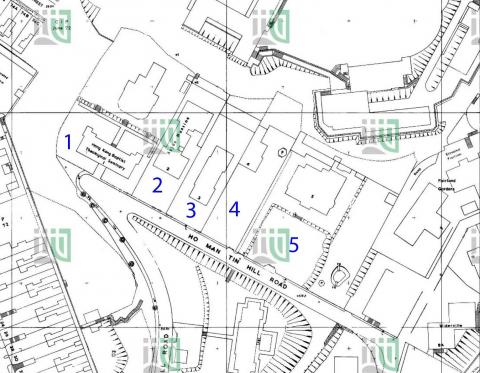
1974: 1974 1:600 Ho Man Tin Hill Road 179-SE-2-(Ed-1974-01)
1975: 1975-09 map of the Gutzlaff Street Area
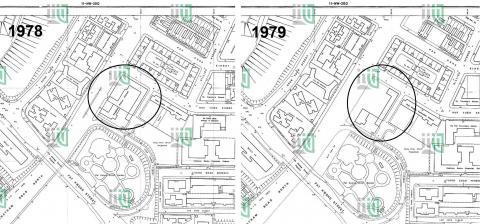
1979: Hung Hom Police Station 1978_79
1980: Bus map 1980
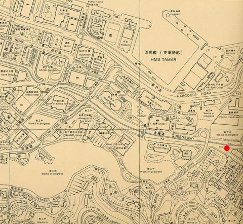
1980: 1980 Map of Admiralty
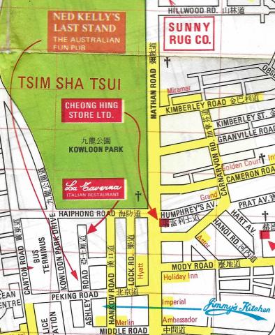
1980: Jimmy's Kitchen Kowloon on the 1980 map
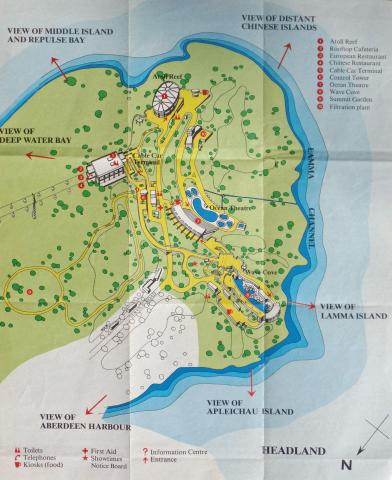
1980: Ocean Park Map Headland (1980).jpg
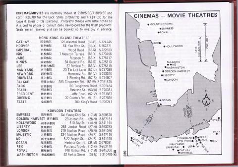
1980: Cinemas/Movie Theatres_1980
1980: Hung Hom Piers (1980)
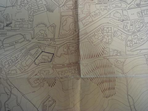
1980: Po Shan Road 1980.JPG
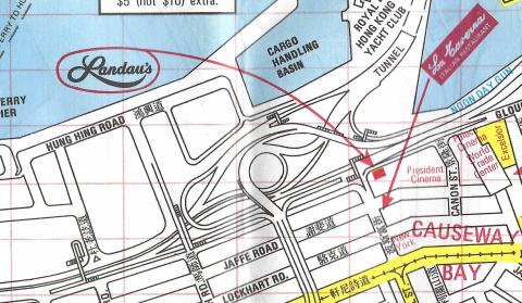
1980: Landau's Restaurant on the 1980 map
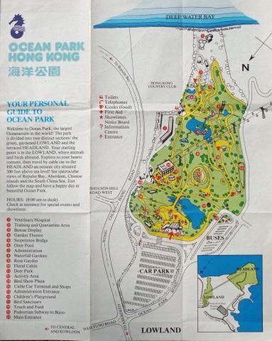
1980: Ocean Park Map Lowland (1980).jpg
![]()
1980: Transport Map 1980
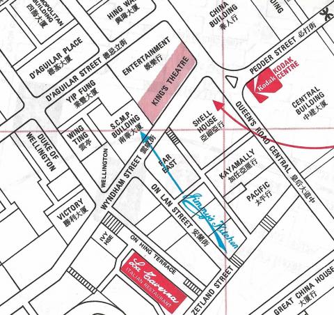
1980: Jimmy's Kitchen on the 1980 map
1980: Hong Kong Map (1980)(2).jpg
1980: Hong Kong Map (1980)(3).jpg
1981: Tsim Sha Tsui.jpg
1983: Kowloon street map
1987: 1987 map of the Shing Mun / Golden Hill area
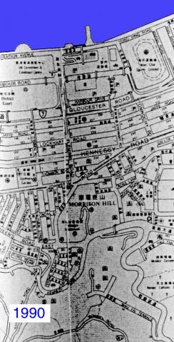
1990: Wanchai 1990
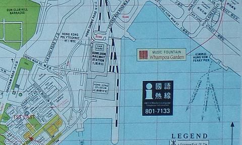
1990: Map of Hung Hom Bay about 1990
1997: 1997 map of Lai Chi Kok
1997: tsing yi power station map
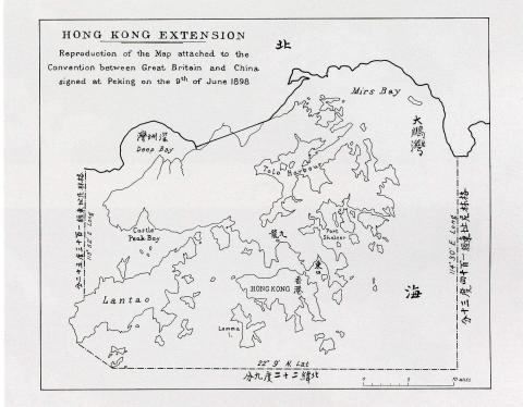
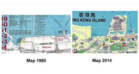
1998: Map of Hong Kong in The Convention for the Extension of Hong Kong Territory in 1898
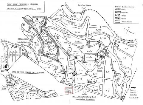
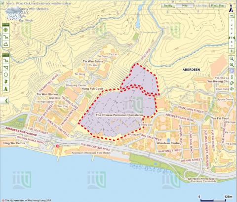
2010: Hong Kong Cemetery Map
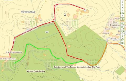
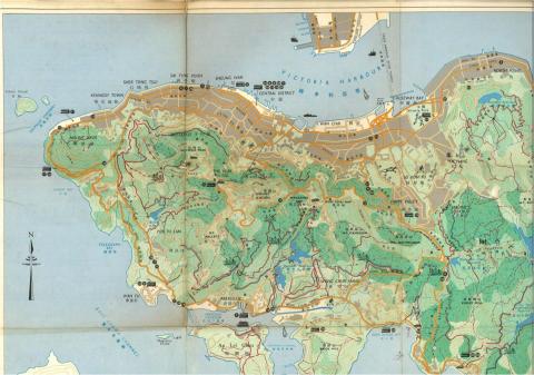
2011: Map of Victoria Peak
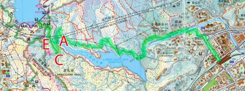
2011: Route from Upper Peak Tram Terminus to Wanchai Gap
2013: 2013 map of lower Shing Mun reservoir
2014: Maps Fenwick Pier 1980_2014
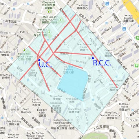
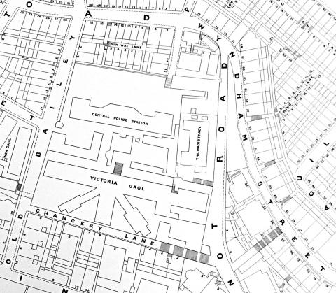
2014: Map of area around Central Police Station
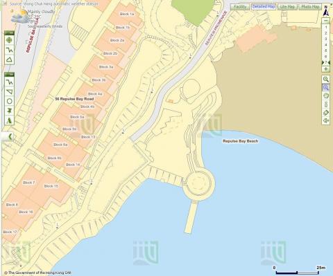
2015: Repulse Bay Map
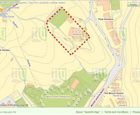
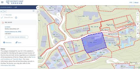
2015: Haystack - RBL 509
2015: AIL 78
2015: A bend on Victoria Road
2015: A bend on Victoria Road and Sai Ning Street Garden
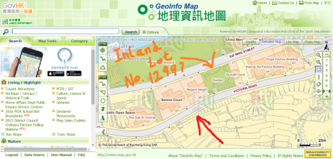
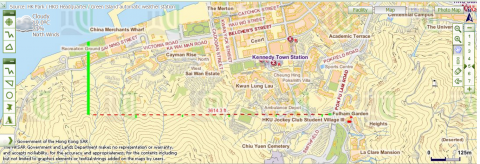
2015: Map
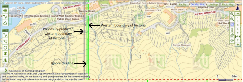
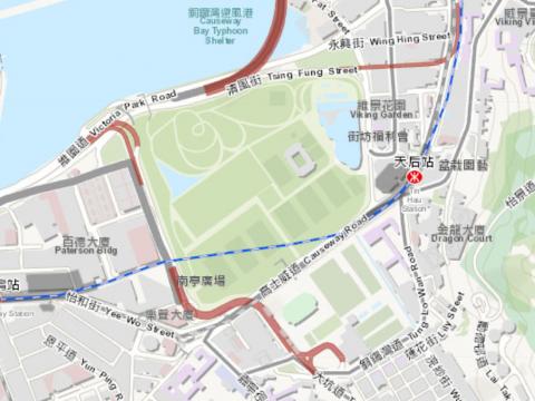
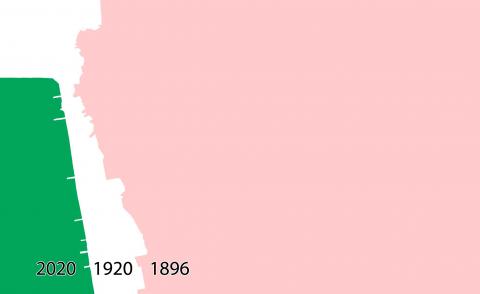
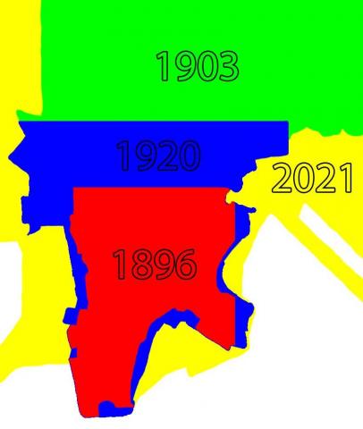
2015: Western boundary of Victoria and previosuly-predicted location of the boundary
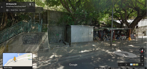
2015: 'Shed' which the city boundary of Victoria cuts through on Victoria Road
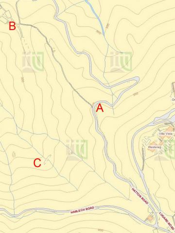
2015: Lines drawn to deduce the location of Victoria's western boundary
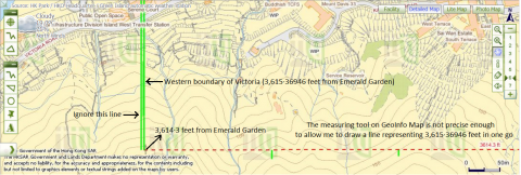
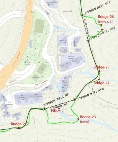
2015: 3,615·36946ft from Emerald Garden
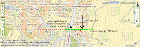
2015: The University of Hong Kong's St John's College and Victoria's southern boundary
2015: Map of High West
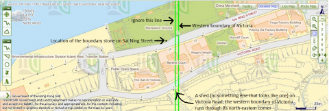
2015: City boundary of Victoria intersects Victoria Road and Sai Ning Street
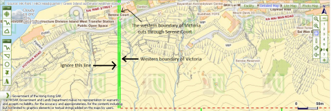
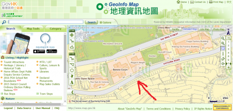
2015: Victoria's western boundary cuts through Serene Court.png
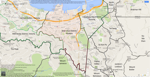
2015: Map of Wan Chai District, Victoria, Hong Kong
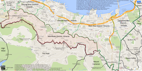
2015: Map of Mid-levels District, Victoria, Hong Kong
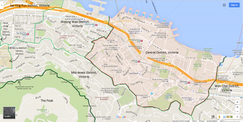
2015: Map of Central District, Victoria, Hong Kong
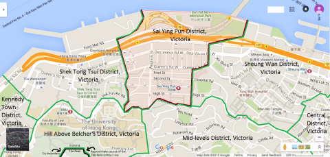
2015: Map of Sai Ying Pun District, Victoria, Hong Kong
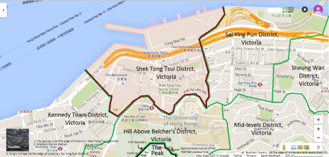
2015: Map of Shek Tong Tsui District, Victoria, Hong Kong
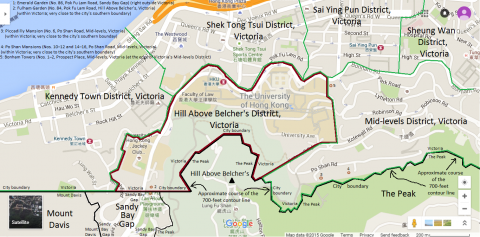
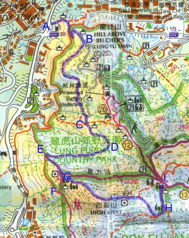
2015: Map of Hill Above Belcher's District, Victoria, Hong Kong
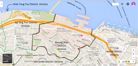
2015: Map of Sheung Wan District, Victoria, Hong Kong
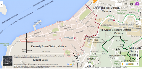
2015: Map of Kennedy Town District, Victoria, Hong Kong
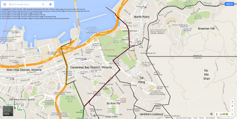
2015: Map of Causeway Bay District, Victoria, Hong Kong
2016: 2016 Causeway Bay map
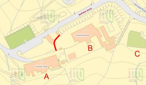
2016: 2016 Map Barker Road.jpg
2016: Map of Anti-Aircraft sites at Tai Mo Shan
2016: IL 619 RP
2016: Tunnel above Siu Sai Wan
2016: Map of Sai Wan Hill Battery & Redoubt
2017: Modern map of HKU area
2017: IL 1874
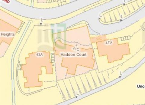
2017: Map of buildings around Haddon Court
2017: 2017 Map of Admiralty
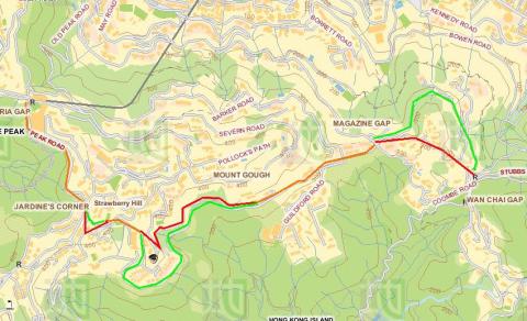
2019: Annotated map of Magazine Gap Rd
2020: Wong Chuk Shan map
2020: Map of The Peak
2020: List of Lights Hong Kong
2021: 2021 Ma Tau Chung's lost hills
2021: The water tunnel inlet above the lower Shing Mun reservoir
2021: Gwulo-A623-Modern-map-crop.jpg
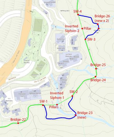
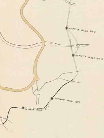
2021: Gwulo-map-of-Pokfulam-siphons.crop_.old+new-conduit.jpg
: LTR escape route map 3: BAAG HQ and British Embassy
: Admiralty, 1964
: Ho Mun Tin reclamation
: hkislandSW.jpg
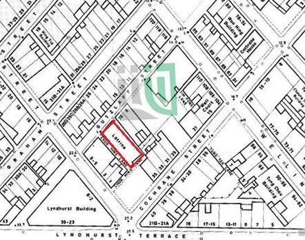
: 1897 map of Cochrane Street
: Tutorial 3
: thepeakarea_a.jpg
: 1889-map-overlaid-Pokfulam-conduit.jpg
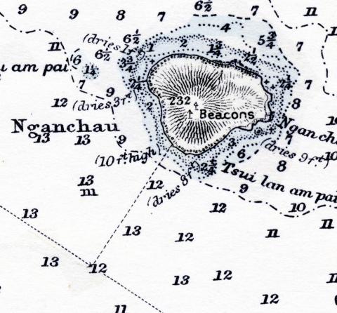
: Nganchau
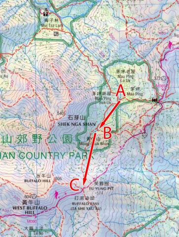
: Map of Wong Chuk Shan boulder trackway
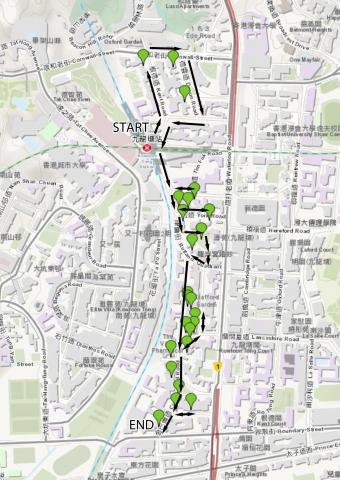
: Map of Kowloon Tong walking route
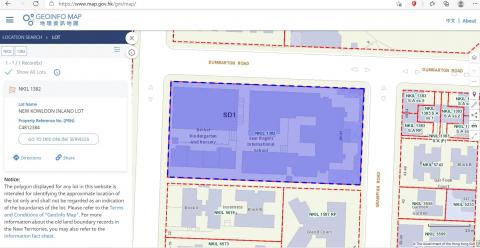
: N.K.I.L. 1382
: Hydrographic Office
: 1928 map of the Shing Mun / Golden Hill area
: Hung Hom reclamation
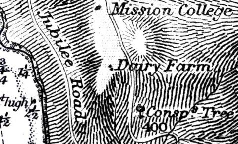
: Conspicuous tree
: Admiralty, 1990
: 1912 Peak Map
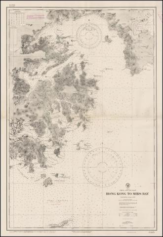
: Hong Kong to Mirs Bay map.jpeg
: Map of Mong Kok in 1920
: hkislandSE.jpg
: Tutorial 04
: hkislandNE.jpg
: TST lights
: Tai Tam (War Office Hong Kong Map)
: Tutorial 01
: 1920 map of Kowloon
: Kai Tak
: Reclamation in TST
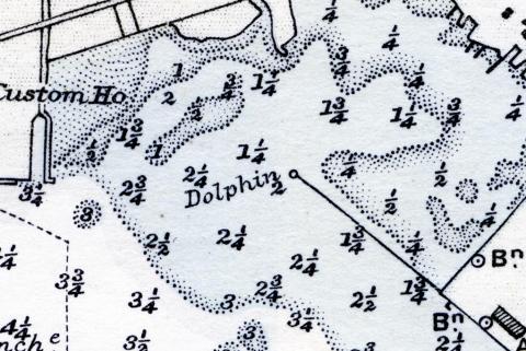
: Dolphin
: 1940s map.jpg
: R.B.L. 549
: Location of North Point Bty
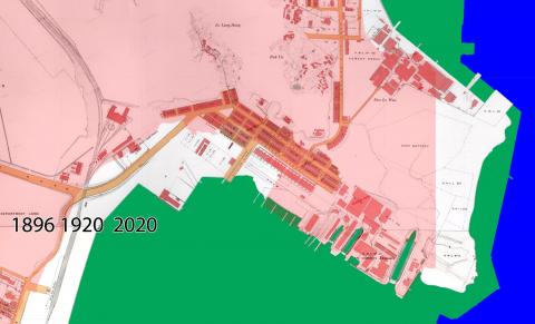
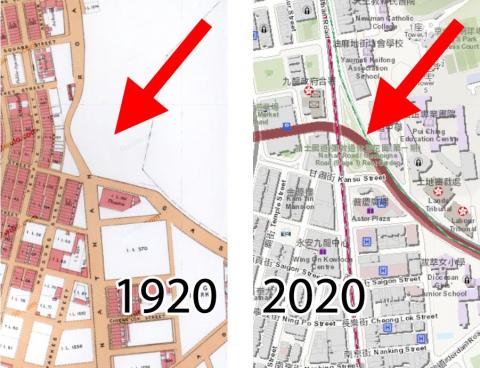
: Comparison of maps
: Hong Kong O\S 1970
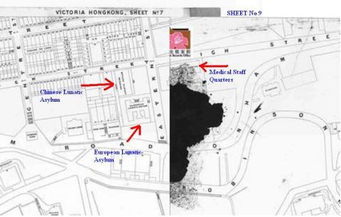
: Plan of the CITY OF VICTORIA 1905
: Tutorial 05
: hkislandNW.jpg
: 1901 map High Street
: Tutorial 02
: DSCF5012.JPG
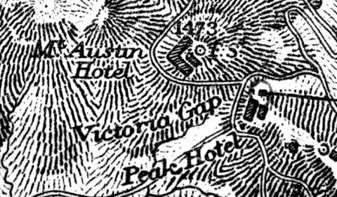
: Mount Austin Hotel

: Yau Ma Tei reclamation
: Hill near Market Street / Nathan Road
: High chimney
: cape_collinson_military_cemetery.jpg

