Get Gwulo's books
Directory
Click on your area of interest to choose from over 30,000 pages about old Hong Kong:
- Images & photos
- View - View galleries - View new - Create - Forum topics
- View - Create - Places & buildings
- View map - View new - Create - Streets
- View map - View new - Create - People
- View - View new - Create - Organisations
- View all - View new - Create - Diaries & memoirs
- View - View new - Create diary - Create page - Events
- View - View new - Create - Jurors lists
- View - Type a page
Or choose a popular article:


Comments
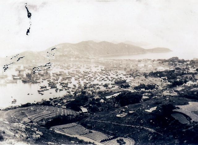
CC's Harbour View from Upper Fairy Well region
Hello everyone,
This photo was being taken at the turning point of the Peak Road West near the westside of the Lot of House #30--The admiralty building , next to the House #29,
Over the nearby farmer's field, there was a litle vale and its east slope was where the Dong Guoong Charity Cementry was supposed to be in the old day.The landowner familyand their related folks had few very well-constructed tombs and surrounding land to separate theirs from the others. You may see them in the picture. Facing West was a very good choice, that should bring good luck to the living ones.
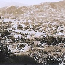
We kids from the CLCY village would run across it to the top of the hill for the site of a grassy field which was really everybody's playground. There were couple of walks leading to this elevated location and the open space can be seen in the other photos related to the Fairy Well region.
Nice area. Aeroplane flied over here many times daily too.
Tung
More comment .....
I have a feeling this photo is being taken around the 1930s or even before that.
As seen over the main harbor, there are many huge fishing vessels of size capable for months long fishing harvest expsditions mainly over the South China Sea.
This is a good piece of evidence, on historic ground, for people here to acknowledge their right and freedom to use and to enjoy the resources over most of the South China Sea. And since , by far, there never any regional disputes prior to the 1970s, between those nearby countries, the best solution to keep peace in today's SCS issue should be a fair deal agreed via working and sharing between the regional countries.
Make sense?
Tung