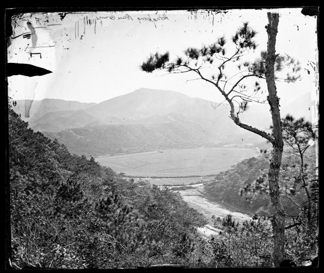
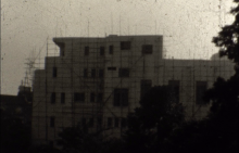
Is that large gap towards the right side part of today's Queen's Road East. Thanks a lot for your help
Get Gwulo's books
Directory
Click on your area of interest to choose from over 30,000 pages about old Hong Kong:
- Images & photos
- View - View galleries - View new - Create - Forum topics
- View - Create - Places & buildings
- View map - View new - Create - Streets
- View map - View new - Create - People
- View - View new - Create - Organisations
- View all - View new - Create - Diaries & memoirs
- View - View new - Create diary - Create page - Events
- View - View new - Create - Jurors lists
- View - Type a page
Or choose a popular article:


Comments
Technically no, but you are
Technically no, but you are in the right general area. It is a remarkable photo that deserves more attention. It is amazing to see the natural topography before everything got paved with concrete or removed outright!
The photographer would be standing on the southern wooded slopes of Morrison Hill. The very narrow strip of white glimpsed between the trees towards the bottom right would be Gap Road . The stream in the bottom right draining towards Happy Valley under Wong Nai Chung Road towards the nullahs and onwards north to Bowrington Canal (beyond the photo to the left) would be now under the precincts of the Muslim Cemetery, approximating to just south of Hau Tak Lane today. The wooded slopes on the right would be Inland Lot No.288 which in two years' time would be deeded on 15th July 1870 by Major General Henry Wase Whitfield on behalf of the Colony of Hong Kong for the purposes of a "Mussalman Cemetery", with boundaries adjusted later in 1938, but still invested in the Crown. To the right of where the stream runs under Wong Nai Chung Road would be where the Ammar Mosque would be built at the foot of the hill.
If you enlarge the photo you can actually see the H.M.S. Vestal Monument poking through the tree line near the centre of the photo. Again if you enlarge the photo, in the distance of the valley, you can see the Wong Nai Chung Village, confirming the correct orientation of the photo's location.
I don't know if my eyes are playing tricks but you can already make out a circular outline of where the circular pond inside the Happy Valley Racecourse would be.
So todays Queen's Road East would include that part of Gap Road we can see in the photo but also the (to be levelled mainly in the 1920s) southern slopes of Morrison Hill that we can see at the bottom centre of the photo..
Thanks for posting daniel - a gem of a picture!