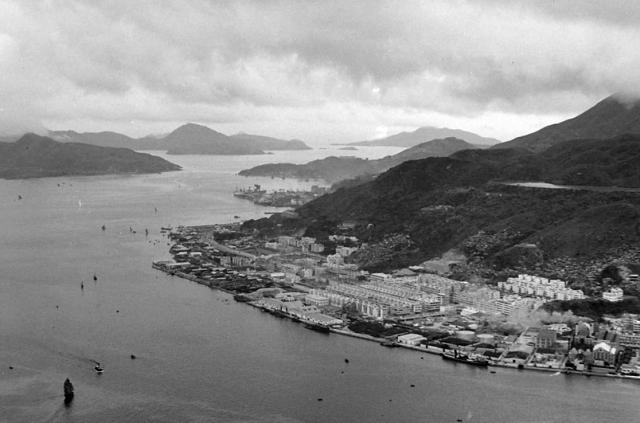
Not much recognisable today. HK Electric's power station is extreme right belching out smoke from its chimney. Taikoo dockyard can be seen in the distance. A reservoir high on the hillside would have been a danger to those below if its walls were ever to breach.
North Point-aerial view-1950.jpg
Primary tabs

Submitted by IDJ
Date picture taken (may be approximate):
Thursday, June 15, 1950
Gallery:
Connections:
- North Point-aerial view-1950.jpg shows Place North Point Power Station [1919-c.1981]
- North Point-aerial view-1950.jpg shows Place Braemar Reservoir [1894-1975]
- North Point-aerial view-1950.jpg shows Place Braemar Terrace (1st generation) [????-????]
- North Point-aerial view-1950.jpg shows Place Luna Park, North Point [1949-1954]
- North Point-aerial view-1950.jpg shows Place Holland-China Trading Company Godown [c.1950-c.1970]
- North Point-aerial view-1950.jpg shows Place North Point Wharves [????-????]


Comments
Re: Luna Park?
Hi there,
I wonder if the open space east of the oil storage was Luna Park. Couldn't make out any features there but if the time frame was right, it should be somewhere around there.
There also were lots of squatterred huts on the slopes on both sides and above the Fortress Street blocks.
T
Re: Ming Yuen Street West flooding in the 1960s
Hi there,
As far as I could recall there had been a severe flood/mud slide along Ming Yuen Street West. Cars parked along the slope were washed down, overturned and into a big pile down at Kong's Road. That would likely have something to do with the reservoir up there.
T
Re: Luna Park
Yes, that is Luna Park next to North Point Wharves (NPW in dark paint on the roof and also on the aerial photo). Luna Park was located at 293 King's Road.