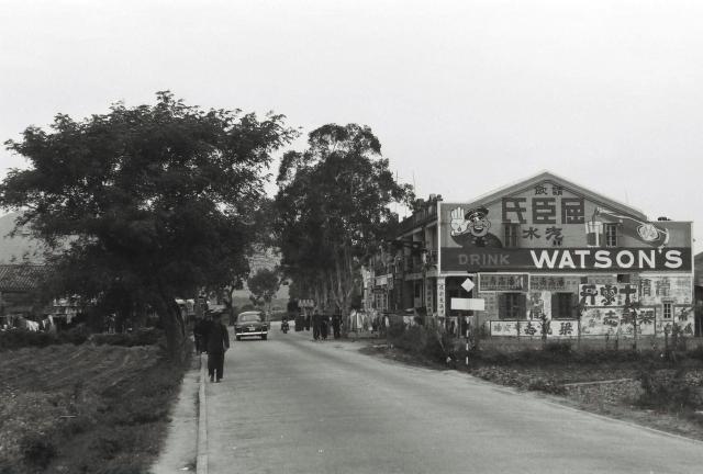
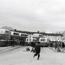
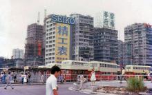
This looks very much like a stretch of the Castle Peak Road, possibly in the Yuen Long, Kam Tin area. I think that I have seen the wall with the advertising signs previouysly. Any suggestions?
Thanks to observations by tngan and terewong, and comparing this image and the one by Dennis Dung with Google Earth street view, it now seems much more likely that they were both taken in the San Hui area just to the north of Tuen Mun. I have inserteed a pin onto the map.


Comments
Tuen Mun
It's Tuen Mun
Thanks for the positive
Thanks for the positive location for Malcolm's photograph. Would you be able to insert a pin on David's map?
Regards Andrew
Re: Tuen Mun
Hi There,
I have to screen capture the zoomed-in photo and then further zoom in a bit before I was able to read the sign 鹿苑酒店 (Look Yuen Hotel) with an arrow pointing to the left hand side of the photo. That made the location somewhere along the Sun Hui area in Tuen Mun.
I believe we have another thread showing the Look Yuen Hotel somewhere on this site.
T
Another view of this building
Another view of this building, photo provided by Dennis DUNG
Look Yuen Hotel
Thank you Thomas and Terewong.
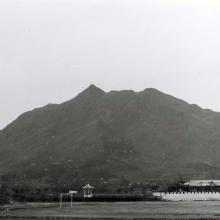
I have inserted a pin for the Look Yuen Hotel photographs taken by Malcolm Teasdale and Dennis Dung, which I think was approximately where the Tuen Kwai Road crosses the Castle Peak Road. My suggestion is based on the line of the hillside shown on the Dung photogaph and the more distant line of the hills on Malcolm's photograph, both when compared with Google Earth Street views. I shall also add links to the pin onto Malcolm's photograph and, if possible, onto the Dennis Dung one. With a bit of luck we have managed to locate both photographs as havingbeen taken slightly to the North in the San Hui area. Regards Andrew
Re: Look Yuen Hotel
Hi Andrew,
The building in the photos was not Look Yuen Hotel itself. But the Hotel is close by. A street was named Luk Yuen Street close to the Sun Hui area, which may be close to the original location of the hotel.
T
Thanks Thomas,
Thanks Thomas,
Would you suggest changing the pin's name and if so how? I have just viewed Luk Yuen Street on Google Earth and see that it is much further to the South on Castle Peak Road than I had thought. Maybe the pin needs moving as well as the title of the image changing! Andrew
Re: Look Yuen Hotel
Hi Andrew,
There is already an existing marker for that. Luk & Look sounded the same in Cantonese and if the street was to commemorate a previous monument\house\place it is usually close to its original location. In this respect I believe it is likely so.
Will have to look up more older maps or older aerial photos for more information though.
T
Location
Thanks @Andrew Suddaby , I dont know how to put the location pin here, would you do me a favor ? the location is https://goo.gl/maps/dDhEUzoBzYvmuwF9A ( provided by Dennis DUNG )
Malcolm Trousdale photograph
Thank you Terewong and Thomas. I have moved the pin to what I think is the spot that Terewong has provided. If not it can be nudged a bit. However, the title that I gave to Malcolm's photograph is not accurate. Can anyone think of a more precise one? 'Castle Peak Road near the turn off for the Look Yuen Hotel' seems rather too long!
Re: Sun Hui, Tuen Mun
Hi Andrew,
I guess 'San Hui, Tuen Mun' should do. "Hui" means a market place. The nearest translation is what the US people call 'Farmet's Market' where Farmers and Traders from the neighbourhood routinely meet for trading. San Hui means New Market.
T
Thank you Thomas. I hope
Thank you Thomas. I hope that I have now made the necessary alterations both for the pin and the title of Malcolm's photograph. Andrew
Location of Luk Yuen Hotel
Luk Yuen Hotel, a garden restaurant, with Chinese style pavilion and bridges on a pool converted from a fish pond, was located to the south of San Hui. The present site is San Hui Market & Yan Oi Town Square just on the eastern end of Luk Yuen Street. The Hotel was clearly shown on the government map displayed at the Map Viewer of the Hong Kong Historic Map website (https://www.hkmaps.hk/mapviewer.html). Go to Map 1960. Go to Map 1963.2 to have an aerial view of the Hotel, too.