Comments on Flickr:
hphbhk
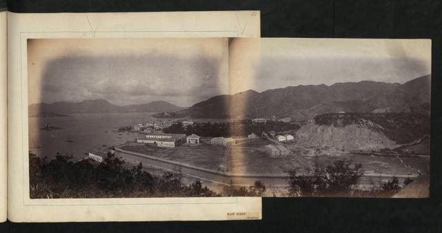
East Point was a cape on the northern shore of Hong Kong Island, Hong Kong. It was a pointed headland that extended from Jardine's Hill, i.e. Lee Garden towards the Kellett Island. It marked the eastern limits of the early City of Victoria. The piece of land separated Causeway Bay in the east and the bay outside Happy Valley. Streams and muds from Tai Hang and Wong Nai Chung (now buried beneath Canal Road) shaped the headland.
Two sides of the cape were reclaimed over a hundred years. The first stage was in the mid-19th century. The east of the cape was reclaimed to the edge of Victoria Park and the west to Hennessy Road. The second stage was between World War I and World War II. Its west was reclaimed to Gloucester Road. The shape of the cape was mostly lost. For the construction of Cross Harbour Tunnel, further reclamation extended the land to Kellett Island and the cape was completely buried.
Physically, the Causeway Bay Station of the MTR and World Trade Centre are built on the body of East Point. Windsor House and Paterson Street falls on its first stage reclamation. The above two areas were referred to as East Point, while to its west was Ngo Keng. Much of the land of East Point was in the hands of Jardine-Matheson. Swire once had a sugar refinery in Sugar Street.
Large scale reclamations make the geographic feature and division less obvious. Causeway Bay originally referred to the circular tung lo-shaped bay. It also referred to the east shore of the bay, i.e. the present-day area in Tin Hau Station. It gradually replaced East Point as the name of that area. The name East Point is still found in East Point Road and East Point Centre.
suryx
Photo taken in the late 1860s, looking east at East Point.
Right at the front was the Bowrington Canal, i.e. today's Canal Road.
Behind the canal were all godowns and offices owned by the Jardines & Co., and is today's busiest part of Causeway Bay.
The little hill behind these was called East Point Hill or Jardines' Hill at that time where the Jardines' house and garden were built. In 1923, this hill was bought by Lee Hysan the tycoon and situated the Lee Garden amusement park and Lee Theatre. Renamed Lee Garden Hill, it had been removed for a few times until complete removal in late 1970s for massive urban development. The Lee Family still owns most properties on the hill at present.
The taller hill to the right of East Point Hill was Leighton Hill.
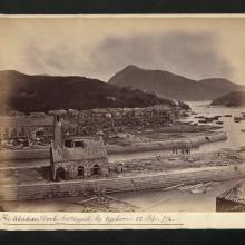
Behind the Jardine's hill located a factory with a chimney, and is today's Sugar Street. The factory had been used as a mint from 1866 to 1868, but was quickly winded up due to fake coins widespread in the city. The factory was later used by the Jardines as a sugar refinery for a few years from 1868.
Date was estimated (from the comments above) to 1870.
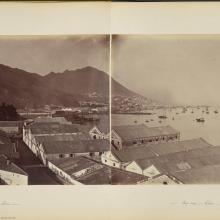
This photos shows early settlements in this area, many more buildings to be identified, e.g. Matheson's and Leighton's Bazaars and others.


