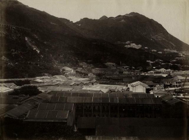
The long buildings to the left side look like factory buildings. What part of Wan Chai can that be. Bowen Road can be seen and also the peak tram in the far distance. Thank you for letting me know.
Showing Wan Chai 1890's (Looking West).jpg
Primary tabs

Submitted by danielwettling
Connections:
- Showing Wan Chai 1890's (Looking West).jpg shows Place Bowen Road above Wanchai [????- ]
- Showing Wan Chai 1890's (Looking West).jpg shows Place Hong Kong Electric Power Station - Wanchai [1890-1922]


Comments
Re: Wanchai
The vertical row of buildings on the left marks Cross Street. Albany Street (today's Tai Yuen Street) should be in the bottom half of the photograph.
Wanchai
Hi Daniel, there are more interesting details on your photo. On the very right hand side is the Wanchai Praya with the Fenwick Shipyard. The photo below is cropped from the original photo.
This part of the coastline was also visible on your photo Early Waterfront.jpg from ca. 1880. I had compared that with one posted by David showing this area in 1902. Fenwick shipyard is on the very left side.
From the changes in buildings and the appearance of the crane, your 1890s photo fits in between those two. Regards, Klaus
Wan Chai
Thanks a lot for the information, Klaus.