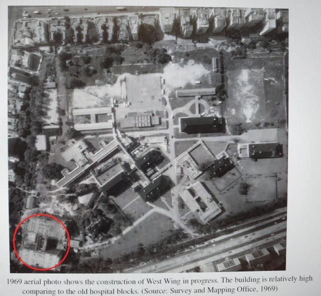
The signal station is a small structure near the northwest corner of Kowloon Hospital. The Red circle is the new west wing under construction.
( Source: Heritage Impact Assessment on Block M at the Kowloon Hospital )

The signal station is a small structure near the northwest corner of Kowloon Hospital. The Red circle is the new west wing under construction.
( Source: Heritage Impact Assessment on Block M at the Kowloon Hospital )
Comments
1949 or 1969?
1949 or 1969?
Edit: title now correct, thanks
Aerial photo by Survey and Mapping Office 1969
It should be 1969. Thanks.
Has to be 1969, This was
Has to be 1969, This was taken before 2 new lodges were built to the east of the big building at the top of the hill.
See this Google aerial photo.
https://www.google.com.hk/maps/@22.3239337,114.1818438,115m/data=!3m1!1e3
Tennis court is where it always have been. Back then it was grass with a huge coconut tree overhanging it. The lodges are still there. I lived in the one just south of the tennis court. The one further to the east was for single doctors back then. Here is the lodge (upside down "L") to the right of the tennis court from Google: https://www.google.ca/maps/@22.3246172,114.1814018,3a,15y,18.83h,17.77t/data=!3m8!1e1!3m6!1sAF1QipN8gkFmwR65zfIoJ6fuldvabjbezbPNg81Mk-7D!2e10!3e11!6shttps:%2F%2Flh5.googleusercontent.com%2Fp%2FAF1QipN8gkFmwR65zfIoJ6fuldvabjbezbPNg81Mk-7D%3Dw203-h100-k-no-pi0-ya303.36115-ro0-fo100!7i8192!8i4096?hl=en&authuser=0
Seeing the open ground bring back plenty of childhood memories.