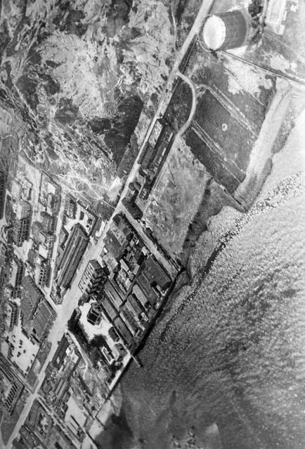
The gasometer at Ma Tau Kok can be seen at top right. To the left of the gasworks is the main road, To Kwa Wan Road that runs from top to bottom. Photo probably taken after the gasworks were completed.
1930s Aerial View of Ma Tau Kok and To Kwa Wan
Primary tabs

Submitted by moddsey
Date picture taken (may be approximate):
Wednesday, January 1, 1936
Gallery:
Connections:
- 1930s Aerial View of Ma Tau Kok and To Kwa Wan shows Place Ma Tau Kok Gas Works (1st location) [1935-c.1994]


