Received by email
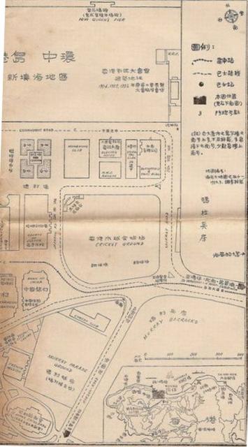
1950s Map of Central district
Primary tabs

Submitted by Admin
Date picture taken (may be approximate):
Sunday, January 1, 1950
Gallery:
Connections:
- 1950s Map of Central district shows Place Cheero Club (aka Cheerio Club), Murray Parade Ground [1949-????]


Comments
1950s Map of Central District
Was this a Government produced map? Or commercially produced, since there are Chinese names included as well. Still in remarkable shape. Is that the full extent or is there more to it?(Folded over). Thx.