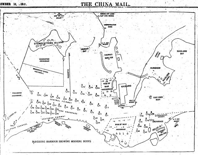
A China Mail sketch map from November 1921 showing various anchorages, moorings and a handful of intersting land sites for reference.

A China Mail sketch map from November 1921 showing various anchorages, moorings and a handful of intersting land sites for reference.
Comments
This would be a bit like a
This would be a bit like a map of the airport today. Instead of "Your plane is leaving from gate 23", you'd need to know which mooring your liner was at to be sure to get back to the right ship!