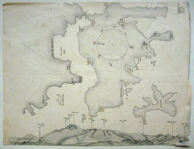
The way to use this map is described in R E Jones' Diary: http://gwulo.com/node/17654
R E Jones' "positioning" map
Primary tabs

Submitted by Admin
Date picture taken (may be approximate):
Monday, November 1, 1943
Gallery:
Connections:
- R E Jones' "positioning" map shows Place Stanley Mound [????- ]
- R E Jones' "positioning" map shows Place Stanley View [????- ]


