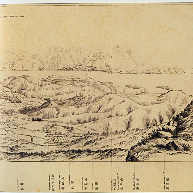
Sketch drawn by Collinson in 1845. Original held in UK National Archive, their ref: WO 78/115
Copy shown in 'Mapping Hong Kong' book, Plate 2-1b

Sketch drawn by Collinson in 1845. Original held in UK National Archive, their ref: WO 78/115
Copy shown in 'Mapping Hong Kong' book, Plate 2-1b
Comments
Spring Gardens
Very interested in the left most line which points to Spring Garden. I assume that is where Spring Garden Lane is today. On the very early Jurors Lists, some people are listed to be living there. I wonder what gave it this name back then, how it came into being, and what it was there for.
Does anyone have information?
breskvar
Re: Spring Gardens
Hong Kong 1841-1862 by G. R. Sayer (originally published in 1937)
"It is not clear when Spring Gardens became attached to the locality rather than to a particular house, but Murdoch Bruce's lithograph (and the map above) of 1846 certainly uses it to indicate a locality. The house which bore the name was originally built by the firm Turner & Co. and it was used as a residence by Governors Davis and Bonham. Why it was called is something of a mystery, though it did have a good well of water in its ground and a stream still runs through the area. There may also be connection with an area which lay in front of Admiralty Arch in London which was known as Spring Gardens, a fashionable residential district for a long time which only disappeared with the construction of Admiralty Arch and the adjoining government offices. There was also, however, a 'Spring Gardens' in the business district of Manchester which British merchants in Hong Kong might have been familiar."
Spring Gardens also appears in the book "The Story of Government House by Mattock and Cheshire" which gives further information of the residences of the Governors (Bonham and Bowring) prior to the completion of Government House.