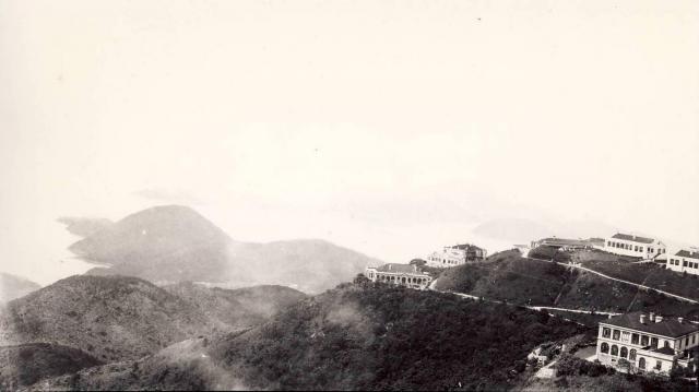
View south3 from 44 Plantation road.JPG
Primary tabs

Submitted by Grousehunter
Date picture taken (may be approximate):
Saturday, January 1, 1910
Connections:
- View south3 from 44 Plantation road.JPG shows Place Cheltondale [????-????]
- View south3 from 44 Plantation road.JPG shows Place Slemish [????-????]
- View south3 from 44 Plantation road.JPG shows Place Peak Police Station [1886- ]
- View south3 from 44 Plantation road.JPG shows Place RBL 34, 1,2 & 3 Gough Hill. 292, 293 & 294 The Peak, 103, 104 & 104A The Peak [c.1888-c.1923]
- View south3 from 44 Plantation road.JPG shows Place Leigh Tor (2nd generation, 2-storey) / Lysholt [????-c.1941]


Comments
Properties on Mt Gough
This photo gives a seldom seen view of the eastern side of the southern spur of Mount Gough. In the bottom right corner is Lysholt. The five buildings on the ridge line are, from right to left, Cheltondale (only partly in view), Slemish, Mount Gough Police Station, 2 & 3 Mount Gough (that's the name of one building), and 1 Mount Gough (also the name of one building).
It's the first photo I've seen of the earliest buildings to be known as 1,2 & 3 Mount Gough. Thanks for posting.