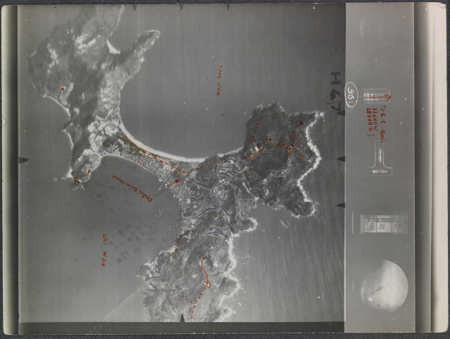
94 years old HIGH-Resolution areal picture of Cheung Chau from 25 November 1924.
Most likely one of the first areal picture of our island ever.
Please enjoy this treasure as much as I do.

94 years old HIGH-Resolution areal picture of Cheung Chau from 25 November 1924.
Most likely one of the first areal picture of our island ever.
Please enjoy this treasure as much as I do.
Comments
Thanks Hans, that's a great
Thanks Hans, that's a great photo!
Any ideas what the markings in red are referring to?
markings at 94 years old HIGH-Resolution areal picture of Cheung
Hi David,
I believe the red markings could be where the power line where.
https://industrialhistoryhk.org/cheung-chau-electric-company/
The blue ones are 100% streams, most of them are still here. I live close to 3 of them around Fa Peng Road.
Cheers,
Hans
A really nice old CC photo
Hello,
Back in the 1960s........
The location for the red mark for Electric Power House is actually not the same as today's, it is be few more houses to the right now, just beside the Y intersection of Peak rd & Police Path right behind Tai Sun Back Street.
For the blue lines, most of them were dirty sewage-infected streams. They are deadly polluted, kids played around them only during the rainny days when water is plentiful. The only better one is the one from the heart of Fa Pang to Kun Yum Wan, its source is a spring and only few families using it. But its flow is very weak, it ends up in the sand beach without reaching the sea water of KYW.
Regards, Tung