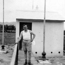
The outpost, that was sited roughly where the Ping Shan RADAR unit had been, was also initially called Ping Shan, the actual village being some 3000 metres away, but it was later re-nanamed, 'Kong Wei'. In the late 1940s and 50s the area was still largely paddy fields and Ping Shan was probably the nearest named place. Note the rather primitive toilet (the thunder box). In 2018 it is still possible to see on Google Earth where the circular perimeter fence was round one of the huts. Look for a circular ring of trees/shrubs a few hundred metres to the north of the Ping Ha road at approximately 22. 26.47.N 113.59.45.E. This circle is MUCH larger than the perimeter fence was in the 1950s. The main Kong Wei building was in the small triangle between the river and the Ping Ha road at 22.26.44.N 113.59.48. E. Another hut was at approx. 22.26.42.N 113.59.44.E. I think that it might have been the latter which features on this photograph.
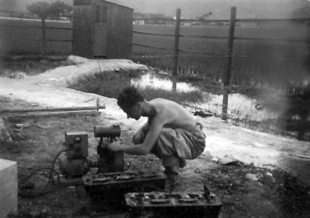
Ping Shan Chris 12v accumulators thunder box.
Primary tabs

Submitted by Andrew Suddaby
Date picture taken (may be approximate):
Tuesday, January 1, 1952
Gallery:
Connections:
- Ping Shan Chris 12v accumulators thunder box. shows Place Kong Wei DF Hut 1 [????-????]


