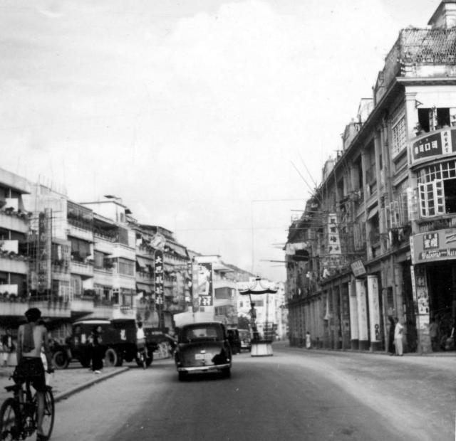
Any suggestions?
Thanks Peter for identifying the location. If I have inserted a pin in the correct location on the map, it is now a VERY busy crossroads. If incorrect, please guide me to the correct place. Best wishes, Andrew

Any suggestions?
Thanks Peter for identifying the location. If I have inserted a pin in the correct location on the map, it is now a VERY busy crossroads. If incorrect, please guide me to the correct place. Best wishes, Andrew
Comments
Nam Cheong and Un Chau Street Junction, possibly
Looks like the traffic policeman was on Nam Cheong Street and Un Chau Street junction, Tai Po Road on the left and Wo Chai Hill just beyond the roof tops. Regards, Peter
Hi Peter.
Hi Peter.
Now, I'm really lost! Would you be able to provide a suitable title for the photograph and also a pin for its location on the map? Many thanks, Andrew
Nam Cheong and Un Chau Street Junction
Hi Andrew, the traffic policeman was likely at Nam Cheong and Un Chau junction because the former was, still is, a wide and busy street. I suggest their junction for your location marker.
I am attaching the following photo which was taken a short distance to the northwest, at the junction of Kweilin and Castle Peak, also looking to the southeast.
Thanks Peter. Please see the
Thanks Peter. Please see the changes I've made, and comment if necessary. Andrew
You are Welcome, Andrew.
You are welcome Andrew. Regards, Peter
Taken this morning for comparison
Hi Phil,
Hi Phil,
Things have certainly changed! Your comment must have the record for being the fastest ‘live’ response.
Best wishes, Andrew
Nam Cheong St