By This file is from the Mechanical Curator collection, a set of over 1 million images scanned from out-of-copyright books and released to Flickr Commons by the British Library.View in BL GeoreferencerView image on FlickrView all images from bookView catalogue entry for book., Public Domain, https://commons.wikimedia.org/w/index.php?curid=37357813
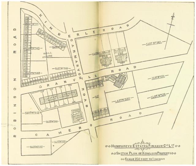
HURLEY(1897)_p172_Map_of_the_KOWLOON_ESTATE_Property

Submitted by Klaus
Date picture taken (may be approximate):
Friday, January 1, 1897
Gallery:
Connections:
- HURLEY(1897)_p172_Map_of_the_KOWLOON_ESTATE_Property shows Street Nathan Road (formerly Robinson Road & Coronation Road) [????- ]


