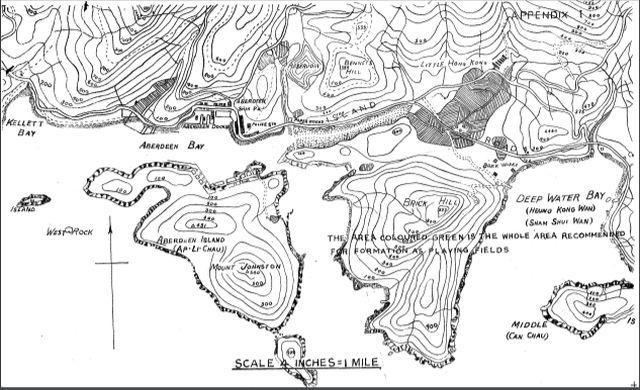
Map extracted from the 1930 Report of the Playing Fields Committee which is available here At the time, the Aberdeen Valley was considered a suitable site for the development of playing fields and the relocation of the Polo Club from Causeway Bay. The site of the disused brick works can also be seen.
1930 Map of Brick Hill
Primary tabs

Submitted by moddsey
Date picture taken (may be approximate):
Wednesday, January 1, 1930
Gallery:
Connections:
- 1930 Map of Brick Hill shows Place Brick Works, Deep Water Bay [c.1889-c.1931]


