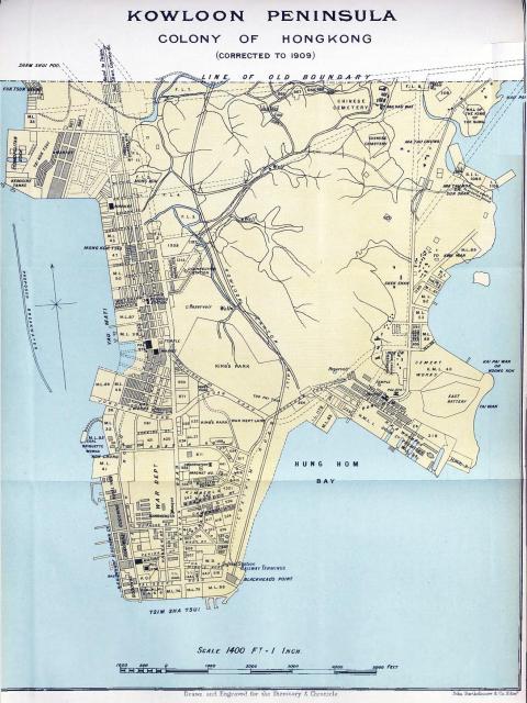
Map of the Kowloon Peninsular drawn in 1909 by the map publisher J. Bartholomew for the Directory & Chroniovale for China, Japan, Corea , Indo-China etc. etc.

Map of the Kowloon Peninsular drawn in 1909 by the map publisher J. Bartholomew for the Directory & Chroniovale for China, Japan, Corea , Indo-China etc. etc.
Comments
KCR Kowloon Terminus at Blackhead's Point
This map drawn in 1909 indicates The Kowloon Canton Railway ( KCR) terminus at Blackhead's Point.
When the railway formally opened on 1st. October 1910 the exact site for the permanent terminus had still not been decided upon.The debate about this had dragged on over several years. Eventually a site stretching from the Star Ferry Pier to Holt's Wharf was decided upon and construction commenced in 1913. The new station building itself was not completed until March 1916.