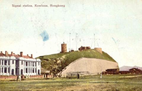
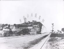
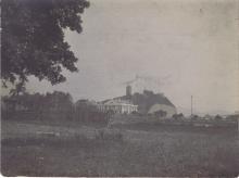
Houses on Middle Road next to Blackhead Point [1915-????]
Primary tabs
Submitted by annelisec on Sat, 2010-11-20 12:32
Current condition:
Demolished / No longer exists
Date Place completed:
c.1915-01-01 (Month, Day are approximate)
11 Oct 2011, update from David:
The attached photos show buildings on Middle Road next to Signal Hill:
Maps show K.I.L. 414 ran along Middle Road from Nathan Road to Signal Hill, and was the site these houses were built on.
We'd previously labelled them 'Rose Terrace', but we've since found that Rose Terrace was on the east side of Nathan Road, opposite the junction with Peking Road.


Comments
http://www.grs.gov.hk
Houses along Middle Rd.
I am in touch with someone who lived in one of those buildings shown in the postcard, the one right next to Signal Hill. We've been trying to find out a bit more about them. She was very young at the time, but has photos taken around 1947/8, showing only part of the building and the retaining wall of the Signal Station. There was a playground with a gazeebo structure and swings and Middle Rd. continuing through the park to Chatham Rd., although not in use.
Please note the newspaper
Please note the newspaper cutting below as it provides important chronological information for dating of photos. The portion of the Middle Road immediately in front of Signal Hill was 'removed' sometime after May 1925 (a walking foot path existed subsequently shortly thereafter) up to its junction with Salisbury Road and Chatham Road on inland Lot No. 414. Some of the photos labelled in the late 1920s may need to be re-dated to any earlier period if the road is no longer there in view of this information.
Source: Hong Kong Daily Press, page 6, 27th April 1925
The Hong Kong Government Gazette May 31, 1929
No. 284.—It is hereby notified that His Excellency the Governor has made the following order under the Streets (Alteration) Ordinance, 1923, Ordinance No. 24 of 1923 :—
That that section of road referred to in Government Notification No. 236 of 24th April, 1925, is closed, namely :--
The portion of Middle Road from the South-East corner of Kowloon Inland LOT No. 414 to its junction with Salisbury Road.
D. W. TRATMAN, Colonial Secretary.
31st May, 1929
Source
The 1920 map gives a good
The 1920 map gives a good view of the layout of these buildings: two identical buildings, each building made up two semi-detached houses. The map also shows Middle Road before the eastern section was closed:
https://gwulo.com/node/7537?a=1#18/22.29572/114.17349/Map_by_ESRI-1920_K...
Completed in 1915
Construction started in 1914, as the 1914 PWD report lists them in item 47 as "4 European Houses, K.I.L. 414, Middle Road" under the heading "Works Commenced".
In the 1915 report, they're listed in item 46 under "Works Completed".