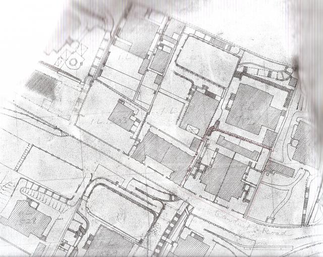
Public Works Department map available by ordering in person at the Lands Department, North Point Government Offices. I've added a faint red outline to the house I think was 14 Conduit Road.
1922 map - 14 Conduit Road
Primary tabs

Submitted by annelisec
Date picture taken (may be approximate):
Sunday, January 1, 1922
Connections:
- 1922 map - 14 Conduit Road shows Place 14 Conduit Road [????- ]
- 1922 map - 14 Conduit Road shows Place Rocklands [????- ]


Comments
re: 14 conduit road
hi annelise. Based on that map - the building you outline as being 14 conduit road is shown here at the very bottom in the middle of the photo, in between the rectangular mansion on left and house set in gardens on right. http://gwulo.com/node/4802