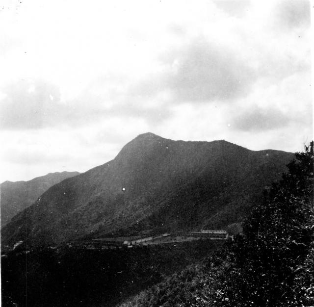
Does anyone know where this might be? It is on the same page in the album as Kowloon Peak and Cameron.
Where is this?
Primary tabs

Submitted by pauline
Date picture taken (may be approximate):
Friday, January 1, 1954
Gallery:
Connections:
- Where is this? shows Place Royal Navy bungalows on north slope of Mount Nicholson [1947-1960]


Comments
Hi Pauline, I've lightened
Hi Pauline, I've lightened the photo a bit to make those buildings at the foot of the hill clearer. I don't recognise them, but hopefully someone else will.
Regards, David
Where is this?
Where is This?
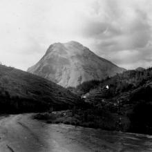
Just to prove I really don't know what I'm doing I managed to post the photo of Mt Nic, but then didn't know how to add the text. So here it is seperate from the pic.
I thought Paulines photo had some similarities to the south east side of Mount Nicolson, so I went for a strole this afternoon to see if I could confirm it. By now I think it is, but I'm far from certain as there are some discrepancies.
I think it was taken from Repulse Bay Road across the Deep Water Bay Valley, with Mount Nicolson in the centre, and Mount Cameron the ridge line on the left. If so, the buildings, and what seems to be some flat ground, would be along the upper reaches of Deep Water Bay Road.
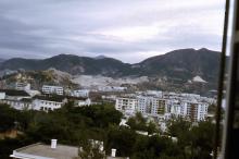
My photo shown above was taken from Repulse Bay Road below No.11, The Brentwood. Even if it's taken from generally the correct location, it's obviously not the exact same place, but there are relatively few vantage points to look across the valley due to trees.
The things that don't add up are, firstly I can't see any trace of Black's Link, and secondly those "buildings". I wonder if they could be on the site of what are today the developements above Deep Water Bay Road and Blacks Link? But the alignment doesn't quite work.
Alternatively, there's a flat, vacant, patch on the left as you come down Deep Water Bay Road which I think is in roughly the same place as the "buildings". As the Road has, in parts, been carved out of the hillside, I'd previously wondered if the flat patch had once served some now forgotten role.
To summarize, I think it's Mt. Nic, but I'm open to better suggestions.
Mt Nic
I think GW has nailed it - I think Pauline's original is perhaps flipped?
Mt Nic
I think GW is correct in saying it is Mt Nick. However I suspect it is the North Side.
The buildings in the photo could be where the Royal Scots had their camp below Middle Gap (between Mt. Nicolas and Mt Cameron), and it is currently a building site for a new development.
The picture could have been taken from Black's Link facing roughly South East with the ridge heading up to Mt Butler in the background. Those are my thoughts anyway.
Where is This?
Thanks Craig, I agree with you. Please see http://gwulo.com/node/17881
Good job pinning down the
Good job pinning down the location.
Any idea what the buildings are in Pauline's photo? We've got a photo of a Royal Navy Married Quarters bungalow on Mount Nicholson taken in 1953 (see http://gwulo.com/node/4551). Is that what we're looking at?
Regards, David
How clever you are!!
Thanks for sharing your knowledge and pinning down the location of this photo.
Pauline
re: Mount Nicholson
that's a great photo, first I've seen of the bungalows. They would have been built relatively hastily after the war given the lack of habitable accomodation and were redeveloped in the 1960s into government flats. This photo shows the same area as a military camp before the war
http://www.grs.gov.hk/PRO/srch/english/imgdisplay.jsp?RecordKey=1000012182&s=HKPRO_Library_web&version=internet