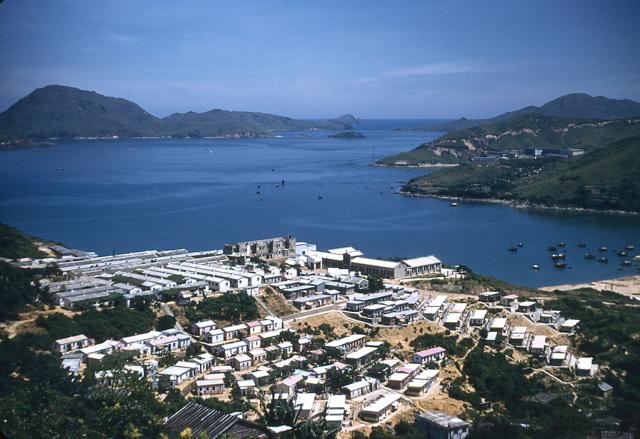
Jack Miller sent in this lovely sharp photo, and writes:
I took this photo in 1959 and forgot where I was in Hong Kong. I think it might have been taken from up on Victoria Peak and I don't know what section of Hong Kong it overlooks.
Can you help me locate the part of the city I was in?


Comments
Re: Where was this taken>?
Hi there,
I wonder if that was somewhere atop Shaukeiwan/Chaiwan pointing the lens towards the Sai Kung Peninsula.
Thanks & Best Regards,
T
Compare this photo with my
Compare this photo with my 1954 photo of Chai Wan:
http://www.flickr.com/photos/58451159@N00/11412013335/in/set-72157631547501753
re: Where was this taken?
Jack,
Based on Thomas and Doug's comments, you were looking out over Chai Wan towards eastern entrance to the harbour. I'd guess you were either on the way to, or returning from the Sai Wan Military Cemetery.
Regards, David
Thanks to you Dave, to Doug,
Thanks to you Dave, to Doug, and Thomas. I appreciate the help very much. I don't remember the name of the cemetary, but I did take another one of a cemetery that was situated on the side of a hill.
1954 View of Chai Wan
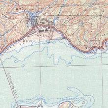
A composite photo of Chai Wan with the Sai Wan War Memorial and Cemetery can be seen here Thanks Doug for the photos.
Chai Wan
Hi,
I've only just found this photograph! Yes, the others have identified it correctly. The photograph was probably taken from the Tai Tam road, above the resettlement camp at Chai Wan. A third of the way down on the right hand side you can see the buildings of R.A.F. Little Sai Wan, with the old camp road (now the Dragon Trail) winding up the hillside. The huge housing complex of Siu Sai Wan was built in that bay in the years following the demolition of the R.A.F. camp in late 1987 and early 1988. The shoreline in 2017 runs from where you can just make out a tall wireless mast at the foot of the Point to somewhere about half way up the left side of the photograph.
Andrew