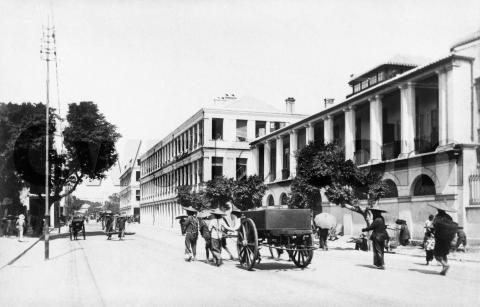
c.1901 - "The Naval Department Buildings, Queen's Road"
Primary tabs
When: This photo is one of set taken by R C Hurley [1] around 1901-1902, and published as a collection titled "Views of Hong Kong".
Where: The photo shows the stretch of Queen's Road that we call Queensway today. We're facing west so the sea and the Navy's buildings are on our right.
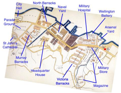
Here's a map of the area from the 1880s:
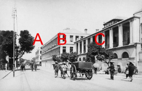
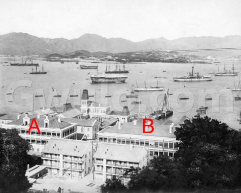
I think the buildings A & B in the current photo are the light-brown buildings on the map, in the area marked "Naval Yard". Then building C is shown in pink on the map and marked "Commissariat" [2].
Here's another view of buildings A & B from the 1890s, as seen from Scandal Point.
A later map from the 1920s [3] shows building A titled:
Police Quarters
No. 2 & 3 Stores
Ground Floor
Building B is still there but without any title, and building C appears to have been re-developed. Of course it's hard to tell from a map whether the building shown is the same one we see in the photo, or a different generation of the building on the same site. If you have any photos that show this area during these years, please could you upload them to Gwulo [4] for us to see?
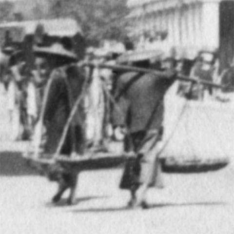
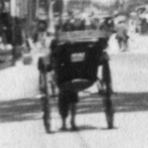
Who: People walking, carrying, pulling.
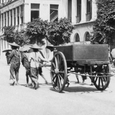
These early 20th-century photos always impress me with how busy the streets are, but with everything powered by manual labour. Even this larger cart doesn't get a horse:
Counting the feet there look to be seven or eight people pulling it. Men or women? We can't see, but this letter from 1916 [5] describes a group of women pulling a similar cart:
The are some queer sights over here, the poor women dragging great loads on waggons through the streets, just like horses, they don't seem to mind, they are talking away to one another all the time, & pulling for all they are worth, and all the people who live on the sampans, its marvelous how they do live.
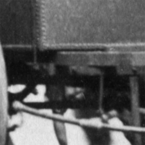
What: Here's a closer view of the cart:
What do you think it was used for?
I guess the riveted box was a water tank, with a curved pipe extending out the back. Then the cart could have been used to spray water on the road to keep the dust down. Better guesses welcome!
A big thank you to Janet Hayes for giving me this photo. Her envelope arrived a few weeks ago, so Christmas has started early!
As this is my last message before the holidays, let me wish you and your family a very merry Christmas, and safe travels if you're heading away from home.
Best regards,
David
Photo reference: NDA11
|
Also on Gwulo.com this week we've got a couple of accounts of life on Broadwood Road:
Please add a comment to either of those pages if you can add more memories of Broadwood Road. |
References:
- R C Hurley: http://gwulo.com/node/22682
- The Commissariat handled supplies for the British Army: http://en.wikipedia.org/wiki/Commissariat#British_Army
- c.1924 map of "Cantonment of Victoria". Copy available at Survey & Mapping Office, their ref HG7. Contact: http://www.landsd.gov.hk/mapping/en/pro&ser/outlet.htm
- How to upload a photo to Gwulo: http://gwulo.com/node/2076
- Letter from Daisy Glendinning, newly arrived in Hong Kong, to her sister Lily in Australia: http://gwulo.com/node/22606

Comments
Naval Buildings - Government Language School
Can anyone remember which of these three buildings ( A, B or C) housed the Government Language School during the mid 1960s and not too long before its demolition? I am inclined to think it was C (the closest to Arsenal Street) . I remember attending Cantonese classes there when Mr Sydney Chao ( joint-creator of the almost unintelligible Barnett-Chao romanization system) was the School's principal.
Queensway buildings
Guy Shirra writes:
The Queensway Building closest to Arsenal Street included the Government Language School where I studied Colloquial Cantonese from Jan to March 1967 and I believe their last use was as a Chinese illegal immigrant last-chance ID card registration centre in the 70s.
The Cart
The same photo appears on Page 54 of "The Hong Kong Album", a 1982 publication of the Urban Council containing photos from the collection of the Hong Kong Museum of History (ISBN 962-7039-02-0). The caption accompanying the pic says, "A Chinese wooden cart serving as a hearse on Queen's Road (P68.101)." I'm not sure what the reference number represents. No specific date is given, but the pic is in the section of the book covering the period from 1860 to 1898. On the same page is another photo showing a coffin being removed from another cart, with the caption, "Removing the body of a victim of the Great Bubonic Plague which broke out in 1894 and lasted until 1896, killing more than 2,500 persons (P65.88)."
re: The Cart
Thanks GW, I'll take a look at that book when I'm home again. I think the "P68.101" is the Mueseum's reference for their copy of this photo.
Regards, David
Sanitary Department Water Cart
For comparison, in the original photo posted one may be looking at a Santary Department water cart as seen below in use in 1918..
watering cart
Eternal1966e carries a photo of a "watering cart" dated 1915. It looks very similar to the one in Moddseys 1918 photo and similar to the one in the earlier pic from David/HK History Museum, except the 1915 and 1918 carts have two sets of wheels and are pulled by animals rather than humans. The strong similarities between the three carts suggest they are earlier and later versions of the same thing, i.e. watering carts.
Thanks for the two watering
Thanks for the two photos of watering carts. Looks like the caption in "The Hong Kong Album" is wrong in this case.
Regards, David
The Naval Department Buildings, Queen's Road.
David,
This photo certainly gets around. It's also on wiki at;
http://en.wikipedia.org/wiki/History_of_Hong_Kong , scroll down that page to the link "History of Hong Kong (1800s-1930s)" immediately beneath the title "Colonial Hong Kong era (1800s-1930s)".
Its caption, copied below, confirms your identification of buildings A, B & C.
"View of the premises of the two-storey Military Commissariat from Queen's Road. The 2 identical 3-storey buildings are the main Royal Naval Dockyard buildings. The entrance to the Dockyard is located between them. Taken c. 1894, author unknown."