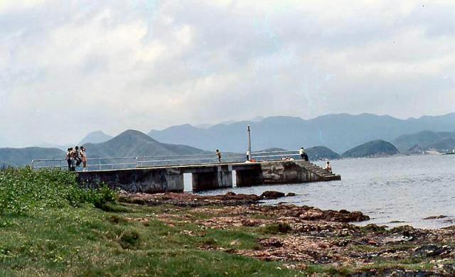
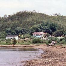
At the time this was the end of the road from Sai Kung - before it was linked to Ma On Shan and Shatin.
1982 - Sai O
Primary tabs

Submitted by Cliff Atkins
Date picture taken (may be approximate):
Sunday, May 30, 1982
Gallery:
Connections:
- 1982 - Sai O shows Place Nai Chung Pier [????- ]


Comments
There's still a pier in that
There's still a pier in that area, called "Kei Ling ha Hoi Pier". Does its location look about right for the pier in your photo?
http://gwulo.com/map-of-places#16/22.4320/114.2696/Hybrid_by_Google-Mark...
Regards, David
Nai Chung Pier
I've had a look at Google maps and the satellite view and as far as I can remember the pier in my photo is Nai Chung Pier.
This is within a couple of hundred metres of the existing car park which was the end of the road at that time.
Cliff
Re: Nai Chung Pier
Hi There,
The current photo of Nai Chung Pier on Google Maps doesn't seem to have the same shape. That doesn't look like the version of Kei Leng Ha Pier as well. That could certainly have changed over the decades. The background ridghes looked more likely for Nai Chung though. Might need some older maps or photos to confirm. But as far as I could recall Nai Chung was the end of the road on Sai Kung's side back then.
T
Thanks for the feedback. I've
Thanks for the feedback. I've added a Place for Nai Chung Pier.
Regards, David