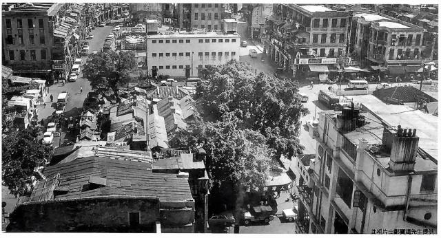
Yau Ma Tei view looking south. If my orientation is correct, the street on the left is Temple Street (note the curve) and Shanghai Street on the right. The street in the foreground is Public Square Street. That 3-storey white building on Market Street is still there today.
Location map: https://gwulo.com/taxonomy/term/478/places-map#17/22.30896/114.17064/Map...
Photo source: uwants.com - post # 1180 by user 4rex - http://www.uwants.com/viewthread.php?tid=14833421&page=79#pid207788104


Comments
50s?
What looks like a UHF TV aerial is in lower left hand corner.
-kpl.
50s?
The car parked in front of the Jeep CJ6 in the lower right foreground also looks a bit post-50s. CJ6 first available from 1956. Still trying to think of something else that looks like a UHF TV aerial.
-kpl.