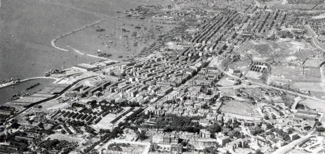
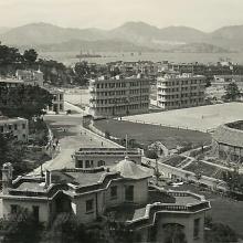
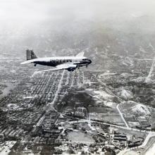
c.1945 Kowloon
Primary tabs

Date picture taken (may be approximate):
Monday, October 1, 1945
Gallery:
Connections:
- c.1945 Kowloon shows Place Former South Kowloon Magistracy [1936- ]
- c.1945 Kowloon shows Place Former King's Park Refugee Camp [1938-????]
- c.1945 Kowloon shows Place Former Site of Royal Navy Fuel Depot [????- ]
- c.1945 Kowloon shows Place Yau Ma Tei Typhoon Shelter (1st generation) [????-????]


Comments
Re: 1930s Kowloon
The South Kowloon Magistracy on Gascoigne Road is visible. So the date of the photo is later than 1936. The absence of the Admiralty Oil Tanks (Fuel Depot) at the western end of Jordan Road, bomb damage and large tracts of wasteland at the western end of Austin Road leads me to suspect that the photo was taken at the end of WWII. Looking at the western end of Whitfield Barracks, there are some letterings either on the ground or on the roof of buildings. POW ???.
To the right of the Magistracy on the hill is the former King's Park Refugee Camp, now the site of Queen Elizabeth Hospital. The Camp was established in late 1938. The HK Telegraph dated 14 November 1938 gives the following:
Three acres of recreation ground in the western area of King's Park bounded by Danger Hill on the north, Gascoigne Road on the south, a nullah on the east and the South Kowloon Magistracy on the west have been utilized by the Government for a refugee camp site. The camp will comprise 24 wooden huts with 18 of them to be used as sleeping quarters.
Good catch, thank you. I'll
Good catch, thank you. I'll update it to c.1945.
1945 Kowloon
China Mail 11 September 1945
The worst damage in the bombed areas in Kowloon appeared to be in Hung Hom, near Kowloon Main Docks where many blocks of residential houses have been completely flattened out, and in the residential section west and northwest of Whitfield Barracks, where several large blocks of houses have been razed to the ground. Demolished buildings are to be seen here and there in various other districts.