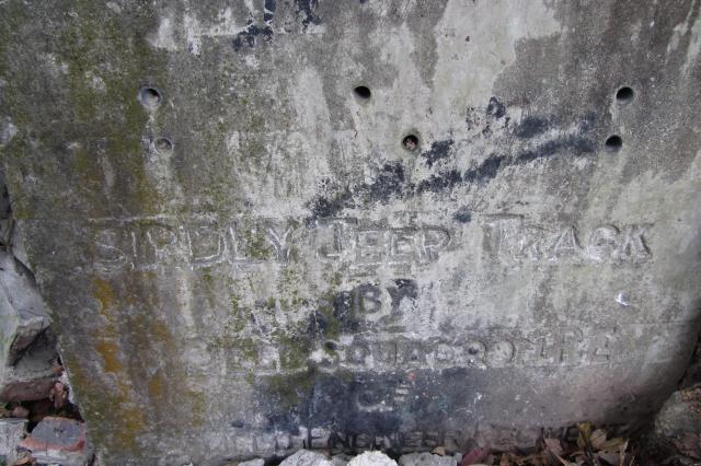
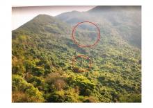
This plaque is on the roadside of the track leading up to Bird's Pass (Kat Tsai Shan Au 桔仔山坳), but the inscriptions are not so clear, can anyone read the inscriptions (Is it "SIRDLY JEEP TRACK" ?)and know about the history of the track? I find this track only on the map of 1952. Thanks a lot!
Birdly Jeep Track concrete tablet
Primary tabs

Submitted by Rachel Kwok 2018
Date picture taken (may be approximate):
Monday, April 2, 2018
Connections:
- Birdly Jeep Track concrete tablet shows Place Birdly Jeep Track concrete tablet [c.1950- ]


Comments
Another mention of this stone
Another mention of this stone calls it "Birdly", so the inscription reads:
BIRDLY JEEP TRACK
BY
??? SQUADRON R.E.
OF
??? FIELD ENGINEER REGIMENT
(If you remember the location of the plaque, please could you make a Place for it - https://gwulo.com/node/add/place )
Here's a plaque for another jeep track in the New Territories: https://gwulo.com/node/39459
The tracks were built by the British Army's R.E. (Royal Engineers) to make it easier to travel up and down the hills.
Reference the Stone Plaque
Having seen another photo of the same stone here, the full inscription is as follows:
BIRDLY JEEP TRACK
BY
11 FIELD SQUADRON R E
OF
24 FIELD ENGINEER REGIMENT
( As noted here , on 1 January 1950. 11 Field Squadron was formed in 24 Field Regiment in Hong Kong. There may be a date on the stone below the '24 Field Engineer Regiment' inscription.)
Looks like the stone is from 1950. The Squadron was based initially at Castle Peak and later at Sek Kong.
As I know it is connecting
As I know it is connecting with a accident, involved a tank and a train. I am interested to know more about it.
Is there a military map
Is there a military map showing all of the plaques in Fanling?