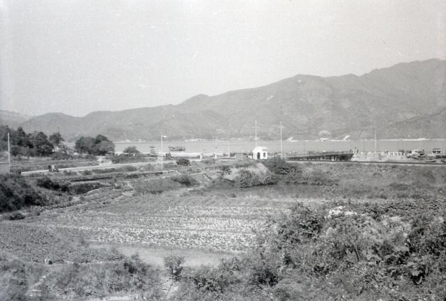
Ted originally just labelled this 'New Territories', but I think that it is somewhere near Shatin. In those days we rarely went far from either the Castle Peak Road, Yeun Long, Taipo Market route, or the train journey along towards Taipo Market. The bridge to the island(?) on the right might be a clue. Andrew


Comments
Taipo
Thanks, Phil. I'll change the
Thanks, Phil. I'll change the label. Andrew
Yuen Chau Tsai
It looks like the former metal bridge crossing at Yuen Chau Tsai - so Island House would be off camera just to the right.
This photo seems to tie in
This photo seems to tie in with the other one, with the beached sampan, that Ted took, probably at the same time. Andrew
Tai Po Road
It looks like Ted was most likely on Tai Po Road, but whether he was going in or out of Taipo is not clear. If he was heading in to Taipo then most likely this photo was taken first because his vehicle would have to follow the road down and over the bridge. At a guess I would say the 'beached" sampan picture was most likely snapped from the bridge in this picture.
Hi Phil. It's very unlikely
Hi Phil. It's very unlikely that Ted had a car. None of us had enough money to afford one. I suspect that he got off a train at Tai Po and walked to where he took both the photographs. I used the train on several occasions to go to Shatin and Taipo Market. We all used to walk for miles, even in the U.K. where very few people owned cars. In the street of 100 houses where I grew up, there were only 3 cars. In 1950s Hong Kong I thought that the streets were really busy with vehicles, yet when I look back at my old photographs I realise how empty they were. Andrew