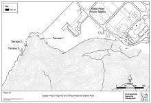
Pillbox 100, Hang Hau [1937-????]
Primary tabs
Submitted by Rob on Tue, 2012-12-18 21:47
Current condition:
Demolished / No longer exists
Date Place completed:
1937-01-01
Year completed is: Approximate
Condition at last visit: Demolished
Date of last visit: Oct-1992
Ref: ROB-00500
Other: With Lyon Light M 001
Condition at last visit: Demolished
Date of last visit: Oct-1992
Ref: ROB-00500
Other: With Lyon Light M 001


Comments
Lyon Light M001
Hi,
Does Lyon Light M001 by pillbox 100 still exists even though the pillbox is demolished now?
Re: Pillbox 100, Hang Hau
Hi There,
Uncertain. The location is among the Ap Tsai Shan area, much over grown these days. There are walking trails around and is popular for locals for morning exercise. You may need preparation for bush whacking if you really want to look for traces of it. Beware of bugs and snakes.
T
Re: Pillbox 100, Hang Hau
Hi There,
Referring to GeoInfo Map (https://map.gov.hk/gm/) the slopes there had been heavily reinforced, maybe owing to previous landslides. The marker is marginally within the area thus we could assume not a trace could be found for both.
T
PB 100 and Lyon Light Shelter.
I first visited the area in the 1990's, when it was covered only in grass, The whole hillside had been reshaped, and there was no sign of any buildings, ruin or otherwise. A 1962 aerial photograph of the area shows a typical demolished PB, with what appears to be the ruins of the LL Shelter a short distance behind.
1962 Aerial photo of PB 100
Hi Rob,
Do you have the link/ the photo of the aerial photo of PB 100 taken in 1962?
Aerial Photo PB 100
Sorry, can't offer a photo. I did my searching before the days of the HK Map Office online services, when to get photos involved going to Java Road, searching individual microfiche negatives with a magnifying glass, ordering and paying, and then revisiting a week later to collect the print. Ah, the good old days! I did record what I looked at fortunately.
The first real coverage of the whole SAR was done in 1963/4, from an altitude where smaller objects could be, with imagination, identified. Prior to this the RAF had done some coverage, but except for some over the Island in 1949 were at higher altitudes. Unfortunately by 1963, development had set in and "interesting" objects had become obscured or disappeared.
The best I can offer is a photograph number. I don't know if it is the same on the online listing, but in its original form at the HK Map Office was:
No. 8930, February 1963, 3,900 feet, Hang Hau.
As it was part of a continuous run there may be overlapping photos showing much the same area.
The photo showed the outline remains of PB 100 and adjacent LL Shelter, with a collapsed tunnel to the PB. It will not be immediately obvious.
Thanks Rob
Thank you for your help! I am going to find the photo when I have time.
Re: 1964 Aerial Photos
Hi There,
If you are close to a Library, you might like to look for a book called 'Hong Kong in Old Times, A Collection of Aerial Photos Taken in 1964'. (ISBN 962-567-185-4) I believe the photo very close to period mentioned by by Rob was in used on page 96. The structures are not displayed clearly owing to the photo size, but they are there. You may need a magnifier. According to the Public Library index there are 28 copies spreading out in the Public Libraries in town.
If you compare it with Google Maps\Earth today, you should be able to see the slopes had been re-inforced and a big chunk is gone.
T