Victoria City, Hong Kong
Primary tabs
Have you ever written your address like that? Probably not, but if you live on Hong Kong island there's a good chance your address lies within the 'City of Victoria'. Here's a map showing the city boundary, as laid out in Solomon Bard's book 'In search of the past: A guide to the antiquities of Hong Kong':
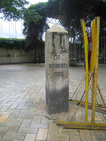
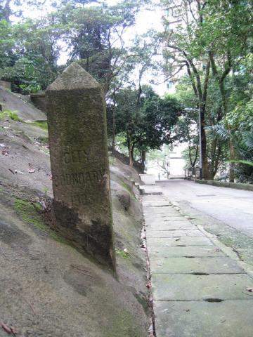
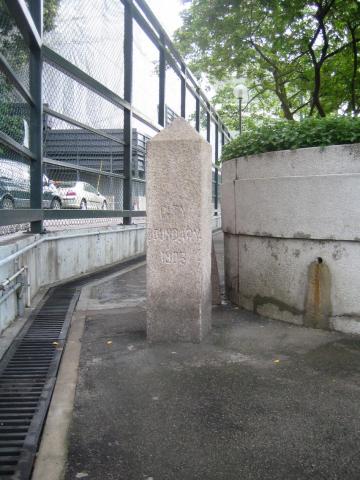
The red dots on the map above show where the stone markers can be seen along the boundary line. Here's a picture of the one on Wong Nai Chung Road:
Dr Bard's book says that there were six stones erected, and that all remain today. However I note that a couple of local websites believe that there is a seventh stone on Magazine Gap Road - look at the top right photo here, for example.
Has anyone seen a government record describing when the stones were erected? That would clarify how many there were originally, and how it was decided which points along the boundary needed marker stones. My guess is that a stone was used when the description of the boundary could be misunderstood, eg when there was no other clear landmark to identify the boundary's course.
Here's an example from 25th Jan, 1901, showing how Hong Kong's continuous development made it difficult to give a fixed description of the boundary:
The ATTORNEY -GENERAL said―Just before coming into the Council it was pointed out to me that in the definition of the city of Victoria the eastern boundary is described as― "A straight line from the skew bridge at the south-west corner of Causeway Bay to Wong-nai Chung public school-house, produced southward until it meets the southern boundary." I am informed that the skew bridge here mentioned has been recently done away with. I therefore put myself into communication with the Director of Public Works, and he suggested that instead of the words "skew bridge" we should use the words "centre of the nullah crossing the Shaukiwan Road."
The point "Wong-nai Chung public school-house" is the same as the Wong Nai Chung Rd marker - the rightmost marker on the map. If you follow the boundary from there up and to the right to the next turn of the boundary, that would have been the "skew bridge" mentioned above. The bridge lay on the coastline in 1901, and so marked the end of the boundary. You can see that reclamation means the boundary has had to be extended Northwards several times since then.
Even though we don't hear the term "City of Victoria" used today, the boundary is still legally recognised (though I'm not aware of when it is used - any suggestions?). Here is the latest description I could find, written in 1998:
BOUNDARIES OF THE CITY OF VICTORIA
On the north-The Harbour;
On the west-A line running due north and south drawn through the north-west angle of Inland Lot No. 1299 and extending southwards a distance of 850 feet from the aforesaid angle;
On the south-A line running due east from the southern extremity of the western boundary until it meets a contour in the vicinity of the Hill above Belchers 700 feet above principal datum, that is to say, a level 17.833 feet below the bench-mark known as "Rifleman's Bolt", the highest point of a copper bolt set horizontally in the east wall of the Royal Navy Office and Mess Block Naval Dockyard, and thence following the said contour until it meets the eastern boundary;
On the east-A line following the west side of the Government Pier, Bay View and thence along the west side of Hing Fat Street, then along the north side of Causeway Road to Moreton Terrace. Thence along the west side of Moreton Terrace to the south-east corner of Inland Lot No. 1580 and produced in a straight line for 80 feet, and thence along the north side of Cotton Path and produced until it meets the west side of Wong Nei Chong Road on the east side of Wong Nei Chong Valley and thence to the south-east angle of Inland Lot No. 1364, produced until it meets the southern boundary.
Finally, how many of the boundary stones have you seen?
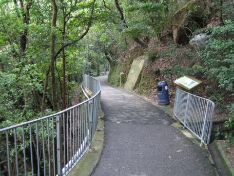
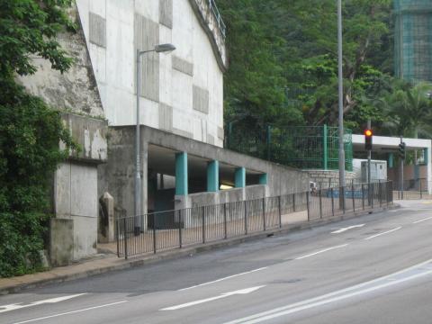
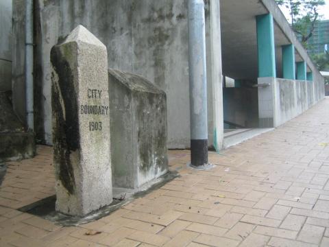
Pictures below, with locations as described on this LCSD page (it also has some more history about the City of Victoria).
Regards, David
Following the boundary in a clockwise direction, the first stone (also shown above) is at the pedestrian road of the car park opposite to St. Paul's Convent School at Wong Nai Chung Road:
Bowen Road near Stubbs Road:
Old Peak Road near Tregunter Path:
Hatton Road near Po Shan Road:
The south of Pokfulam Road near the pedestrian subway of Mount Davis Road:
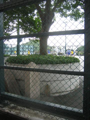
The Kennedy Town Temporary Recreation Ground at Sai Ning Street:
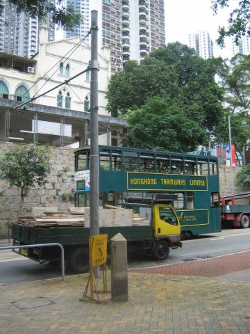
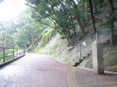
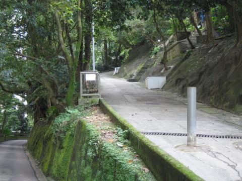

Comments
The Magazine Gap Road boundary stone
Thanks to reader Moddsey for tracking this down:
He also managed to find more detailed information in records from Legco about when the boundary was formalised:
Thanks Moddsey! MrB
Was there an eighth marker stone?
As Moddsey writes above, there seems to be a large gap in the middle of the island without any marker stones. Were there more than the seven we've seen? My first thought was to look at old maps from the early twentieth century, in the hope that the marker stones would be shown on the map. I thought if I could see any special mark on the map at a place I know a stone exists today, I could then look across the map for the same mark at any other places. No luck with that approach, but I did find a 1964 government map that showed the boundary in more detail. I've marked the boundary in blue, and also the points where the boundary crosses a road. Green marks are where a stone exists today (including the 7th stone on Magazine Gap Rd), and red marks are possible locations of extra stones.
I felt that the Wanchai Gap Road was the most likely place we'd see another stone, but despite a sweaty walk up the hill from Wanchai, I couldn't find any trace of a marker stone. Maybe there would be a stone on Stubbs Rd? Moddsey made a valid point that Stubbs Road was unlikely, for the simple reason that it did not exist in 1903, the date on the stones. The name 'Stubbs Road' was only gazetted in 1923, soon after the road was completed. He then went on to search the old government records to see if any details of the stones' locations could be found. No luck there, but he found a couple of relevant entries from the Director of Works' Annual Reports:
Hmmm, so although the stones were dated 1903, they may not have been erected until 1924, and some as late as 1929! With this in mind, Moddsey took a walk through the likely areas for extra stones:
We've run out of ideas for now. If anyone has more definitive information about the original number and location of the stones, please do let us know. MrB
Just a bit of nitpicking
I checked whether Moddsey's
Well spotted
Junction of the eastern and southern boundaries
So it would mark
the point of the sharp turn in the boundary? Do let us know if you get a chance to check out the area.
A couple of months back I did have another good look around the Wanchai Gap area, based on the extra info about the contour, but no sign of any stone.
MrB
The shifting eastern boundary
Reader Isdl notes this definition of the eastern boundary in 1911 (see page 8):
The Queen's Recreation Ground covered the area that is now Central library + Causeway Bay Sports Ground + Chinese Recreation Club sports ground.
This is the only boundary that was repeatedly redefined as reclamation and development changed the landmarks in that area. There is almost no change in the definitions of the other three boundaries between the 1911 and 1988 versions.
MrB
Unfortunately the Magazine
Unfortunately the Magazine Gap Road stone was destroyed in June 2007. This caused an outcry in some internet forums.
I read somewhere that there used to be a stone on the Causeway Bay coast which, after reclamation turned the former typhoon shelter into Victoria Park, is the present-day Causeway Road.
re: Magazine Gap Stone
Yes, we had several posts about it at the time - very frustrating.
I hadn't heard of the stone that used to be on Causeway Bay Road, though the location makes sense. Please let us know if you find any more references to it.
Causeway Bay stone
Dear mrb,
I found an article (in Chinese) by Mr. Walter CHU Wai Tak (朱維德) -- a well-known television host, news anchor, hiker, traveller and historian -- about the Causeway Bay stone. It was originally published in the Feb. 2008 issue of the Ming Pao Monthly.
http://www.mingpaomonthly.com/cfm/Archive2.cfm?File=200802/cal/01a.txt
The penultimate paragraph is translated as follows:
"The tram started to run on Hong Kong Island in 1904, but the double-track line ended in Causeway Bay. In early years, the City of Victoria did not include Causeway Bay and the city boundary was at Moreton Terrace. In the past, a "City Boundary Stone" could be found at the northeast corner of the present-day Central Library. This was the Queen's Recreation Ground which was where servicemen practised polo. The Queen's Recreation Ground occupied a big piece of land on which the present-day Queen's College, Causeway Bay Sports Ground, Chinese Recreation Club, Civil Aid Services Training Centre and bus terminal stand......"
An aside: I also read somewhere that the Japanese erected a monument in the same area.
re: Causeway Bay stone
C, thanks for the extra info. So this would have been stone #9. Does anyone know of a #10?
Walter Chu
On an aside, I borrowed one of Walter Chu's books from the library not so long ago. I think it was called "Memories of Hong Kong Vol2" (something like that) and was packed full of great (and old) photos all over the NT and Islands. Highly recommended (and it's bilingual).
Boundary Stone at Rosaryhill School?
With access to the 1:1000 government digital maps, I have identified a monument at the south side of the Rosaryhill School. It appears to be set amongst stone steps, south of the basketball courts and probably on the school premises. the map uses the same symbol as that for the identified city markers, but it is within about 10m of its expected positon if the boundary is projected form the marker on Wong Nai Chung Gap road.
It may be another monument, but someone at the school could confirm it's existence?
re boundary stone
Hi Anon - that would be an amazing find if so... the basketball court you mean is this one I'm guessing
http://maps.google.co.uk/maps?f=q&source=s_q&hl=en&geocode=&q=hong+kong+rosaryhill&sll=22.329973,114.1462&sspn=0.198485,0.204964&gl=uk&ie=UTF8&hq=rosaryhill&hnear=Hong+Kong&ll=22.264276,114.182147&spn=0.001489,0.001601&t=h&z=19
Re: Monument market on 1:1000 maps?
Hi there,
If you go to the Hong Kong Map Server site, select Search Map, you should be able to see an M being marked in the approximate location of it. It's closer to the basterball field toewards the east, behind the school main block instead of the one filled with school buses.
I checked and found both Old Peak Road and Hatten Road stones also the M marked there. I am uncertain if the one marked at the school is one of those City Boundary stones. But I guess a polite letter asking the school office for a bit more information while showing them the map might be useful.
I have checked the Legend and M is only one item being listed.
Best Regards,
T
Re: M for Monument in 1:1000 government maps
Hi there,
A brief ploughing over the 1:1000 digital maps around the Aberdeen Reservoir revealed they did not put the stone markers of the older maps in, like the 197X old HK Island maks I had. Many of those bunkers/pillboxes and even some Monument/Aniquity are marked with the special sign of:
Those 1:1000s are very detailed maps, but there are just too many of them. looking through them for details would be great fun, but t would alsoe be very time consuming. You would most like to have a 100" projector while you browse........
Browsing at the HK Map Server is free as that is what you do before you order it electronically.
Best Regards,
T
Boundary Stone
This is very interesting.
Thomas, I 'm not sure which website I should be looking at to see the detailed map with the 'M'. Please could you let us know the link?
Thanks & regards, David
Re: Boundary Stone
Hi David,
The main site is strange enough, https://www.hkmapservice.gov.hk Just select your language and in your go. You would then be redirected to https://www1.hkmapservice.gov.hk/DDS/checkclientconfig/failure.jsp bullshit saying your system is not compatible, blah blah blah, same old government website Internet Explorer junk, which still requires users to be using IE 5.5 or 6.0. It also says version higher than these two (together with other browsers) are not tested and some features might be missing.
Some XLM might be required to run to test out your computer. Just click all through and you should still be able to view. I went in with latest version of Firefox under Windows XP and 32-bit IE8 under 64-bit Windows 7 and all looked fine.
It will time you out if you fall into inactivity. Just select the 1:1000 base map and have fun.
BTW, I spotted a Tunnel Portal being stated on the map very close to the Victorial Peak radio station. Don't know if it is behind the barb wires though.
Best Regards,
T
Monument inside the Rosary Hill School
Hi there,
I took a second look at the top most photo with the red line overlay. The Rosary Hill School complex is sitting just adjacent to the red line. So it might just be one of it.
Best Regards,
T
Re: Boundary Stone at Rosaryhill School?
Has anyone gone to or contacted the school about the possibility of a boundary stone?
re: Rosaryhill School
Hi the M as marked on the map is a shrine, as seen here:
http://home-and-garden.webshots.com/photo/1174732861057953253uEBnuv
on the school's web site it says:
Every Catholic school is proud to have on its premises a shrine dedicated to Our Lady, the Mother of our Lord. Rosaryhill School is no different. On the eastern end of the school grounds, next to the Kindergarten play area, stands a group of white sculptured figures representing the Blessed Virgin Mary’s apparition to the three shepherd children of Fatima. This is where Our Lady warmly and visibly welcomes all who, no matter what race or creed, come to Rosaryhill School in search for the Light of Truth in learning
The northern boundary is
The northern boundary is moving too, although it doesn't have to be redifined in the statute - the definition of the northern boundary is elastic.
As an aside, I wonder how
As an aside, I wonder how many people notice that ocean going ships registered in the HKSAR bear the name "Hong Kong"on their sterns, not "Victoria". This use of the name of a territory, rather than a town or city, to designate port of registration is unique, and was adopted many years ago to avoid confusion, as there are so many other places in the World named Victoria.
Boundary stones
This is all fascinating stuff. But presumably the City boundary is defined in the law, and so unless there is a specific reference to a boundary stone in the legislation, the marker has no legal significance but merely indicates the proximity of the boundary. It should not therefore be assumed that if a marker is moved (or removed) this indicates a change in the boundary.
Boundary stone on Sai Ning Street is not at the original place
Does your 1964 map also show the western boundary and the western-most part of the southern boundary, MrB?
It says in Dr Solomon Bard's In Search of the Past: a Guide to the Antiques of Hong Kong that the boundary stone on Sai Ning Street was 'later moved slightly for better display', so we can't rely on the present location of that boundary stone to determine the precise western boundary of Victoria; unfortunately, Dr Bard didn't say how far that boundary stone had been moved by and where it originally was in his book. The description of the western boundary in schedule 1 to the Interpretation and General Clauses Ordinance isn't very helpful neither, as it uses the north-western coner of 'inlad lot no. 1299' as a reference point but it was nearly impossible to locate it (I can only find 'inland lot no. 1299' on the on-line land register (https://www1.iris.gov.hk/eservices/searchlandregister/search.jsp), but it doesn't give us a map of it). Also, the map showing the boundaries of Victoria in Dr Bard's book is a large-scale map which doesn't even give half as much details as your 1964 map.
Would you mind posting on here the full map showing all the boundaries? Can I also ask what the name of the map/atlas is?
Map of City Boundary
Hi Doug,
The map is Plate 3-6 in the Mapping Hong Kong book. Unfortunately they don't show anything further west than you see above. You might be able to find a copy of the full map in one of the local map libraries: http://gwulo.com/old-hong-kong-maps
I hadn't noticed that the Sai Ning Street stone has been moved, so please let us know if you find its original location.
Regards, David (aka MrB)
Map showing the western boundary of Victoria
I've just come back from the Map Library in the Hong Kong Central Library shortly after you posted your reply, David, and I've found something interesting. I was able to find a 1967 government map titled 'The Island of Hong Kong' there: sheet 4 of that map shows, among other things, Victoria and, most importantly, its boundary; the only part of Victoria that is not shown on that sheet is the eastern end of the city (the eastern and south-eastern ends of Victoria Park, Hing Fat Street, et c.). The map you've posted on here a few years ago appears to be part of that map I've seen earlier this afternoon: on the right of the picture below is that bend in Victoria's southern boundary at Hill above Belcher's that is shown at the top left-hand corner of your 1964 map.
Sai Ning Street did not exist back in 1967 as part of it lies on reclaimed land that was still the harbour back then (the area between the coast line and broken line in the map shown in the picture below). If you zoom in and look very carefully, you can see the course of the then-future Sai Ning Street roguhly sketched on the map above the northern end of the western boundary. If I'm correct, the boundary appears to cut across the present-day apartment blocks of Serene Court (No. 35, Sai Ning Street) (its back faces Victoria Road) and/or The Sail at Victoria (No. 86, Victoria Road) (its back faces Sai Ning Street) (see the picture below). Before I knew that the boundary stone on Sai Ning Street had been moved, I had once drawn a straight line through the present location of that boundary stone on a map and the line cut through Serene Court. It appears that the boundary stone on Sai Ning Street has only been moved 'slightly' as Dr Bard said in his book, although it remains unclear as to how far and from where the stone has been moved.
In the description of the western boundary of Victoria in schedule 1 to the Interpretation and General Clauses Ordinance, the western boundary was described as a straight line that runs through the north-western corner of a certain 'inland lot no. 1299'. This map shows the western boundary running through exactly the north-western corner of a plot of land (see the picture above and the one below): I suspect that that piece of land could be 'inland lot no. 1299', because it is quite far away from the sea and is at the edge of Mount Davis; it is less likely to be reclaimed land which did not exist in 1903 when Victoria's boundaries were statutorily defined.
With the information I've gathered, it's still difficult to establish the precise western boundary of Victoria; however, I believe we're a tiny step closer to the goal.
By the way, I've just found out that this sheet of the map is available on-line at https://mmis.hkpl.gov.hk/coverpage/-/coverpage/view?_coverpage_WAR_mmisportalportlet_actual_q=%28%20%28%20%2Ball_dc.title%3A%28the%29%20AND+%2Ball_dc.title%3A%28island%29%20AND+%2Ball_dc.title%3A%28of%29%20AND+%2Ball_dc.title%3A%28hong%29%20AND+%2Ball_dc.title%3A%28kong%29%29%29%20AND+%28%20verbatim_dc.category.category%3A%28%22Map%22%29%29&p_r_p_-1078056564_c=QF757YsWv5%2BQo3MQeLhtPQFLahK6Ye9C&_coverpage_WAR_mmisportalportlet_sort_order=desc&_coverpage_WAR_mmisportalportlet_o=1&_coverpage_WAR_mmisportalportlet_filter=dc.publicationdate_dt%3A%5B1960-01-01T00%3A00%3A00Z+TO+1969-12-31T15%3A59%3A59Z%5D&_coverpage_WAR_mmisportalportlet_sort_field=score&_coverpage_WAR_mmisportalportlet_hsf=the+island+of+hong+kong&_coverpage_WAR_mmisportalportlet_log=Y&tabs1=CATALOGUE.
Possible location of 'inland lot no. 1299'?
On the same map, we can see that there are two gaps between what appears to be two plots of land.
The shapes of those two gaps appear to look like two streams/nullahs on Mount Davis in the same area near that bend of Victoria Road.
As the 1967 map indicates, the western boundary of Victoria cuts through what appears to be the north-western corner of a plot of land. If that gap to the west of that plot of land is that stream/nullah closer to Serene Court, then the north-western corner of 'inland lot no. 1299' will be where the red square is in the picture below.
re: Possible location of 'inland lot no. 1299'?
Thanks Doug, that looks right.
Regards, David
We seem to be further away from the answer than we thought
You're welcome, David. I want to add two things.
If we draw a vertical line from the corner of that 'plot of land' to the coast, we can see that the line cuts through that part of the Kennedy Town Temporary Recreation Ground which is very close to where the present location of the boundary stone on Sai Ning Street: so, this proves Solomon Bard right about that boundary being moved only 'slightly'.
However, it seems that we are further away from the answer than we think.
Schedule 1 to the Interpretation and General Clauses Ordinance describes the western boundary of Victoria as follows: 'A line running due north and south drawn through the north-west angle of Inland Lot No. 1299 and extending southwards a distance of 850 feet from the aforesaid angle'. This suggests that part of Victoria's western boundary is not fixed: that part of the boundary running from the harbour. Victoria's northern boundary) to the north-western corner of 'inland lot no. 1299'.
Since we know the precise location of the boundary stone on Pok Fu Lam Road and that boundary stone has never been moved, we can deduce the location of the north-western corner of 'inland lot no. 1299' using the location of the boundary stone on Pok Fu Lam Road: first, we draw a horizontal line from where the boundary stone on Pok Fu Lam Road is on a map; then, draw a vertical line of a length equivalent to 850 feet in the real world from that horizontal line and cutting through the corner of that 'plot of land' (the black dot in the picture above). We should be able to produce a line that cuts through Serene Court and ends at the middle of the northern edge of that plot of land on which Serene Court stands: the line will end just before it reaches Sai Ning Street and that point at which the line stops could be the north-western corner of 'inland lot no. 1299'. Below is a picture of what I did and the result I got. I used the GeoInfo Map which is prepared by the government and is availabe on-line; however, the drawing tools aren't very good so, for technical reason, I was only able to start drawing the horizontal line a tiny bit further south that it should have been.
However, if we compare the end of the vertical line (that point at Serene Court) on the map shown above and the northern end of Victoria's western boundary in that 1967 map (which is right at the coast), we can see that they appear to be at the same position. Since the statutory description of the western boundary suggests that there're two 'sections' in the western boundary (the first section is that section running from the coast to the northern-western corner of 'inland lot no. 1299' and the second section runs from the northern-western corner of 'inland lot no. 1299' to a point that is 850 feet from there), it will appear that something is not adding up.
If that point at Serene Court is the northern-western corner of 'inland lot no. 1299', it will seem that the western boundary of Victoria only has the 'second section'; if the black dot in the first picture above is the northern-western corner of 'inland lot no. 1299', a vertical line running southwards will meet that horizontal line running from the boundary stone on Pok Fu Lam Road before 850 feet (which contradicts with 'and extending southwards a distance of 850 feet from the aforesaid angle' in statute).
I'm not 100% sure that the
I'm not 100% sure that the Pok Fu Lam Road boundary stone is in its original location, as the slope there has been cut away and the road re-aligned. To get a fixed landmark it looks like finding a map that shows IL1299 would be your best bet.
Just curious, why would you like to know the exact location of the western boundary?
Regards, David
Thanks for the information,
Thanks for the information, David. There are two reasons.
First, I really want to establish the precise boundary of Victoria: I want to be able to say, with precision, whether an address is within Victoria (this's perfectly possible since Victoria is the only HK place the boundary of which is statutorily defined).
Second, the impression I have is that the focus of those who are researching Victoria's boundary is the boundary stones (some of which, sadly, may not be at their original place), instead of the precise 'lines on the map' (which give us a much clearer idea of where the boundaries are): I see a void here and I want to fill it.
Doug
Victoria City
If all else fails, I wonder if the mapping department have the boundary available as a layer in their electronic maps of HK, and could print a copy for you?
Please let us know what you find out, and especially if you get a firm location of the elusive IL1299.
Regards, David
Boundary delineation after reclamation?
I can think of three land boundaries in Hong Kong: City of Victoria boundary, boundary between Kowloon and the New Kowloon part of New Territories, and the boundary between the New Kowloon part of New Territories and the rest of NT.
I wonder if delineation was done in recent years after reclamation created new land, or the boundaries are simply extrapolated. A special case for which extrapolation is not possible is Kai Tak Airport. The airport forced the boundary between Kowloon and New Kowloon to turn southwest (along Ma Tau Chung Road), then southeast (along Sung Wong Toi Road).
re: Boundary delineation after reclamation?
For the Victoria City boundary, it depends which end you're looking at.
On the western boundary, it's a north-south line passing through the NW corner of IL1299, and running north til it hits the north boundary, described as the harbour. So no problem there, if you reclaim more land you just extrapolate the boundary north to the new seashore.
But on the eastern end, the boundary zig-zags around different lots of land, so if there is reclamation the extended boundary would need to be delineated.
Regards, David
Re:City Boundary on the eastern end
Eastern boundary
Hi T,
C posted an extract from a book by that author with the location you describe. It's in the comment titled "Causeway Bay stone" above.
Regards, David
Sai Ning Street stone
Stumbled upon this site when I was looking up stories about the boundary stones (I jogged regularly along Bowen Road but the stone only caught my eyes lately...)
I read in the chinese wiki page regarding the stones and they have a short mention about the location of the Sai Ning Street stone:
這塊界碑原應放在堅尼地城巴士總站的域多利道旁,不知何時被人移到遊樂場內,而該處是1970年代後期的填海區,因此把界碑搬遷到該處已完全抹煞了它原來用作標示維多利亞城邊界的意義
This roughly translates into: This boundary stone (supposedly) used to be on the Kennedy Road Bus Terminus (on the side of Victoria Road). The current location has diluted the significance of the stone as it's a reclamation in the late 1970s.
However, there's no source for this claim so I don't know how accurate/legit it is.
Interesting discovery, joop.
Interesting discovery, joop. However, if you look at the map I've posted above, the western city boundary cuts through the first bend on Victoria Road from the road's eastern end (where Sai Ning Street Garden (the garden between Huncliff Court and Regent Height) is today): the bus terminus is further east from that bend, so it doesn't seem to be possible for the boundary stone and the boundary to be there.
I've been wrong the whole time
I think I've established that I've been wrong about the location of Inland Lot No. 1299 the whole time. Index of Streets, House Numbers and Lots in Hong Kong, Kowloon and New Kowloon, an index of land prepared by the government, has proven me wrong. The index lists out all property on every street in order and their correpsonding street numbers and lot numbers.
I went to the Hong Kong Central Library yesterday to borrow a few editions of that index to look up Inland Lot No. 1299: I've looked it up in the index for 1956, 1961, and 1987 (the other one available at that library is the one for 1988, which I think won't be too much different from the one for 1987).
Below are the relevant pages.
I'm sorry for any neck pain caused by trying to read the pages: I've rotated the photos before uploading them, but the Web site, somehow, undoes the rotation for me; if anyone knows how to rotate a photo on this Web site, please let me know!!![I've now figured out how to rotate the pictures.]In the index for 1956, four pieces of land are said to be in a row on the same side ('seaward side') of Victoria Road: Inland Lot No. 1703, Inland Lot No. 2082, Inland Lot No. 1299, and Inland Lot No. 1891.
Since Inland Lot No. 1299 is on the 'seaward side' of Victoria Road, that piece of land I've previosuly identified above in this thread cannot be Inland Lot No. 1299, as it's on the same side as Mount Davis.
The index advises readers to 'see Belcher's Bay' as well, so I also flipped to the relevant page: in the section 'Belcher's Bay', only those four pieces of land are listed:
Moving on to 1961.
Victoria has grown in 5 years' time and there're more buildings on the same side of Victoria Road as Inland Lot No. 1299; meanwile, all of those four pieces of land were still there.
So far, we still haven't lost sight of our elusive friend, Inland Lot No. 1299.
26 years later, however, in the index for 1987, Inland Lot No. 1299 and his neighbour, Inland Lot No. 2082, have disappeared from the index (see the 'right side' section of the 'Victoria Road' section (the later editions of the index have replaced the expressions 'seaward side' and 'landward side' with 'right side' and 'left side', respectively)):
Inland Lot No. 1299, the piece of land we're after, and Inland Lot No. 2082 seem to have been carved up and become a few pieces of land: Inland Lot No. 8079, Inland Lot No. 8621, Inland Lot No. 8642, Inland Lot No. 8505, Inland Lot No. 8504, Inland Lot No. 8678, and Inland Lot No. 8682.
Just when I was in despair, I suddenly remembered that all lots are listed in order. We know that Inland Lot No. 8682 is the inland lot immediately preceding Inland Lot No. 1891 in the index for 1987. We also know that Inland Lot No. 1299, the one we're after, immediately precedes Inland Lot No. 1891 in the older indexes. So, here's my theory: Inland Lot No. 8682 is at the western end of Inland Lot No. 1299 and the north-western corner of Inland Lot No. 8682 is the north-western corner of Inland Lot No. 1299.
Inland Lot No. 1299 can still be found on the Integrated Registration Information System (I. R. I. S.) maintained by the Land Registry; however, it can't be found in the more recent editions of Index of Streets, House Numbers and Lots or on GeoInfo Map, an electronic map prepared by the government.
Inland Lot No. 8682, on the other hand, can be found on GeoInfo Map and appears to be at the western end of a piece of land (hence, its north-western corner is also the north-western corner of the wider piece of land, possibly Inland Lot No. 1299):
The western boundary of Victoria is described, in schedule 1 to the Interpretation and General Clauses Ordinance, as a line that runs through the north-western corner of Inland Lot No. 1299: it seems that this corner is the north-western corner of Serene Court and that my previous prediction (a few comments above) is, although wrong, not too wrong.
Rotating images
Hi Doug, Here are a couple of suggestions for ways to rotate them back:
http://gwulo.com/node/23687
Regards, David
Thanks, and I'm wrong again
Thanks, David, the 'IrfanView' method works.
I'm afriad I'm wrong again, everybody, so please ignore what I've said in my last comment.
In my previous comment, I predicted the location of Inland Lot No. 1299 based on the assumption that Index of Streets, House Numbers and Lots ('The Street Index') contains every piece of land in Hong Kong and lists them all out in order. However, I discovered, yesterday, that this assumption is wrong after speaking to a member of staff at the Land Registry's Urban Customer Centre.
I went there to see I could obtain a plan of Inland Lot No. 1299, hoping it would show the shape of that piece of land and the street(s) and property nearby.
Here's a summary of what I've learnt about 'The Street Index' and Inland Lot No. 1299 there:
1. 'The Street Index' only shows land that is held by private owners: since Inland Lot No. 1299 was returned to the government in 1979, it won't appear in 'The Street Index' for 1980 or a later year
2. Inland Lot No. 1299 is still on the Land Register, but there's no record of this piece of land being re-granted to someone else or being carved up into two or more smaller pieces of land on the Land Register
So, the conclusion we can draw is that Inland Lot No. 1299 still exists as 'Inland Lot No. 1299' and it's only a question of where it is: I tried solving the mystery by turning to the plan of this piece of land:
Unfortunately, the plan isn't very helpful, as it was drawn in the late 19th century (when the coast line was different and Victoria Road still wasn't there) and it only shows Inland Lot No. 1299's location in relation to Cadogan Street, Belcher's Street, Catchick Street ('Chater Street' on the plan), and New Praya, Kennedy Town ('Praya' on the plan): even when we use the scale on the plan to measure its distance from Belcher's Street or Cadogan Street, we can still only find out Inland Lot No. 1299's approximate location on a 2015 map.
I then looked at the plan of Inland Lot No. 1891 (which appears after Inland Lot No. 1299 in 'The Street Index'), hoping that it would tell me something about the neighbouring Inland Lot No. 1299 as well.
On the right-hand side of the plan, we can see the western end of Inland Lot No. 1299 and its north-western corner (which the western boundary of Victoria cuts through); we can also find out the location of Inland Lot No. 1299 in relation to Victoria Road. Using the scale at the bottom of the plan, we can also work out its approximate distance from Victoria Road.
This plan has also cleared another misconception about Hong Kong land I had been having: it tells me that not every piece of land has a lot number and there's government land (called 'Crown land' before 1/7/1997) that hasn't been given a fixed shape and assigned a number, like those surrounding Inland Lot No. 1299 and Inland Lot No. 1891 (see the plans).
The bend on Victoria Road shown on the plan above appears to be this bend:
Since Inland Lot No. 1299 is at the right-hand end (eastern side) of the bend, it seems that either Sai Ning Street Garden is Inland Lot No. 1299 or a part of that garden (possibly near the Sai Ning Street end of the garden) is this inland lot.
However, the evidence we now have are still not conclusive enough: I'll get back to everybody when I have more information.
Victoria's western boundary
David, you said earlier that the boundary stone on Pok Fu Lam Road has been moved slightly. It seems that it hasn't been moved too far. I've established that while I was trying to work out the precise location of Victoria's western boundary.
[To see the images below in full size, right click on an image and click 'Open link in new tab' on the menu]
After getting bogged down in finding the exact location of Inland Lot No. 1299, the north-western corner of which touches the city's western boundary, and not being able to find too much information about its location, I discovered that the key to the question of where Victoria's western boundary is lies in a map I've seen and upload to this Web page earlier this year. It doesn't matter we can never establish the precise location of Inland Lot No. 1299 and I'll explain why below. This's the map I'm talking about:
On the right-hand side of the map, we can see that the western-most section of the city's southern boundary (the horizontal dotted line on the map) runs through the northern edge of two pieces of land: on those two pieces of land are Emerald Garden (left) and Pokfulam Heights (right), respectively, on Pok Fu Lam Road.
After discovering that, I went back to the Hong Kong Central Library's Map Library to borrow that map (sheet 4 of The Island of Hong Kong (first published in 1964; partially revised in 1968)) again. I first measured the straight-line distance between The University of Hong Kong's St John's College (marked as 'SCH.' on this map) and the city's southern boundary on the map. It's 299·113300 feet from the boundary. If you sketch a horizontal line that is 299·113300 feet from the college, you'll see that this line touches the north-western corner of that inland lot where Emerald Garden stands – this shows that the 1964 map is fairly accurate.
From the map, we can also establish that the boundary stone on Pok Fu Lam Road has not been moved too far from where it originally was.
I then measured the distance (see the previous picture) from the north-western corner of Emerald Garden to the city western boundary: I've established that they're 3,615·36946 feet apart. At that point which is 3,615·36946 feet away from the north-western corner of Emerald Garden, draw a vertical line until it reaches the harbour, and that's the western boundary of Victoria for you. The western boundary cuts through Serene Court, as I previously deduced; but, the western boundary is further east than I previously predicted.
Zooming into the area near Serene Court for more details:
On Victoria Road, we may be able to rely on something beside the road to determine if we're still in Victoria: that thing is a shed, or something that looks like a shed. This's the 'shed' as seen on Google Maps:
And this's a picture showing all the lines I'd drawn when I was figuring out the location of Victoria's western boundary:
With these information, the 1964 map I posted here earlier above, and the map David posted here a while ago above, I'm confident that we can now say for certain whether a street or a building is located at Victoria.
My word of advice for those doing research on Victoria and/or the boundary (stones) is that the boundary stones may have been moved for 'better display', like the one on Sai Ning Street (according to Dr Solomon Bard in his book In Search of the Past: a Guide to the Antiques of Hong Kong), so some/all of them may not be sitting on the city's boundary: the best thing to do when in doubt is reading the statutory description of the city's boundary and, in particular, refer to maps produced during the days when people still remembered Victoria.
I'm aware that I've been bombarding this Web page with loads of information, pictures, and photos. I do so because I want to rescue the place name 'Victoria' from obscurity by showing the world the precise boundary of this place: a concrete idea of 'Victoria' can't come into existence without first putting a precise 'definition' into people's head; this Web site can be browsed by anyone having access to the Internet and its content shows up in search engine search results, so I believe this's the ideal place to achieve that.
Many Hong Kongers have the misconception that every MTR station is named after a particular place in Hong Kong, hence people begin to pull places out of thin air: e. g., the 'place' that is often referred to as 'Jordan' is actually a part of Kwun Chung (Jordan Station is named after Jordan Road); similarly, 'Prince Edward' is not a 'place' in its own right but the northern part of Mong Kok (Prince Edward Station is named after Prince Edward Road). I believe this misconception contributes to the demise of the concept of 'Victoria' as a place (which consists of a few districts) and of the use of this place name. Another reason I can think of is the influence of Cantonese in English writing. Traditionally, 'Victoria' is used by Anglophone Hong Kongers and Western expats and in government publications, while Cantonese-speaking Hong Kongers and Chinese immigrants/expats have a parallel place-naming system in their language: the Cantonese-speaking community hardly ever use(d) 'Victoria' and, somehow, refer to the different districts of Victoria as stand-alone 'places'. When Cantonese-speaking Hong Kongers become better educated and fluent in English, they begin to write things in English, usually under the influence of their 'Cantonese mindset' (which they've developed since childhood): so, the parallel Cantonese-language place-naming system gets translated into English and enters everyday English vernacular.
As late as at least the late 1980s, 'Victoria' was still in use (see an example below). Today, the boundary of Victoria is still defined in schedule 1 to the Interpretation and General Clauses Ordinance, so it's not 'archaic' or 'incorrect' to refer to Victoria as 'Victoria'.
Re Western Boundary of Victoria
It has been quite a while since I perused the subject but I tended to assume at the time that the western boundary of Victoria commenced from the harbour to where the original Kennedy Town Police Station (later turned into a hospital during the plague) was located as shown here .
The nine districts of Victoria
With a clear idea of where Victoria's boundaries are, we can now also establish the boundaries of all districts of Victoria. There're nine districts in Victoria: Kennedy Town, Shek Tong Tsui, Sai Ying Pun, Sheung Wan, Central, Wan Chai, Causeway Bay, Hill Above Belcher's, and Mid-levels.
Below are the maps of every district on which the districts' boundaries are highighted by maroon lines; the areas shaded in light pink are Google Maps' own understanding of the districts' location and boundaries. To view an image in full size, right click on the image and click 'Open link in new tab' on the menu.
1. Kennedy Town district, Victoria
2. Shek Tong Tsui district, Victoria
3. Sai Ying Pun district, Victoria
4. Sheung Wan district, Victoria
5. Central district, Victoria
6. Wan Chai district, Victoria
7. Causeway Bay district, Victoria
8. Hill Above Belcher's district, Victoria
9. Mid-levels district, Victoria
Memo re reciting of the boundary stone at Victoria Road in 1978
Hi Doug T.,
I am now researching on the same matter as you. I just found a memorandum of government committee regarding the reciting of the boundary stone at Victoria Road in 1978 via HK Public Library online resources:
https://mmis.hkpl.gov.hk///c/portal/cover?c=QF757YsWv58Sngm8Qm6Mn%2BsOJW2xBtqy
It mentioned clearly the purpose of reciting the boundary stone to the temporary playground. And it proved that the boundary stone was originally located at Victoria Road (though the exact point was not mentioned).
Hope it helps. By the way, I am still locating the exact plan of IL 1299 in order to identify its exact north-west angle. Do you have any updated findings?
GIS
Hello everyone, thank you for this interesting and informative thread. I am working on a GIS project on historical maps of Hong Kong, I am wondering whether anyone has made a shapefile of Victoria City boundaries or simply has a list of coordinates of the boundary markers?
Thank you very much, I'll be happy to furnish more information about my project if needed.
About Western Boundary
Hi my33,
I did a research-based art project about the original location of one of the boundary stones marking the western boundary:
https://www.terryng.net/cbs
You may find some basic information there which maybe relevant to your project. Hope it helps!
That's really cool, thank you
That's really cool, thank you!
Pages