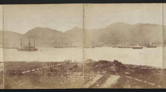
Part of the panorama from 1879, actually one sheet (of four) of the panaorama posted by the National Archives UK on Flickr.
The path/road on the left, an early evidence of Nathan Road?

Part of the panorama from 1879, actually one sheet (of four) of the panaorama posted by the National Archives UK on Flickr.
The path/road on the left, an early evidence of Nathan Road?
Comments
Nathan Road - possibly its early location
Greetings. Allow me to cast my yes vote. Supporting hints are its orientation and distance from the site of the Water Police Station, trees only on the west side near the water, the shape of the bend on the right looks about right for Kowloon Wharf. Interesting views are the smoke from the tall chimney likely the Wanchai power station - https://gwulo.com/node/7191#15/22.2759/114.1651/Map_by_ESRI-Markers/100 , and that flat-bed-look ship on the right. Regards, Peter
I think it's more likely a
I think it's more likely a road along the edge of the bay, so more of an E-W or NE-SW orientation, and not part of what would be Nathan Road.
Nathan Road - Not Quite
Hi David, I had my initial doubt because of how it relates to the roads to the right (west) which I thought were later re-aligned. I agree, more like NE-SW orientation, and too small a gap to squeeze in the big hotel, YMCA, and others. Regards, Peter
The road pictured is an
The road pictured is an unnamed track that ran across the wasteland on Kowloon point. It disappeared around 1900 with the development of the area. Nathan Road is out of sight to the left of the picture. The chimney in Wanchai is the sugar refinery, not the power station
Early TST photo - thanks for the corrections
Thank you David and Herostratus for the corrections. Regards, Peter