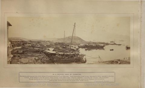
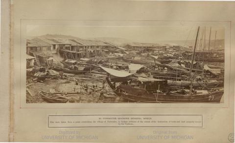
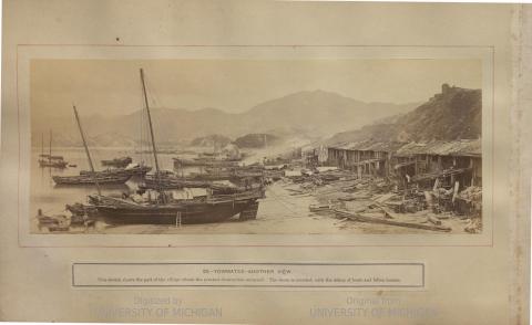
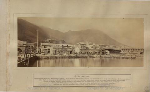
Last Album of William Pryor Floyd Taken in Hong Kong - Views of the Typhoon of 23rd September 1874
Primary tabs
Submitted by Herostratus on Wed, 2019-10-09 11:22
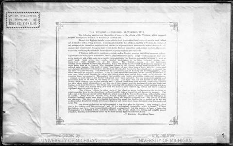
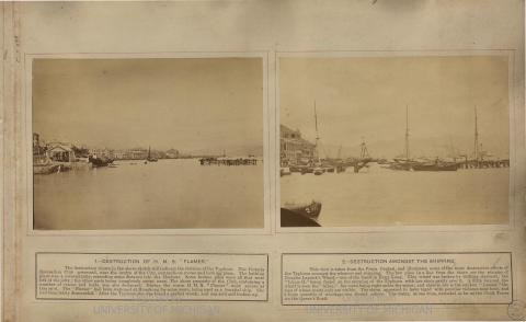
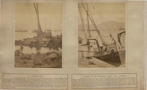
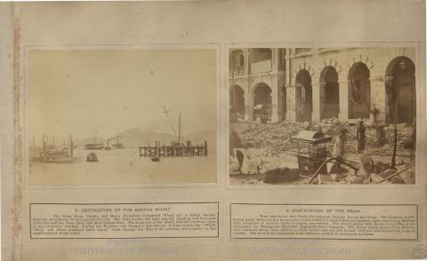
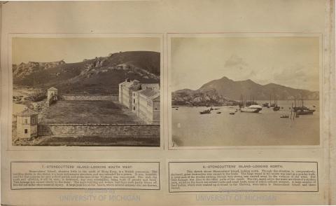
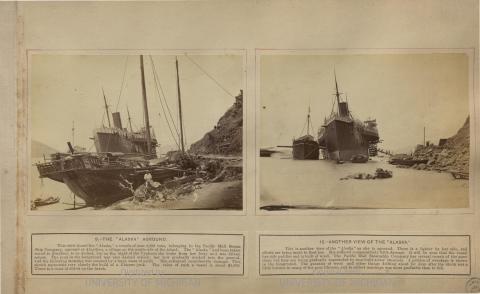
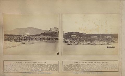
I found this album in the University of Michigan Archives, said to be the last album William Pryor Floyd created in Hong Kong before he left. The views are all of the aftermath of the Typhoon of 23rd September 12874. Lai Afong also photographed the same Typhoon - many of his pictures can be seen on Gwulo. Click on the picture for a full view and to zoom in to read the captions
x
Forum:
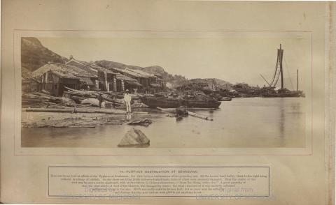
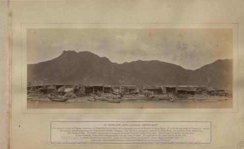
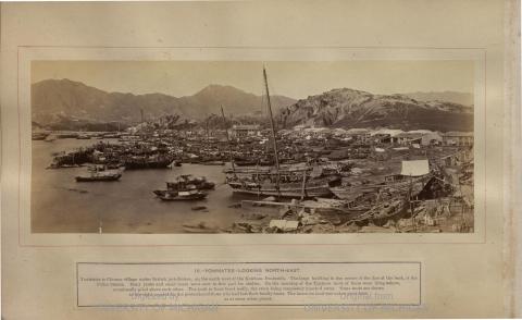
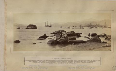

Some excellent views there,
Some excellent views there, thanks for posting. Don't think I've seen the prison buildings on Stonecutters Island before.
Please do you have a link or reference to the document's listing in the University's Archives? I couldn't find it via Google.
I cant find the link either
I cant find the link either which is very strange as I almost certainly found it originally via google.
Photography and China
Found this in the internet:
Photography and China by Claire Roberts (2013) on page 42:
Photographic records of newsworthy events created opportunities for sales. A fierce typhoon struck Hong Kong on 22-23 September 1874. William Pryor Floyd, who was then preparing to leave the colony, documented the devastation, as did Henry Everitt of the Hong Kong Photographic Company. Views of the typhoon's destructive force, with English captions, could be purchased singly or assembled in thematic albums. After Floyd left Hong Kong in late 1874 and Everitt in 1877, Chinese studios dominated the market. A notice in an album produced by Afong refers to a collection of 35 views of the effects of the late typhoon, and in another album an unidentified advertisement describes 'the most numerous, the largest, the most complete and the most com-prehensive' set of such photographs, suggesting that the Afong studio either took photographs of the typhoon too or recycled those of Floyd and Everitt.
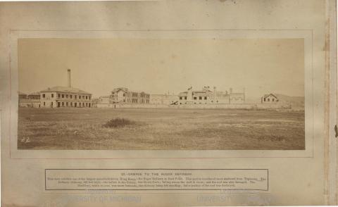
22. Damage to the sugar refinery 1874
I am confused as to the position of the photographer. In an 1889 map, Causway Bay was still a tidal mud flat. This appears to be the position of the photgrapher but there is grass and shrubs growing, unless it only flooded during spring tides. The direction appears almost due west.
Re: Sugar Refinery
Not able to view a map from the 1870s but I think in the 1874 photo, the damaged sugar refinery was located closer to Bowrington and to the west of the Jardines owned refinery (final site). Probably located where the godowns are, as seen on this map here .
The photographer is standing
The photographer is standing south of East Point, around the location of Great George Street, looking North towards Kowloon. The building on the far right of the picture is on the bay that became Victoria Park in the 1950s. You can see part of the bay on the far right
Here is a view of the same area looking southwest across the bay from Tin Hau c1880s:
22. Damage to the Sugar Refinery
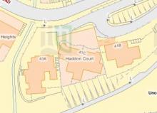
I think I have it now, thank you. In the 1889 Hong Kong historic maps there is a vacant lot due south of the sugar refinery, this being the photographers location. What confused me was one more lot farther south is the distillery. I thought that was the building on the far left, in the 1874 photo, with the chimeny intact. You Sir are absolutely correct he was standing on Great George Street. Still trying to master uploading a screen shot or photo but here is a connection. Screen Shot 2020-04-08 at 10.21.41 PM.png
Here is the link to the
Here is the link to the collection online: https://hdl.handle.net/2027/mdp.39015082302566