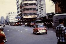
Perkins Road [????- ]
Primary tabs
Submitted by HK8082 on Sun, 2020-03-29 11:40
Current condition:
In use
Does anyone know the origin of the name Perkins Road? It's in a book called Hong Kong's street names and their origins but that book is unobtainable for me. I lived on that road from 1980-1982 in Cavendish Heights and we share the same name so it's always been a point of curiosity.
Thanks


Comments
Perkins Road
According to Signs of a Colonial Era it is named after Thomas Luff Perkins who was one of HK's Director of Public Works.
Great, thanks! Do you have
Great, thanks! Do you have any idea when it was built or when that area was developed? It had some nice houses up there but it seemed younger than the Peak despite being called Jardine's Lookout (which is apparently an erronious designation).
No sign of any roads yet on
No sign of any roads yet on the 1952 map:
https://gwulo.com/node/48847?a=1#15/22.2694/114.1940/Map_by_ESRI-1952_Al...
If you work through the maps at http://www.hkmaps.hk/mapviewer.html from the 1950s on, you should be able to see when the development begins.
Google
When I ask Google for "perkins road hong kong" it says (without any references made):