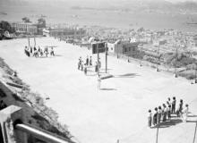
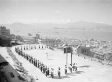
Hospital / Bonham Roads Basketball Court [????-????]
Primary tabs
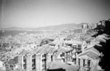
Appears in several photos taken by Harrison Forman in 1940/41. The actual name of the Playground is not known. Further comments from contributors:
a) David Ma - I believe the gateway was at Upper Station Street and the location of the basketball court is now occupied by Central and Western District Saint Anthony's School at 2, Hospital Road;
b) Cosmo525 - A discussion with Dr. Wong, the Author of "Illustrating Hong Kong Historical Buildings" in a Facebbok group about this picture reveals the basketball court was used as a public court after the relocation of No. 8 Police Station.
Mention is made here of the No. 8 Police Station on this site being demolished in 1925.


Comments
The northern slope of this
The northern slope of this piece of land was the site of the Po Hing Fong landslide in 1925, that killed 75 people in the houses at the bottom of the slope. I guess it's the reason that the land stayed empty and undeveloped in the years that followed, allowing it to be used as a basketball court instead.