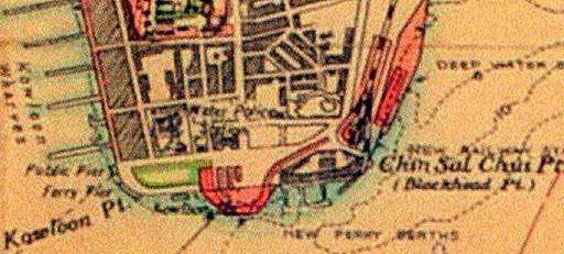
This segment of a larger circa 1940 map shows a development proposal for Tsim Sha Tsui which relocates the railway terminus, moves the Star Ferry piers to where Holt’s Wharf was, and moves cargo unloading around the corner. Included, is what looks like a traffic free plaza where the present bus terminus next to Star House is now (emulating a more recent government proposal). Buses in this map appear to terminate opposite the YMCA and Peninsula Hotel. Presumably the war put a stop to any of these proposals.


