Get Gwulo's books
Directory
Click on your area of interest to choose from over 30,000 pages about old Hong Kong:
- Images & photos
- View - View galleries - View new - Create - Forum topics
- View - Create - Places & buildings
- View map - View new - Create - Streets
- View map - View new - Create - People
- View - View new - Create - Organisations
- View all - View new - Create - Diaries & memoirs
- View - View new - Create diary - Create page - Events
- View - View new - Create - Jurors lists
- View - Type a page
Or choose a popular article:
User login
Timeline
A timeline of Places at this site.
This:
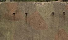
- Lookout Shelter with man-made cave in the back. [????- ]


Comments
Re: Lookout Shelter with Man-Made cave
Hi there,
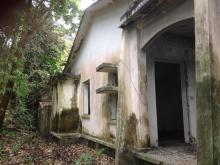
It would seem Google Earth has a photo of the entrance of the cave. Also, if you zoom in, I believe you should be able to see the ruin a bit to the left hand side of the marker. On the other hand, the foot path is clearly visible in Google Earth. It appear to start quite close to the Visitor Centre of this Country Park, at Tai Hang Tun.
Best Regards,
T
Hello, Yes, the foot path
Hello,
Yes, the foot path is visible though its quite bushwacky. It starts around the start of the Lung Ha Wan Country Trail next to the visitor centre. Its not hard to miss as it is marked with ribbons. You can go in and back from this trail. There is two other ways to get out. One goes back up the ridge line. The other continues closer along the coast and takes you what is referred to as the seated buddha. I have started marking my photos for google maps. So, the cave entrance photo is mine.
I have one picture of the ruin as well.
Thanks
W