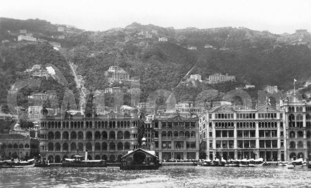
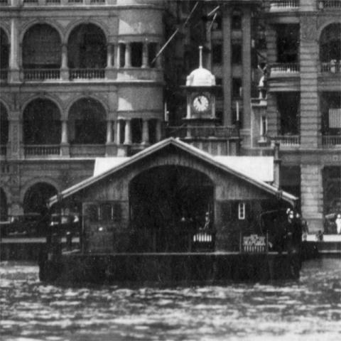
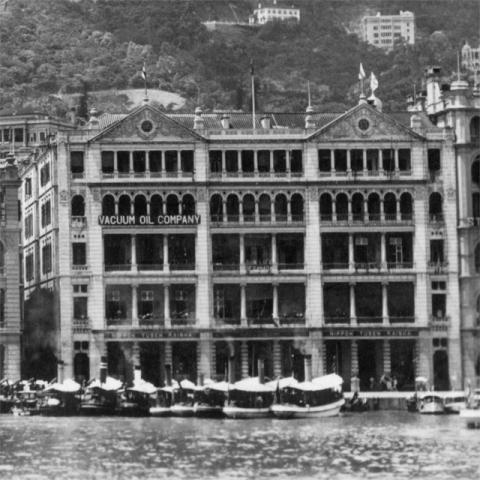
Where: We're looking at Connaught Road in Central, which ran along the seafront at that time. Here's the old Star Ferry Pier, at the end of Ice House Street:
The photographer may well have taken this photo from one of the Star Ferries.
|
Gwulo talk: More photographs of old Hong Kong and the tales they tell When: Wednesday, 20th November at 7pm Where: Harold Smyth room, St. John's Cathedral Details and booking: http://www.cab.org.hk/Old_Hong_Kong.png |
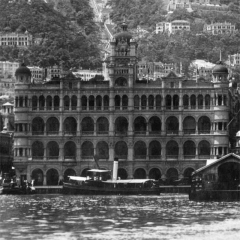
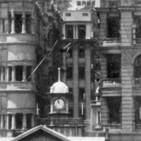
Across Connaught Road from the pier, and on the left as we look at it, is Queen's Building, where the Mandarin Hotel stands today:
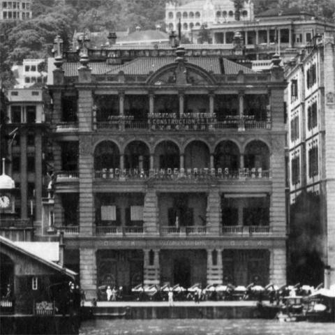
On the other side of Ice House Street is St. George's Building, since replaced by a newer building with the same name:
And next to it stood King's Building, now part of the Chater House site:
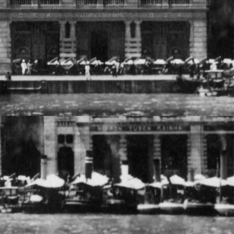
What: Ferries weren't the only means of transport. Lined up in front of St George's Building are sedan chairs and rickshaws, waiting for customers. Then over in front of King's Building is another line, this time of launches, used to shuttle passengers to and from the larger ships out in the harbour:
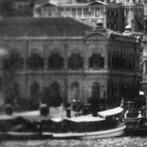
When: Over on the far left, we can see across Statue Square to the western end of the old City Hall.
That was demolished in 1933, so this photo must have been taken earlier than that.
And looking along Ice House Street we get a glimpse of the Bank of Canton at the junction with Des Voeux Road.
That building opened in 1924, giving us a possible range of dates for this photo: 1924-1933.
Some of the buildings up on the hillside might narrow it down. Can any of our mid-levels experts spot any clues?
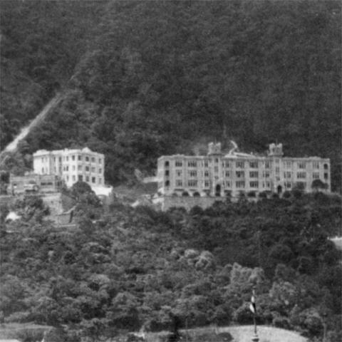
Here is a pair of buildings on the left of the photo:
I don't think we have Places for them yet. Can anyone identify them?
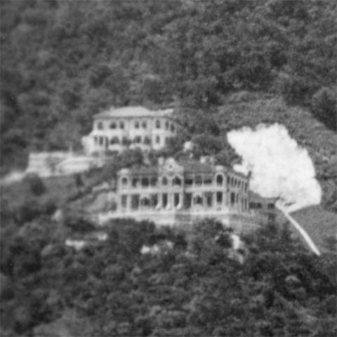
Just to the right of the Peak Tram tracks is this group of three houses:
From left to right we have:
- The small house in the left foreground is the oldest. The best guess so far is that it was called Ava House [1].
- The lighter-colour building above it is believed to be Ava Mansions [2]. It isn't shown in a photo of this area that we've dated to 1924 -
- so its construction date could be helpful to date this photo. - Then the largest building of the three is Branksome Towers [3]. However that was completed in 1918, so doesn't help with dating the current photo.
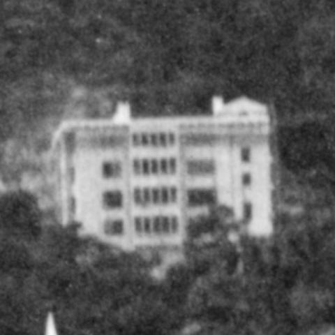
Futher to the right is this building:
It looks as though it is still covered in scaffolding, so I'm guessing it is brand new and just finishing construction. If anyone knows the building's name and / or the date it was built, that could pin down the date this photo was taken.
Who: The signs on the buildings show some of the companies who had offices here. St. George's Building has:
- Hongkong Engineering & Construction Co. Ltd., offering Reinforced Concrete, Foundations & Structures.
- China Underwriters Ltd. This insurance company was founded in 1924, but is shown to be "Winding Up" [4], which means it is either already out of business, or heading that way.
- OSK. Osaka Shosen Kaisha, a Japanese shipping line, had the ground floor. The "O" of OSK lives on as the "O" in the name of a modern Japanese shipping company, MOL.
Next door in King's Building are a couple of competitors, Sun Life in insurance, and Nippon Yusen Kaisha in shipping. Both companies are still in business, though the shipping company is more commonly known by its initials, NYK.
The other company in King's Building is the Vacuum Oil Company, with its partner / competitor Standard Oil just visible on the far right of the photo. Vacuum began life as an independent company, was acquired by Standard Oil in 1879, then became independent again in 1911 when Standard Oil was broken up. In 1931 it merged again with SOCONY, one of the other children of the Standard Oil break-up. Today it is part of ExxonMobil [5].
As always, any questions, corrections or extra information are very welcome. Please leave a comment below.
Regards,
David
Trivia: When I first received the photo I was annoyed to see this white mark, thinking I'd bought a photo with a bad scratch.
After scanning I can see the light-coloured patch is actually part of the photo, not a sign of damage. It shows a recent landslip, and is another clue to the date of the photo. Are there any landslip experts reading this?
References:
- Ava House: http://gwulo.com/node/14302
- Ava Mansions: http://www.gwulo.com/node/5544
- Branksome Towers: http://gwulo.com/node/5517
- CHINA UNDERWRITERS LIFE & GENERAL INSURANCE COMPANY LIMITED: http://www.companies-hongkong.com/china-underwriters-life-general-insurance-company-limited-fs/
- Vacuum Oil Company: http://en.wikipedia.org/wiki/Vacuum_Oil_Company
Reference: A222

Comments
1926-27 Landslide
That BIG landslide at the end of May Road, where it joins with Magazine Gap, was 1927 as far as I know,
(but there was a major rainstorm 19 July 1926, so it could be then)
and they've built retaining walls and a Nullah,
so 1928 would seem to be the date.
(i've seen a postcard, very similar to this, which doesn't have Aigburth Hall, but does have the landslide, Posted May 1928)
Alun
1928, Aigburth Hall and the Landslide
Thanks Alun, 1928 it is.
Re: the BIG landslide, is that the explanation for the tree-less strip of hillside running down from the Victoria Hospital area and disappearing out of sight behind the Queen's Building's middle tower?
Regards, David
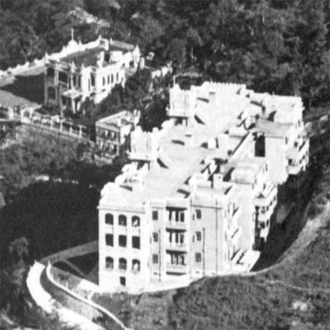
THORPE MANOR
As Thorpe Manor is shown to the left of the Peak Tram track at the same level as Ava house and Brankston Tower this has to place the date as post 1921 which was when Thorpe Manor was completed.
The big landslide
Have a look at the picture of Thorpe Manor (c.1927) that I posted a while ago.
http://gwulo.com/node/14304
It shows that the small landslide pre-dates the big one, because the retainng walls and drain pipes have been completed,
and the picture was taken shortly after the big landslide.
Alun
The Victoria Hospital
Thanks for the prompting David.
Reading further, the Tennis Court of the Hospital on Barker Road was carried away by the deluge in 1926. (China Mail 19 July 1926).
Alun
re: The Victoria Hospital
Good find! Thanks for digging this up,
Regards, David