see comment at www.gwulo.com/atom/21078
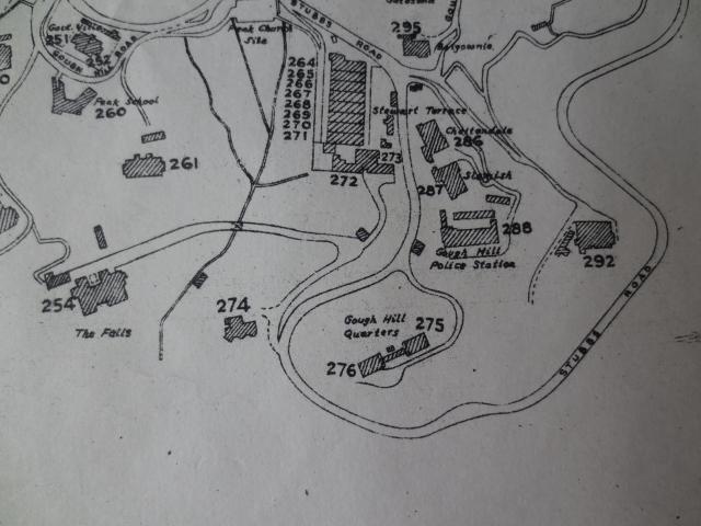
1950s Map of Gough Hill
Primary tabs

Submitted by gw
Date picture taken (may be approximate):
Saturday, January 1, 1955
Gallery:
Connections:
- 1950s Map of Gough Hill shows Place Gough Hill Quarters, 275 & 276 The Peak [1925-c.1985]


