A wintertime wander through Shau Kei Wan: Part 2
Primary tabs
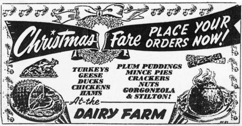
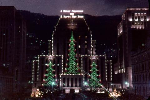
We'll finish off the walk around Shau Kei Wan, then I'll suggest some more walks you might like to try over the holidays. But more important things first - let me wish you a very Merry Christmas:
A wintertime wander through Shau Kei Wan: Part 2
When we finished part 1 of this walk, we'd just walked down from the Sai Wan Redoubt. Mr Chan asked if we were going to look at the old barracks area [1], but we said we didn't have tickets [2]. He replied that "We morning walkers often walk through there. As long as we don't steal or break anything, they don't mind. Follow me." So we did!
Lyemun Barracks
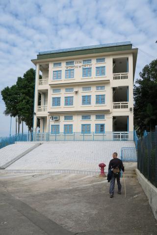
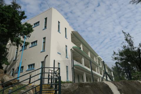
We soon reached the "Wordsworth" block [3]:
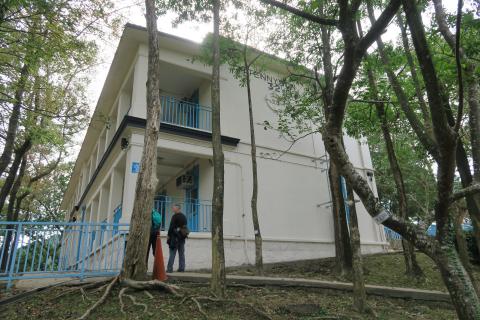
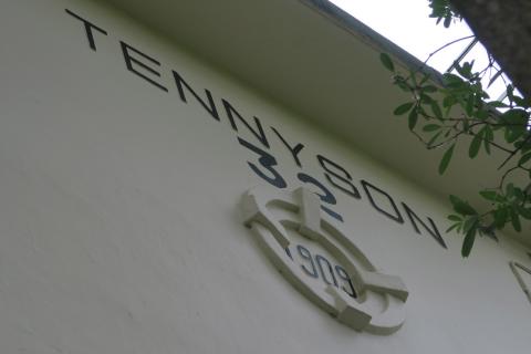
It's one of several blocks in the area named after English poets - Tennyson [4] appeared soon after:
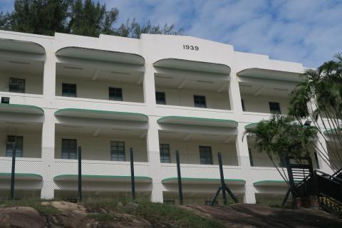
The newest (and poet-free) block is Block 3 [5], at the bottom of the hill near the riding centre. (There used to be a Block 2 in the same style as Block 3, but it was demolished to make way for that riding centre.)
The year '1939' shows Block 3 was built just before the Second World War. Its appearance reminded Phil of the old Wanchai Market [6], which was also built around that time.
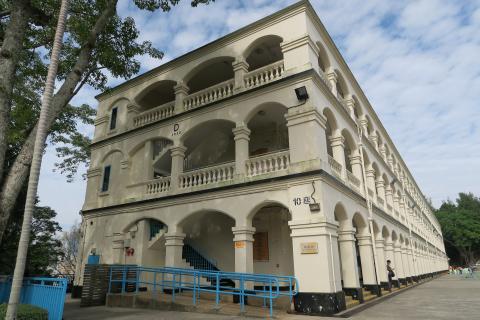
From here we walked back up the hill to Block 10 [7]:
In the middle of the wall facing us you can see a letter "D", and beneath it is written the year "1935". This is a much older style of building though, and was definitely built before 1935 as it appears in this view of the area from 1902:
It's the long building on the skyline. The modern building is even longer, so perhaps 1935 refers to the year an extension was completed?
Look closely at the 1902 photo, and left from Block 10, on a small rise at the end of the ridge, is Block 7. You can imagine it would have had great views out over the harbour. Today Block 7 has been converted into a cafe, and its viewing platform still gives you a great view of the area:
The view explains the British military interest in this area. The Lei Yue Mun channel is the narrow eastern entrance to Hong Kong's harbour. In the 19th- and early 20th-Centuries, when Britain was worried about attacks on the harbour by foreign navies, this was an important area to defend. We've already seen one of their gun batteries up on Sai Wan Hill, but they also built more batteries downhill, nearer the water.
Several of the batteries lie in the grounds of the Museum of Coastal Defence [8], and are open to the public. The white, tent-like roof on the right is the Museum's main exhibition building.
By now our tummies were starting to rumble, so we asked Mr Chan for his lunchtime recommendations, and walked back down in to Shau Kei Wan town.
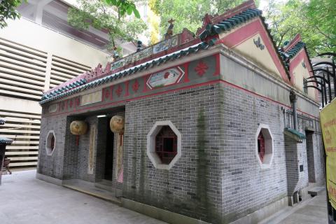
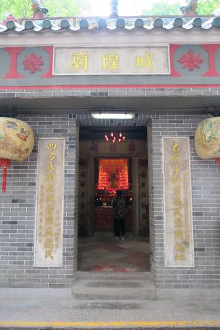
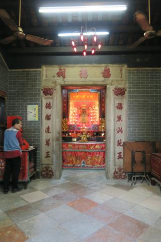
Shing Wong temple
We made a small detour on the way to lunch, to stop and take a look at the Shing Wong temple. It's easy to find as it is right by the loop of track that marks the end of the tram line.
"Shing Wong" is translated as the "City God", the god who looks after a certain locality and its residents.
After thanking Mr Chan for all his help, and saying our goodbyes, we had a quick lunch then set about exploring the local streets.
Curvy buildings
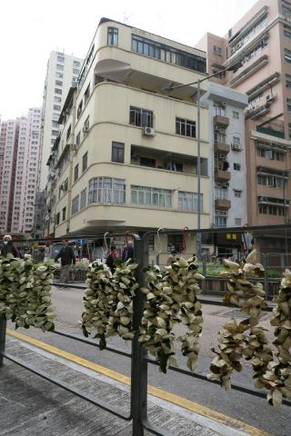
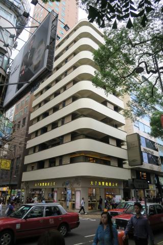
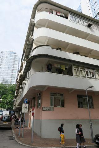
Is there an official name for this type of building? Here's one we saw on the corner of Po Man and Mong Lung Streets [9]:
It is six storeys high, built c.1960, and originally had open balconies running around the building. Over the years the balconies tend to be enclosed, and you end up with a mix of styles as each owner takes a different approach. But a similar building in TST [10] was recently redeveloped and returned to its original appearance:
I think it looks rather smart!
Every movie, ever
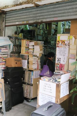
If you follow Hong Kong's history through old movies, you might want to pay this shop a visit:
Shelf after shelf of VCDs and DVDs, stacked up to the ceilings. The address says it is 20A Ngoi Man Street, but the entrance is in an alley that runs along the back of that building.
Caves in the cliff
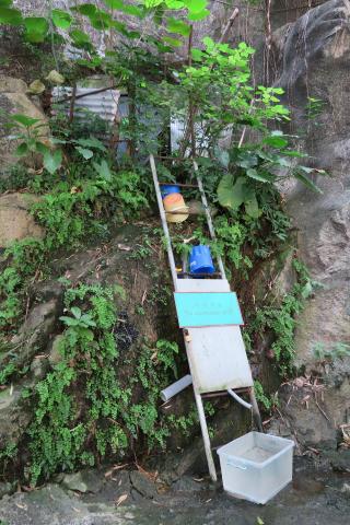
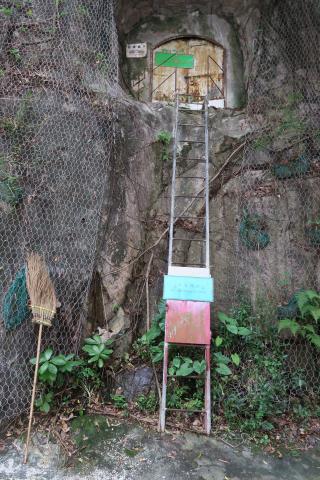
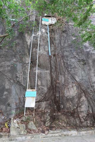
Walk along to Sun Shing Street, and you'll find these curious caves in the cliff face, reached by ladders. There are three in a row, each with a ladder that is longer than the last.
They look like the type of cave a wise old sage would live in, but in fact they're another wartime relic. These were part of a network of tunnels, network number 29 [11], built as air raid shelters c.1940.
Now if you need to get into an air raid shelter, you're probably in a hurry. Then a ladder seems an odd design choice!
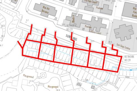
A map of the tunnels explains:
The red lines mark the original extent of the network. Back in 1940, the tunnel entrances were further north, opening out onto the hillside there. Since then the slope has been dug away to make room for Sun Sing Street, so now the remains of the tunnels are left high up the cliff face.
Ready for lift off
We followed the road around then walked west along Sai Wan Ho Street til we saw this building:
It's the Lee Ga building [12], built in 1981. No curves on this one, it's all straight lines and angles.
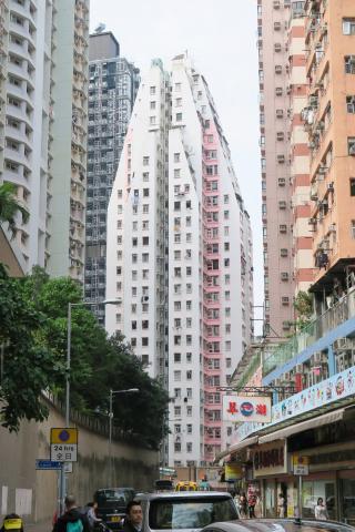
Lots of buildings from around this time have a similar, slanted top. It is explained by an old rule that a building's profile had to fit under a line drawn up from the centre of the road, at 76-degrees to the horizontal [13]. The idea was to make sure enough light and ventilation reached the streets, with the natural side-effect to limit the height of buildings. Initially, building heights stopped where they reached that 76-degree line. Then later, developers realised they could squeeze in extra floors by stepping the highest floors inwards to follow the line. That rule no longer applies, so newer buildings are higher still.
More curves
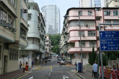
Towards the western end of Sai Wan Ho Street, the curvy buildings are back in force.
One day these will become as rare as the old shophouses are. But today there are still plenty to be seen:
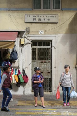
One other unique feature of this area is the street name signs. They are cast from concrete, and much larger than a typical sign:
Other walks for the Christmas holidays
That marked the end of our outing - is it one you'd like to try over the holidays? Other straightforward walks on paved paths are the walk around Happy Valley, or the one around Mount Davis. If you fancy heading a bit further afield, how about an outing to Cheung Chau?
For a more challenging outing, the scramble up High West should get you sweating, and reward you with great views. Another long walk with great views (unless you pick a foggy day like we did!) is the visit to explore the Japanese wartime radar site at Tai Mo Shan.
Two more sites with a wartime theme are the Shing Mun redoubt, and the Japanese pillboxes at Luk Keng. You'll see from the photos that these are very interesting to visit, but the Luk Keng site can be difficult to get to.
If you're planning to do another walk, take a quick look at Gwulo's map of Places to see what interesting things are near your route. And please let us know what new things you discover!
Happy exploring,
David
|
Readers ask for information (photos, facts, memories, etc.) about:
New on Gwulo.com this week: |
References:
- Lyemun Barracks
- Details of the official way to visit the Lei Yue Mun Park, built on the site of the old Lyemun Barracks.
- "Wordsworth" Barracks Block 34
- Tennyson Barracks Block 30
- Barracks Block 3
- Wanchai Market (2nd generation) [1937-2009]
- Barracks Block 10
- Museum of Coastal Defence
- 21, Mong Lung Street
- The Camphora
- ARP Tunnel Network 29
- Lee Ga Building
- Building Codes and Postwar Reconstruction in Hong Kong
