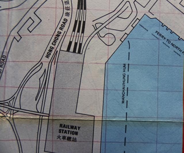
From my Hong Kong Map (1980). The map shows two ferry piers ("onshore", not extending into the sea): the north-eastern one going to North Point, the south-western one to Wanchai.
Hung Hom Piers (1980)
Primary tabs

Submitted by Klaus
Date picture taken (may be approximate):
Tuesday, January 1, 1980
Gallery:
Connections:
- Hung Hom Piers (1980) shows Place Former Hung Hom Ferry Pier (1979) for Hung Hom / North Point service [????-????]
- Hung Hom Piers (1980) shows Place Former Hung Hom Ferry Pier (1979) for Hung Hom / Wanchai service [????-????]


