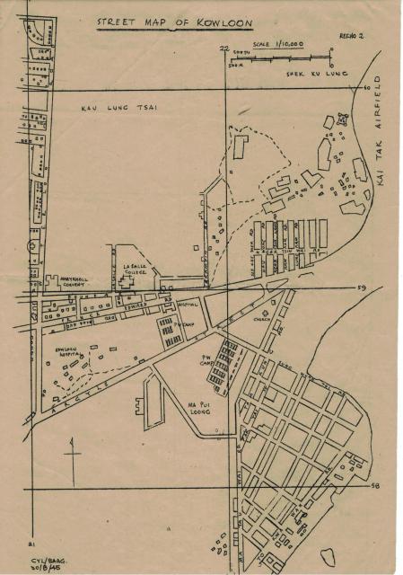
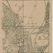
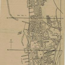
This is the page marked with ref 2 of the Kowloon streetmaps. Note the Prison of War Camp next to Kowloon Hospital on either side of Argyle Street.
I have now amended the title to Boundary Street to eliminate confusion. I did have a look at the map in magified form and it was marked Boundary Street.
I have done a bit more research to find out why it was referred as Boundary Road in an unaccompanyed note that I have. I must say the information in the note was rather confusing. So rather than trying to dig deeper, I will just put it as an error on my behalf. All good now.
And thanks to Megabyte for the authenticated information about Boundary Street.
All good!


Comments
POW Camps
Nice to see the delineation of the Argyle Street and Ma Tau Chung POW Camps.
Central British School and
Central British School and field also on map (later KGV)
Why Boundary Road?
As far as I recall it's always been known as Boundary Street, but here we have on the main page several mentions of Boundary Road instead. Just saying. Thanks.
Boundary Road or Boundary Street?
All I can say is "No idea". But it is the same street/road.
Well it can't be both right,
Well it can't be both right, and I would welcome any other source that calls it a road. Even GWULO's repro of the Govt map shows it is named a Street. Ignorance is no excuse. QED.
Boundary Street or Road
Whether it is called Boundary Road before is not something I can verify. Only absolute way to find out would be to ask my father who produced these maps for military reoccupation of Hong Kong after WWII I'm 1945. Unfortunately he passed away long time ago.
it would be great if there are someone else with authority can help us. If I have time, I will try to do some research and come back to you.
Thanks for your interest in these maps.
Re: Maps
Thank you for posting the hand drawn BAAG maps used in the re-occupation of Hong Kong. Have gone through each map and added in most of the place names from the 'place' directory on Gwulo.
Appears that these maps served the purpose of the day.
Furthermore regarding Boundary Street....
Just so happens I was a HK Govt PWD map draughtsman by profession for 30 years and so I can ascertain the name "Boundary Street" has remained exactly that in both English & Chinese, so I hope we can put the matter to rest once and for all.
Boundary Street or Road
So you must right then!
You can see my explanation in the amended description above.
Thanks for the authenticated informtion.
Maryknoll School
Thank you AH Leung, your map might help confirm whether this photo of my mother was taken at Maryknoll School. There were some discussions pro and con. Your map shows a building on the west side of Waterloo Road marked with a cross which might have been a small hospital hence taller and larger than its neighbours. Could it be moddsey's "dark object at mid-right" on my mother's photo? While the school opened in 1937, I believe construction of the building was not completely accomplished hence the different appearance in the photo. Regards, Peter
https://gwulo.com/atom/28529
Waterloo Road buildings
Hi Oldtimer, your interest also aroused my curiosity. So I looked at what is there at that circulate spot. It is where the Kowloon Tong Club is. The website of the club stated that it has occupied this address since 1935. So the cross shown was probably the outline of a building than indicating a hospital.
Looking at those round pillars on the right of the photo you posted, they looked more like the entrance to a convent or church. Likely to be a significant structure of Maryknoll school?
Waterloo Buildings
Thank you AH for the reply. Unless the dark tall building was Kowloon Tong Club, the photo's site can not be confirmed as on Waterloo Road. Regards, Peter