1903 Map of Kowloon
Primary tabs
The latest addition to Gwulo's collection of maps is one of Kowloon from 1903.
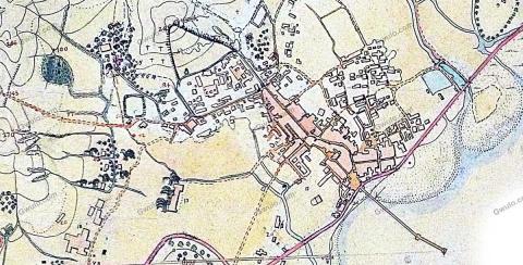
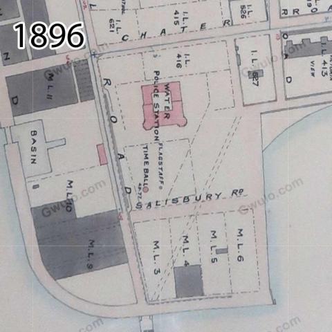
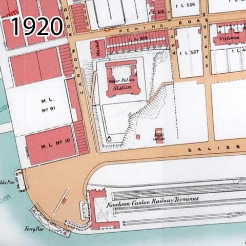
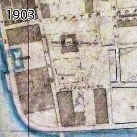
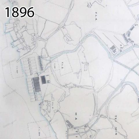
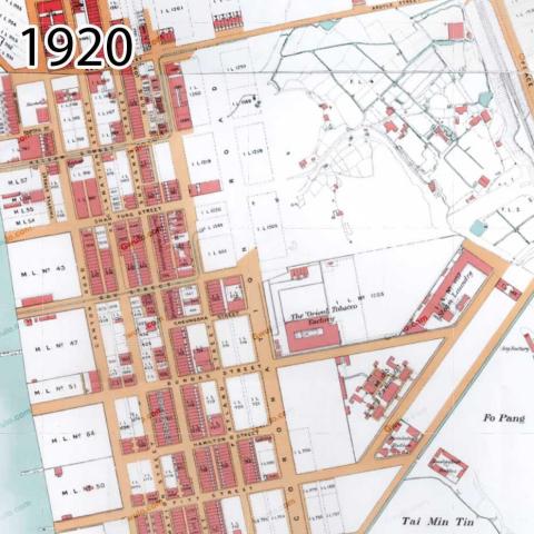
If we compare its view of Tsim Sha Tsui with a couple of other maps on Gwulo, it seems this is a poor addition to the site, looking rather smudged, and without much text to tell us what we're looking at:
But the 1903 map does have two important benefits for us.
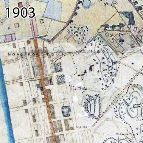
Here's a section from further north up the peninsula, showing the area around today's Mong Kok. You'll see the 1903 map is a composition of two different sheets, and fortunately the second sheet is much sharper. This section also shows one of the benefits I have in mind - can you spot it?
The 1903 map has contour lines!
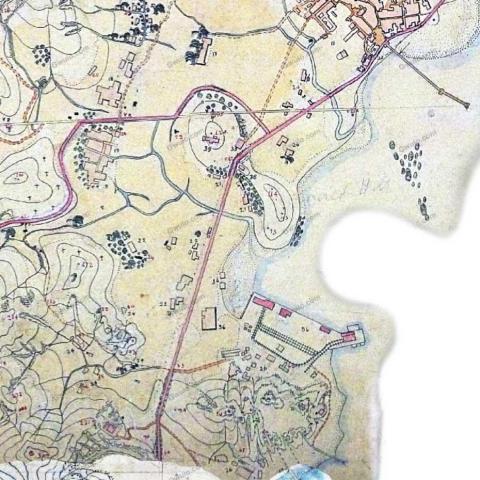
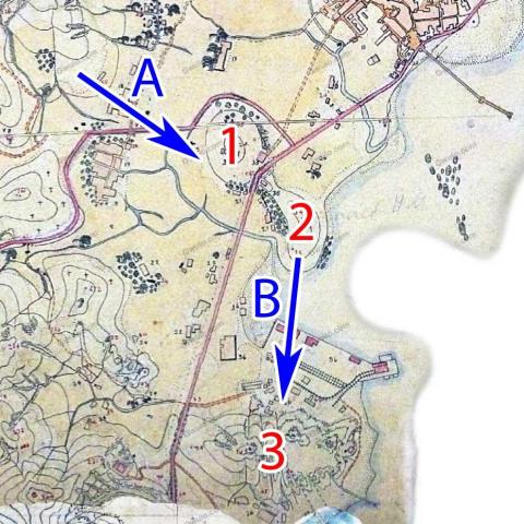
One of my current fascinations is the changing shape of the ground in Kowloon. The new map gives us a couple of good examples - here's the section around modern-day Ma Tau Chung, Ma Tau Kok, and Ma Tau Wai.
Below I've marked the hills we'll look at as 1, 2, and 3, and also labelled a couple of views as A and B.
If you've got Volume 4 of my books, turn to the last photo to see view A, showing hills 1 and 2. On the 1903 map, hill 2 is labelled 'Sacred Hill' in very faint pencil, while the 1920 map calls it 'Hill Of The King Of The Sung'.
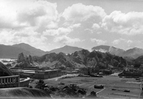
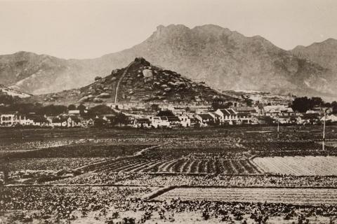
Here's another photo of the area that shows view B. The photographer was standing on Sacred Hill, looking south across farmland towards a very jagged-looking hill number 3.
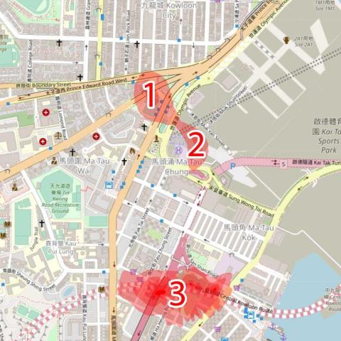
Don't feel bad if you're struggling to work out where these hills are today. The map below shows their location on a modern map, but if you walk there today you won't find even the slightest incline to give you any hint of where the hills once stood. They've been excavated and completely removed, leaving perfectly flat land behind.
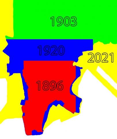
To show the the second benefit of the 1903 map, here's a comparison of the area each map covers.
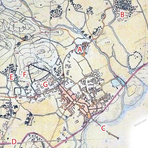
The 1903 map extends much further north and east than the other two old maps. That caught my attention because it's the first of the maps that covers where I live, San Po Kong. Here's the area I walk around several times a week.
Much of the history of this area was erased by the expansion of Kai Tak airfield during WW2, but there are still traces of several of the items shown on the 1903 map:
- A) Nga Tsin Wai village. (Map & notes)
The map shows the village still had its moat and defensive wall in 1903.
- B) Po Kong village. (Map & notes)
This was the 'old' Po Kong, that gave its name to today's San Po Kong - literally New Po Kong.
- C) Lung Tsun Pier. (Map & notes, photos)
The section closer to shore was made from granite, and has survived until today. The section at the sea end was a wooden extension, and is shown in photo 21 of Volume 3.
- D) Boundary Street.
Running along the line of the old boundary that separated British Kowloon and China in the years before the lease of the New Territories.
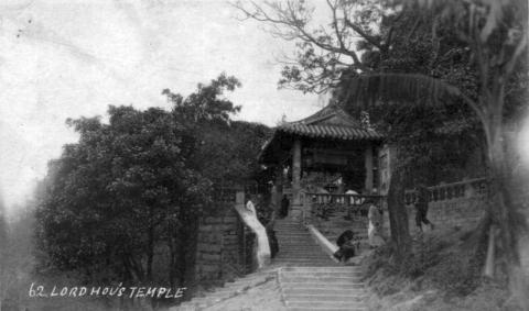
- E) Hau Wong Temple. (Map & notes, photos)
- F) Cemetery on the hill next to the old Walled City (Map & notes, photos)
- G) Kowloon Walled City (Map & notes, photos)
The map
The work to produce this map is described in item 48 of the PWD's annual report for 1903: Survey of the New Territory. It notes there was a large group of men working on the project:
The staff engaged upon this portion of the work in the early part of the year consisted of 1 Inspector, 24 Surveyors, 32 Indian Chain-men and about 45 Chinese coolies, [...]
And that in total they'd produced 557 sheets, drawn at 32 inches to the mile.
I photographed the map seen above in 2011, on a visit to the UK's National Archive. Their reference is MPH 1/149, dating the map to 1903 with the description:
Survey of Hong Kong. Drawn by Paras Ram, Kudrat Ali and Dalbir Rai. 27 sheets.
It's a much smaller map then 557-sheet monster described above, so I think the National Archive's copy is a reduced copy derived from the original.
Trivia
The team of men that surveyed the land included "32 Indian Chain-men". They used a metal chain, known as a Gunter's Chain, to measure distances. Each Gunter's Chain is a standard 66 feet in length. This length became known as a 'chain', and is a common unit of measurement in older British documents.
Modern measurements in Britain use the metric system so the chain has fallen out of use, unless you play cricket! The wickets on a cricket pitch are exactly one chain apart.
Returning to the map, I noted several items that deserve further investigation:
- Just north of hill 3 there's what looks like an industrial area with the small railway. (See on map)
- A short distance west of the walled city there's what looks like another square moat - similar to Nga Tsin Wai, but without any sign of buildings. (See on map)
- The boundaries of the Kowloon rifle ranges north of Kowloon City have been marked on the map in pencil. (See on map). The corners of the boundaries are marked "B.S.", which means there were Boundary Stones erected to show their positions on the ground. Much of the old rifle range area is within the modern Morse Park, so I wonder if any of the old stones have survived.
Further reading
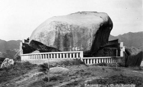
- Sacred Hill / Sung Wong Toi (Map & notes, photos)
- Mr Edmund Gunter [1581-1626], and Gunter's Chain.
- To get the most from the maps on Gwulo I recommend you watch the short tutorial video first, then explore the 1903 map in more detail. (I've only added the sections of the map that cover Kowloon and New Kowloon to Gwulo, but you can see an online copy of the full map by selecting layer 1904.2 at the HK Maps website.)
- To see how Kowloon has changed over the years, visit Gwulo's other maps of Kowloon from 1896, 1920, 1945, and 1956.

Comments
Re: Industrial area Ma Tau Kok
Sorry, no clue what this really was.
But - the 1901 map on hkmaps.hk shows that this area was reclaimed shortly before (The foreshore was extremely shallow, so it wasn't too difficult). The lot is K.I.L.1094, and this lot was sold by the government in 1900 (Public Works Annual Report for 1900, page 322). Couldn't find anything further in the reports for 1898 to 1903.
In 1926, the PWR reports: Rope Works on K.I.L. 1094, Ma Tau Kok.
P.S: Great achievment, will surely give valuable information about Kowloon (e.g. European House at the New Kowloon City Road [c.1900-????] which I could update already)
Further Reading
A good read of To Kwa Wan, Ma Tau Kok, Ma Tau Chung and Ma Tau Wai can be viewed here