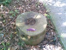
Ho Hok Shan - on site (photos added)
Primary tabs
Hi there,
I am on the slope of Ho Hok Shan, facing approximately SW right now. In the past 20 minutes or so I have walked along and acrossed quite a few trenches. They are mostly over growned and some of the slopes are quite steep. The hill is nothing that tall, but it feel great up here despite the smog. I will go up the top of the hill before making the decision of going to Nam San Wai or about turn and make for Tai Lam, or even Tsuen Wan. Photos would have to wait.
More later.
T
(edited - my typos made from the freaking virtual keyboard from my tablet (9th Oct)


Re: Ho Hok Shan - on-site
Hi there,
I'm still going over the photos. I will select some of them and put them up in the next few days.
I made an about turn from the summit and attempted to find the foot path towards Tai Lam yesterday. However I have probably missed it and had to turn towards Kam Tin's direction, looking for a way to go down. That was way past 1600 hrs (and it would be getting dark at around 1730 hrs these days). Fortunately some hikers left behind ribbon markers at some point. I was able to find my way down, decending into a village very near the Kam Sheung Road MTR Station. I ended up walking back to Yuen Long from there.
More later.
T
Re: Ho Hok Shan - on-site
Hi Thomas,
Please can you make a Place for the location, so we can see where it is?
Thanks for the on-site report. I don't think we've had a live report before, so that's a first!
We now return you to the studio....
Regards, David