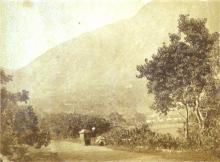
Everything tagged "Shek Kip Mei shanty town" | Gwulo: Old Hong Kong

Everything tagged "Shek Kip Mei shanty town"

SKM-6 Their Home Map c.1956.jpg

Date picture taken (to nearest decade for older photos): 
1956

Please see page connection - https://gwulo.com/atom/41848

Shek Kip Mei shanty town children looking at the lane map of their neighbourhood (on wall) newly posted by the city.

Photo source: Harrison Foreman -   https://collections.lib.uwm.edu/digital/collection/agsphoto/search/searc...

SKM-4&5 Ditch&Jeep c.1956.png

Date picture taken (to nearest decade for older photos): 
1956

Please see page connection - https://gwulo.com/atom/41848

SKM-5 Wo Chai St c.1956

Date picture taken (to nearest decade for older photos): 
1956

Shek Kip Mei shanty town.  While it was labelled Wo Chai Street, I believe its alignment/location is not the same as the current Woh Chai Street.  I remember stepping over the ditch several times.  This site is very close to Tai Po Road, and by the time of the 1963 photo, the area had been altered to make way for 6-storey resettlement buildings.

Please see lead page at - https://gwulo.com/atom/41848   

Photo source: 

SKM-4 Children next to small ditch c.1956

Shy but friendly and smiling children.  This site, located further downstream and closer to Tai Po Road, was likely the beginning of Forman's visit to the shanty town.  The small concrete defect was noticeable everytime I crossed this small ditch.  The walkway continued up and to the right.

Please see lead page at -  https://gwulo.com/atom/41848  

Photo source:

SKM-3 Woman and baby c.1956

Date picture taken (to nearest decade for older photos): 
1956

Please see page connection - https://gwulo.com/atom/41848  

This door, old and in poor shape, got my attention after my visits to the relatives.  Then one day a new door appeared.  

Shek Kip Mei shanty town c.1956. Photo source:

https://collections.lib.uwm.edu/digital/collection/agsphoto/search/searc...

SKM-2 Looking West to Garden Hill c.1956

Date picture taken (to nearest decade for older photos): 
1956

Shek Kip Mei shanty town looking west to Garden Hill.

Photo source:

https://collections.lib.uwm.edu/digital/collection/agsphoto/search/searc...

SKM-1 如意坊 三巷 一號 二樓c.1956.jpg

Date picture taken (to nearest decade for older photos): 
1956

如意坊 三巷 一號 二樓 on far right of photo.   The photographer was standing halfway up on the wooden straight staircase, the same staircase I climbed to visit my relatives. Note the concrete-lined ditch on the ground that drained southward.  The children in the photo are now in their early 70s.

Photo source:

SKM-0 Harrison Forman Photos c.1956

Date picture taken (to nearest decade for older photos): 
1956

Locations of photos taken by Harrison Forman during his visit to Shek Kip Mei shanty town in 1956, marked on an aerial photo dated 1963.  For reference, the location of the subsequent extension of Cheung Sha Wan Road has been added.  During this seven-year period, physical changes to the area are expected, such what are shown in Forman's photos may not be the same, or no longer there, in the aerial photo.  There is another candidate site a short distance to the north, but after looking at the pros and cons, I have decided on the current location markers.  Corrections are welcome.

Shek Kip Mei Village Crop from 1963.2 Photo.png

Date picture taken (to nearest decade for older photos): 
1963

Shek Kip Mei Village - cropped from the 1963.2 air photo.  The centre of this photo is about the site of the current Park Tin Estate, Chak Tin House, a short distance northwest of the Pak Wan - Nam Cheong junction.  

Connection - https://gwulo.com/atom/28796

Student Book Bag (1950s)

A student's book bag made of wicker.

Street scene of Shek Kip Mei shanty town in the 1950s.

Subscribe to Everything tagged "Shek Kip Mei shanty town"