Articles tagged "water supply" | Gwulo: Old Hong Kong

Articles tagged "water supply"

Pokfulam's Inverted Siphons

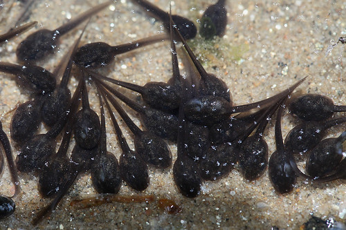
I've got another 'old Hong Kong waterworks' puzzle for this week's newsletter. Unlike the recent pouring pipe mystery, this one took much longer to solve. It all started around ten years ago, back in a time of tadpoles.

tadpoles


Looking for tadpoles, finding pillars

When our daughters were younger, an annual ritual each April / May was to go looking for tadpoles. We'd take a jam jar's worth home, enjoy watching them grow into baby toads, then take them back to their stream and let them go.

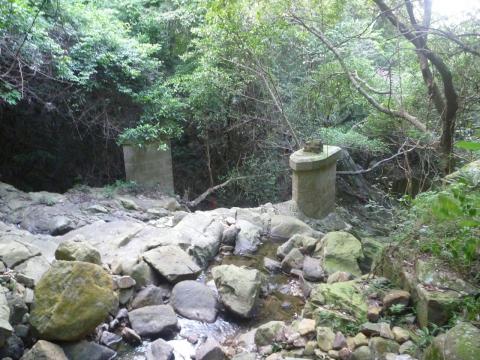
The path to the tadpoles passes these two old pillars, made from granite blocks and standing unused in the centre of the stream.

Pillars below the Pokfulam conduit
The pillars in 2014


What were they built for?

A little further uphill the path crosses the

“Water supply in Hong Kong” The Far Eastern Review, 1927 - 1934, courtesy of the P. A. Crush Chinese Railway Collection

Articles on “Water supply in Hong Kong” published in The Far Eastern Review in 1927 and 1934, courtesy of the P. A. Crush Chinese Railway Collection

Water supply in Hong Kong - The 'Shing Mun' Valley Scheme

The Pokfulam Conduit

In early Hong Kong, you got your water from wells or streams. The first attempt to provide a more reliable source was the Pokfulam Reservoir, and its associated conduit. The conduit carried water round the island from the reservoir, following the hillside above Pokfulam Road, and ending near the junction of Albany Road and Robinson Road.

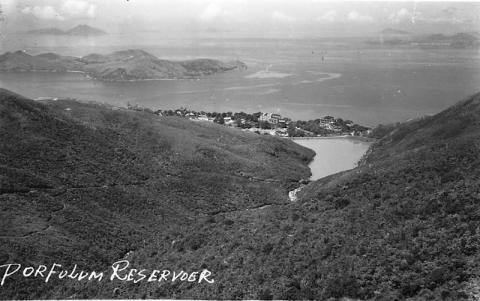
There are still plenty of signs of this old water system. Pokfulam reservoir is the most obvious, clear to anyone looking south from the Peak:

1940s Pok Fu Lam Reservoir

And the path of the old conduit above mid-levels is immortalised by the name of the road that was built on top of it:


View Larger Map

Thomas, one of the regular contributors to Gwulo, has been using the 'Places' feature to document other parts of the conduit's route that are still visible. Here they are on a map and list. (If you know of any more, just create a Place and give it the tag Pokfulam Conduit, and it will automatically appear on the map and list below.)

The map is 'live': you can drag it around with your mouse, click the +/- buttons to zoom in and out, and click the Map/ Satellite/ Hybrid buttons to change the appearance of the map.

REPLACE THIS WITH THE NEW LEAFLET MAP

Pages

Subscribe to Articles tagged "water supply"