Everything tagged "Stone Nullah Street" | Gwulo: Old Hong Kong

Everything tagged "Stone Nullah Street"

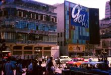
Stone Nullah Lane 1966_June_12_floods

Date picture taken (to nearest decade for older photos): 
1966

Probably junction of Stone Nullah Lane and Queen's Road East.

From Wikimedia Commons (public domain)

Stone Nullah Lane [c.1850- ]

Named after: the water channel that ran through it.

A creek starting just below (todays) Kennedy Road ran down the hill and drained into Victoria Harbour where (todays) Wanchai Road runs. Possibly as early as the late 1840s, when Queen's Road was built, the creek was diverted and ran covered under the street. 

Timeline

Burst of underground pipe in Stone Nullah Lane 1966

Date picture taken (to nearest decade for older photos): 
1966

On 12 June 1966 (so called "612" incident) 382.8 mm (+15 inches) of rainfall was recorded in one day, being the highest record at that time.  Between 6:00 - 7:00 am, an hourly highest record of 108.2 mm rainfall was also recorded.   The heavy downpour made Hong Kong suffer one of the worst disastrous floods.

Viewing Wanchai District from Bowen Road 1895

Date picture taken (to nearest decade for older photos): 
1895

This photo (dated in 1895) was loaded from Public Library gallery which shows the old Wanchai School, but in small image.   This photo was taken at a spot above the dam which formed part of Bowen Road.   It clearly shows the Seamen's Hospital at the top of hospital hill.  To its south was the old Wanchai School (at the right side of the photo).  For those who are familiar with Wanchai District, Wanchai Road and Stone Nullah Street can be identified easily in the photo.    The shoreline was Praya East, which was later

old Wanchai School to the south of Seamen's Hospital

Date picture taken (to nearest decade for older photos): 
1873

The painting shows the Seamen's Hospital at hospital hill in Wanchai in 1873. To the south, one can find the old Wanchai School surrounded by short walls.  On the left is the open stone-nullah.  The present day "Stone Nullah Street" follows this alignment, and the open stone-nullah became a box-culvert under the road surface.   On the foreground one can find a twin-structure with decorations on the roofs.  It is the Pak Tai Temple, which was built in 1863.

Subscribe to Everything tagged "Stone Nullah Street"