Everything tagged "Mirs Bay" | Gwulo: Old Hong Kong

Everything tagged "Mirs Bay"

Hong Kong to Mirs Bay map.jpeg

I put the link to this hydrographical sea chart on the thread connected with Plover Bay. However I thought it deserves an image in its own right on Gwulo as the names are so evocative, e.g. Crooked Harbour, Port Shelter, Rocky Hanrbour and the Nine Pin Group of islands, and I'm not sure if they still exist. There's also a nice little glossary of Chinese to English geographical terms. From the information given, I believe the chart was from the 1906 British Survey but not printed till 1912 and then reissued by the US during World War 2.

L33 at Mirs Bay.jpg

Date picture taken (to nearest decade for older photos): 
1929

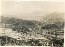
I've uploaded these photos from WR Fell's 1928-1929 album which must be contemporary with the recreational small boat trips to the nearby Plover Cove that the officers took, sometimes with friends from shore and which relate to the photos labelled "Plover Cove".

2000 - view across Mirs Bay from Tung Ping Chau

Date picture taken (to nearest decade for older photos): 
2000
Places shown in this photo: 

1897 Tourist Map of China and Soon to be New Territories

Date picture taken (to nearest decade for older photos): 
1897

Taken from the book: The Tourist's Guide to Hong Kong, with short trips to the Mainland of China (1897) by HURLEY, R.C.


EIGHT SHORT TRIPS TO THE MAINLAND.


INTRODUCTION.

Subscribe to Everything tagged "Mirs Bay"