Articles tagged "All" | Gwulo: Old Hong Kong

Articles tagged "All"

The CLP History Film Project

The CLP History Film Project is a documentary detailing the history of CLP (China Light & Power) and the ways in which its development has become interlinked with the development of Hong Kong as a whole, as well as its more recent investments in China and India. We are currently searching for archive film footage of Hong Kong from the early 20th Century onwards. Having searched through the local government records service and resources, we would welcome any submissions or leads to private collections and other archive sources!

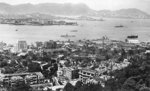
c.1946 View over HK harbour from May Road

c.1946 View over HK harbour from May Road

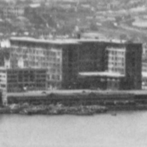
When: A couple of clues say this photo was taken not long after the end of WW2. First there's the blotchy appearance of the Peninsula Hotel, still wearing the camouflage paint applied during the Japanese occupation of Hong Kong.

Peninsula with camouflage

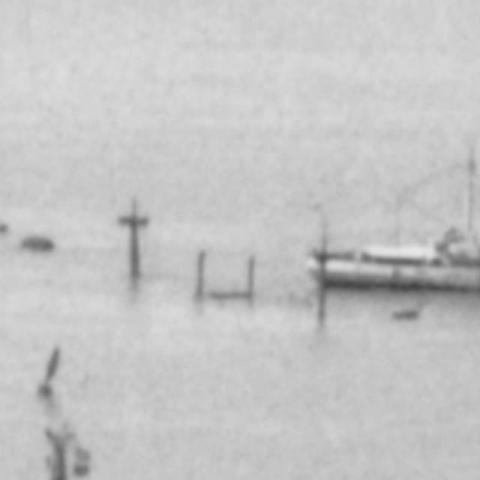
Second are these masts sticking up from the sea, and what looks like a salvage boat working next to it. The masts belonged to one of the many ships sunk by American bombers during the war.

Wreck

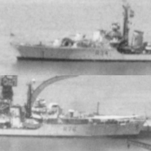
Other clues for the date are the two Royal Navy C-class destroyers.

Destroyers

Out in the harbour is

4.6 Speed up the "1.1 Map of all Places".

I've got the upgraded maps to the point where you can try them out. So for "Map of all Places", here's the old version:

http://gwulo.com/place-map-search-OL

And here's the new one:

http://gwulo.com/newmap

Improvements in the new map:

1950 Military Installations Closed Areas

Moddsey has previously given us the link to this useful document. Here's a text version to make it easier to read on the website.


MILITARY INSTALLATIONS CLOSED AREAS (AMENDMENT AND CONSOLIDATION) ORDER.

(Cap. 245, section 10).

(Ordinance No. 59 of 1948).

[17th November, 1950.]

1.    This order may be cited as the Military Installations Closed Areas (Amendment and Consolidation) Order.

1954 Hong Kong Tram Routes


Kennedy Town to Sai Ying Pun

Ice at the Peak, January 2016

Yesterday I wrote there was a strong chance of frost during the current cold spell. The Observatory website showed the temperature at the Peak had already dropped below zero this morning, so off we went to take a look.

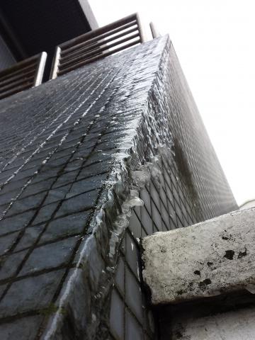
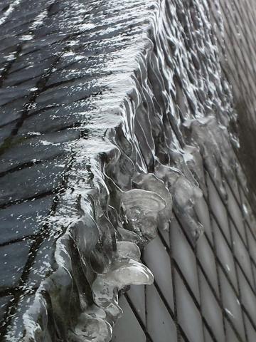
Walking up Old Peak Road I didn't see any signs of frost or ice - til I nearly slipped over on a sheet of ice! Freezing rain had turned the steps up to the Peak Tower into a mini ice rink. As is often the case, once we knew what we were looking for we could see it everywhere. Here's ice coating the wall up to the Peak Tower:

20160124_113018.jpg
20160124_113018-crop.jpg

And turning round we could see icicles hanging from

1874 Typhoon

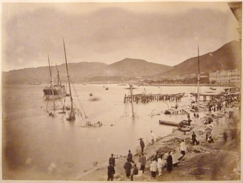
In one of Martyn Gregory's old photo albums a couple of photos show the destruction of this powerful typhoon, and a folded, yellowed slip of newspaper describes the event. All are reproduced here with Martyn's kind permission.


The first photo shows several sunken ships and the ruined piers and sea-wall between Central and Sheung Wan. The large building on the right in the distance is the City Hall.

Damage from 1874 typhoon


North-China Daily News

EXTRA.

[ISSUED TO SUBSCRIBERS.]

TUESDAY, 29th SEPTEMBER, 1874.

TERRIFIC TYPHOON AT HONGKONG.

IMMENSE LOSS OF LIFE AND PROPERTY.

(Abridged from “Daily Press.")

It is our painful duty to record one of the most appalling disasters that has ever happened in this Colony. A typhoon of unprecedented violence raged in this neighbourhood on Tuesday night and Wednesday morning last.

The weather

Help ID police staff at old Tai Po police station

Idy and Stella have asked us to try and identify the officers in their display photos at the Old Tai Po police station Green Hub; can you help? 

1. two Expats (Donald Burlingham ASP below?)

Victoria Gap and Peak Tram 1890-1930

In science there is a term called data mining – extraction of new informations and interrelations from already existing data. I had the idea of image mining – using images on Gwulo for new (unreported) connections and timelines.

My special interests are buildings on Barker Road, so I chose from Gwulo photos of Victoria Gap and the Peak Tram with Barker Road on them.

Let’s start in 1890. This one was probably taken from Severn Road and shows the Peak Tram and Mount Austin.

B. Upgrade Imaging & Media

Notes from the 'Gwulo in 2016' post:

Upgrade imaging. The software we use to handle images is due for an upgrade, and so is the zooming viewer we use to display them.

Scald:

Pages

Subscribe to Articles tagged "All"